world.wikisort.org - Canada
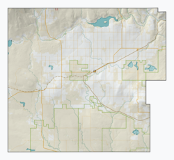
Oxarat is an unincorporated community within Rural Municipality of Reno No. 51, Saskatchewan, Canada. The former town-site is located 15 km west of Highway 21, about 15 km north of the village of Consul and Highway 13.
Oxarat | |
|---|---|
Unincorporated community | |
 Oxarat  Oxarat | |
| Coordinates: 49.433°N 109.584°W | |
| Country | Canada |
| Province | Saskatchewan |
| Region | Southwest |
| Census division | 4 |
| Rural Municipality | Reno |
| Established | 1910 |
| Government | |
| • Administrator | Lacelle Kim |
| • Governing body | Reno No. 51 |
| Population (2006) | |
| • Total | 0 |
| Time zone | CST |
| Postal code | S0N 2G0 |
| Area code(s) | 306 |
| Highways | TWP Rd. 60 |
| Railways | None |
| [1][2][3][4] | |
Population
Oxarat, like so many other communities throughout Saskatchewan, has struggled to maintain a sturdy population causing it to become a ghost town, with few or no residents.
Education
Oxarat no longer has a school, but those who may live in Oxarat and area are sent to the neighboring village of Consul which has a school that covers Kindergarten to Grade 12 serving approximately 100 students.
See also
- List of communities in Saskatchewan
References
- National Archives, Archivia Net, Post Offices and Postmasters
- Government of Saskatchewan, MRD Home, Municipal Directory System, archived from the original on November 21, 2008
- Canadian Textiles Institute. (2005), CTI Determine your provincial constituency, archived from the original on 2007-09-11
- Commissioner of Canada Elections, Chief Electoral Officer of Canada (2005), Elections Canada On-line, archived from the original on 2007-04-21
Places adjacent to Oxarat | |
|---|---|
Subdivisions of Saskatchewan | |
|---|---|
| Subdivisions |
|
| Communities |
|
| Cities |
|
| Topics |
|
| |
Division No. 4, Saskatchewan | |||||||
|---|---|---|---|---|---|---|---|
| Towns |  | ||||||
| Villages | |||||||
| Rural municipalities |
| ||||||
| First Nations |
| ||||||
| Indian reserves |
| ||||||
| Unincorporated communities |
| ||||||
| |||||||
This article about a location in the Census Division No. 4 of Saskatchewan is a stub. You can help Wikipedia by expanding it. |
This Canadian ghost town-related article is a stub. You can help Wikipedia by expanding it. |
Другой контент может иметь иную лицензию. Перед использованием материалов сайта WikiSort.org внимательно изучите правила лицензирования конкретных элементов наполнения сайта.
WikiSort.org - проект по пересортировке и дополнению контента Википедии