world.wikisort.org - Canada
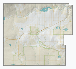
Consul (2021 population: 50) is a village in the Canadian province of Saskatchewan within the Rural Municipality of Reno No. 51 and Census Division No. 4. The historic Red Coat Trail and Highway 21 pass through the village. The village features one of the last existing grain elevators in the region. It is 211 km southwest of the City of Swift Current.
Consul | |
|---|---|
Village | |
| Village of Consul | |
 The Former Saskatchewan Wheat Pool elevators in Consul | |
 Consul  Consul | |
| Coordinates: 49.2954°N 109.5198°W | |
| Country | Canada |
| Province | Saskatchewan |
| Region | Southwest |
| Census division | 4 |
| Rural municipality | Reno |
| Government | |
| • Type | Municipal |
| • Governing body | Consul Village Council |
| • Mayor | Linda Brown |
| • Administrator | Yvonne Leismeister |
| • MP | Jeremy Patzer |
| • MLA | Doug Steele |
| Area | |
| • Land | 0.65 km2 (0.25 sq mi) |
| Population (2021) | |
| • Total | 50 |
| • Density | 130.1/km2 (337/sq mi) |
| Time zone | UTC-6 (CST) |
| Postal code | S0N 0P0 |
| Area code(s) | 306 |
| Highways | |
| Railways | Great Western Railway |
History
Consul incorporated as a village on June 12, 1917.[1]
Demographics
In the 2021 Census of Population conducted by Statistics Canada, Consul had a population of 50 living in 30 of its 36 total private dwellings, a change of -31.5% from its 2016 population of 73. With a land area of 0.7 km2 (0.27 sq mi), it had a population density of 71.4/km2 (185.0/sq mi) in 2021.[4]
In the 2016 Census of Population, the Village of Consul recorded a population of 73 living in 39 of its 40 total private dwellings, a -15.1% change from its 2011 population of 84. With a land area of 0.65 km2 (0.25 sq mi), it had a population density of 112.3/km2 (290.9/sq mi) in 2016.[5]
Education
Consul School is a Kindergarten to Grade 12 facility serving approximately 70 students in the extreme southwest corner of Saskatchewan. Consul School is a part of the Chinook School Division which includes most of southwest Saskatchewan.
See also
- List of communities in Saskatchewan
- Villages of Saskatchewan
References
- "Urban Municipality Incorporations". Saskatchewan Ministry of Government Relations. Archived from the original on October 15, 2014. Retrieved June 1, 2020.
- "Saskatchewan Census Population" (PDF). Saskatchewan Bureau of Statistics. Archived from the original (PDF) on September 24, 2015. Retrieved May 31, 2020.
- "Saskatchewan Census Population". Saskatchewan Bureau of Statistics. Retrieved May 31, 2020.
- "Population and dwelling counts: Canada, provinces and territories, census divisions and census subdivisions (municipalities), Saskatchewan". Statistics Canada. February 9, 2022. Retrieved April 1, 2022.
- "Population and dwelling counts, for Canada, provinces and territories, and census subdivisions (municipalities), 2016 and 2011 censuses – 100% data (Saskatchewan)". Statistics Canada. February 8, 2017. Retrieved May 30, 2020.
Другой контент может иметь иную лицензию. Перед использованием материалов сайта WikiSort.org внимательно изучите правила лицензирования конкретных элементов наполнения сайта.
WikiSort.org - проект по пересортировке и дополнению контента Википедии

