world.wikisort.org - Canada
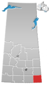
Maryfield (2016 population: 348) is a village in the Canadian province of Saskatchewan within the Rural Municipality of Maryfield No. 91 and Census Division No. 1. The village lies south of the intersection of Highway 48 and Highway 600 and is about 8 km west of the Manitoba border. It is a junction point on the Canadian National Railway between the main line heading northwest towards Regina and a branch line heading southwest toward Carlyle and Lampman.
Maryfield | |
|---|---|
Village | |
| Village of Maryfield | |
 Views of Maryfield, 1909. | |
 Maryfield Location of Maryfield  Maryfield Maryfield (Canada) | |
| Coordinates: 49°50′06″N 101°31′33″W | |
| Country | Canada |
| Province | Saskatchewan |
| Region | Southeast |
| Census division | 1 |
| Rural Municipality | Maryfield |
| Post office founded | 1896 |
| Incorporated (village) | 1907 |
| Government | |
| • Type | Municipal |
| • Governing body | Maryfield Village Council |
| • Mayor | David Hill |
| • Administrator | Denine Neufeld |
| • MP | Robert Kitchen |
| • MLA | Daryl Harrison |
| Area | |
| • Total | 2.69 km2 (1.04 sq mi) |
| Population (2016) | |
| • Total | 348 |
| • Density | 129.5/km2 (335/sq mi) |
| Time zone | UTC-6 (CST) |
| Postal code | S0G 3K0 |
| Area code(s) | 306 |
| Highways | |
| Railways | Canadian National Railway |
| [1][2][3][4] | |
History
Maryfield incorporated as a village on August 21, 1907.[5]
Demographics
In the 2021 Census of Population conducted by Statistics Canada, Maryfield had a population of 311 living in 130 of its 157 total private dwellings, a change of -10.6% from its 2016 population of 348. With a land area of 2.57 km2 (0.99 sq mi), it had a population density of 121.0/km2 (313.4/sq mi) in 2021.[8]
In the 2016 Census of Population, the Village of Maryfield recorded a population of 348 living in 139 of its 178 total private dwellings, a -4.9% change from its 2011 population of 365. With a land area of 2.69 km2 (1.04 sq mi), it had a population density of 129.4/km2 (335.1/sq mi) in 2016.[9]
Climate
| Climate data for Maryfield | |||||||||||||
|---|---|---|---|---|---|---|---|---|---|---|---|---|---|
| Month | Jan | Feb | Mar | Apr | May | Jun | Jul | Aug | Sep | Oct | Nov | Dec | Year |
| Record high °C (°F) | 10.0 (50.0) |
15.0 (59.0) |
21.5 (70.7) |
34.4 (93.9) |
36.7 (98.1) |
38.3 (100.9) |
37.0 (98.6) |
39.0 (102.2) |
36.7 (98.1) |
33.0 (91.4) |
24.0 (75.2) |
12.5 (54.5) |
39.0 (102.2) |
| Average high °C (°F) | −10.9 (12.4) |
−7.0 (19.4) |
−0.4 (31.3) |
10.0 (50.0) |
18.4 (65.1) |
22.4 (72.3) |
25.0 (77.0) |
24.6 (76.3) |
18.1 (64.6) |
10.7 (51.3) |
−0.8 (30.6) |
−8.6 (16.5) |
8.5 (47.3) |
| Daily mean °C (°F) | −15.9 (3.4) |
−11.8 (10.8) |
−5.3 (22.5) |
3.9 (39.0) |
11.7 (53.1) |
16.1 (61.0) |
18.5 (65.3) |
17.7 (63.9) |
11.7 (53.1) |
4.9 (40.8) |
−5.1 (22.8) |
−13.2 (8.2) |
2.8 (37.0) |
| Average low °C (°F) | −20.9 (−5.6) |
−16.6 (2.1) |
−10.1 (13.8) |
−2.2 (28.0) |
4.9 (40.8) |
9.8 (49.6) |
11.9 (53.4) |
10.7 (51.3) |
5.2 (41.4) |
−0.9 (30.4) |
−9.5 (14.9) |
−17.8 (0.0) |
−3.0 (26.6) |
| Record low °C (°F) | −40.0 (−40.0) |
−41.0 (−41.8) |
−35.6 (−32.1) |
−23.5 (−10.3) |
−8.0 (17.6) |
−1.1 (30.0) |
3.0 (37.4) |
−1.5 (29.3) |
−6.5 (20.3) |
−21.0 (−5.8) |
−33.5 (−28.3) |
−40.0 (−40.0) |
−41.0 (−41.8) |
| Average precipitation mm (inches) | 22.8 (0.90) |
17.5 (0.69) |
26.1 (1.03) |
29.5 (1.16) |
56.1 (2.21) |
80.5 (3.17) |
64.7 (2.55) |
58.8 (2.31) |
50.1 (1.97) |
30.2 (1.19) |
20.3 (0.80) |
24.4 (0.96) |
480.9 (18.93) |
| Source: Environment Canada[10] | |||||||||||||
Notable people
- Brock Lesnar, American mixed martial artist, former professional football player, and professional wrestler currently signed to WWE
- Joel Laing, former professional ice hockey player
- Sable, former WWE Women's Champion and wife of Brock Lesnar
- Val Sweeting, curler
See also
- List of communities in Saskatchewan
- Villages of Saskatchewan
References
- National Archives, Archivia Net, Post Offices and Postmasters, archived from the original on 2006-10-06
- Government of Saskatchewan, MRD Home, Municipal Directory System, archived from the original on November 21, 2008
- Canadian Textiles Institute. (2005), CTI Determine your provincial constituency, archived from the original on 2007-09-11
- Commissioner of Canada Elections, Chief Electoral Officer of Canada (2005), Elections Canada On-line, archived from the original on 2007-04-21
- "Urban Municipality Incorporations". Saskatchewan Ministry of Government Relations. Archived from the original on October 15, 2014. Retrieved June 1, 2020.
- "Saskatchewan Census Population" (PDF). Saskatchewan Bureau of Statistics. Archived from the original (PDF) on September 24, 2015. Retrieved May 31, 2020.
- "Saskatchewan Census Population". Saskatchewan Bureau of Statistics. Retrieved May 31, 2020.
- "Population and dwelling counts: Canada, provinces and territories, census divisions and census subdivisions (municipalities), Saskatchewan". Statistics Canada. February 9, 2022. Retrieved April 1, 2022.
- "Population and dwelling counts, for Canada, provinces and territories, and census subdivisions (municipalities), 2016 and 2011 censuses – 100% data (Saskatchewan)". Statistics Canada. February 8, 2017. Retrieved May 30, 2020.
- Environment Canada Canadian Climate Normals 1971–2000, accessed 10 September 2010
Другой контент может иметь иную лицензию. Перед использованием материалов сайта WikiSort.org внимательно изучите правила лицензирования конкретных элементов наполнения сайта.
WikiSort.org - проект по пересортировке и дополнению контента Википедии
