world.wikisort.org - Canada
North Battleford is a city in west-central Saskatchewan, Canada. It is the seventh largest city in the province and is directly across the North Saskatchewan River from the Town of Battleford. Together, the two communities are known as "The Battlefords". North Battleford borders the Rural Municipality of North Battleford No. 437, as well as the North Battleford Crown Colony (census subdivision).[4]
North Battleford | |
|---|---|
City | |
| City of North Battleford | |
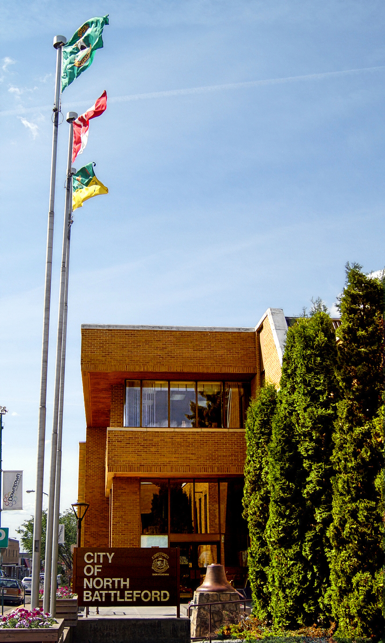 North Battleford City Hall | |
 Flag | |
 North Battleford  North Battleford  North Battleford | |
| Coordinates: 52°45′27″N 108°17′10″W | |
| Country | Canada |
| Province | Saskatchewan |
| Census division | 16 |
| Rural municipality | North Battleford |
| Village | 1906 |
| Town | 1907 |
| City | 1913 |
| Government | |
| • Mayor | David Gillan |
| • MLA | Jeremy Cockrill (SKP) |
| • MP | Rosemarie Falk (CON) |
| Area | |
| • Land | 33.55 km2 (12.95 sq mi) |
| • Metro | 1,122.99 km2 (433.59 sq mi) |
| Population (2011)[1] | |
| • City | 13,888 |
| • Density | 414.0/km2 (1,072/sq mi) |
| • Metro | 19,216 |
| • Metro density | 17.1/km2 (44/sq mi) |
| Time zone | UTC−6 (CST) |
| Forward sortation area | S9A |
| Area code(s) | 306, 639 |
| Website | City of North Battleford |
| [2][3] | |
The Battlefords are served by the Yellowhead Highway and Highway 4, Highway 26, Highway 29, and Highway 40.
Battlefords Provincial Park[5] is 40 kilometres (25 mi) north on Highway 4.
History

For thousands of years prior to European settlement, succeeding cultures of indigenous peoples lived in the area. The Battlefords area (including the present city of North Battleford and town of Battleford) was home to several historic indigenous groups, including the Algonquian-speaking Cree and Blackfeet as well as Siouan Assiniboine First Nation band governments, who contested for control of local resources.
Early European settlement began as a result of fur trading by French colonists in the late 18th century. The Canadians founded Fort Montaigne d'Aigle (Eagle Hills Fort) [6] nine miles below the confluence of the Saskatchewan and Battle Rivers in 1778.[7] A year later the fort was abandoned following conflict between traders and natives.[citation needed]
Permanent European settlement in the area centred around the town of Battleford, founded 1875 and located on the south side of the North Saskatchewan River. Battleford served as capital of the North-West Territories between 1876 and 1883.[8]
In 1905, the construction of the Canadian Northern Railway main line to Edmonton placed the line on the north side of the North Saskatchewan River. North Battleford, built along the railway line, was incorporated as a village in 1906, as a town in 1907, and as a city (with a population of 5,000) in 1913.[9]
The Assyrians were one of the first settlers of the area in and around North Battleford. The immigrant colony comprised 36 men and a few women from the town of Urmia in northwestern Persia. It was established in 1903 by Dr. Isaac Adams, an Assyrian Presbyterian missionary. In 1907, 40 more settlers arrived. Eventually, due to economic hardships, Dr. Isaac Adams and a few close relatives emigrated to Turlock, California. The descendants of the families who remained in North Battleford have names that are Assyrian in origin. Examples of Assyrian family names include Bakus, Essau, and Odishaw.[10][11]
Population growth stagnated until the 1940s and then grew to approximately 10,000 by the 1960s. The city has grown into an administrative centre and service hub for the economic, education, health and social needs of the region.[citation needed]
North Battleford used STV-PR in its city elections from 1920 to 1924.[12]
The Latter Rain Revival, a Christian movement, started here in 1946–48.[13]
Historic sites
A number of heritage buildings are located within the city. The North Battleford Public Library was built in 1916 with a $15,000 grant from the Carnegie Foundation of New York.[14] and the Canadian National Railways Station was built in 1956.[15]
Demographics
In the 2021 Census of Population conducted by Statistics Canada, North Battleford had a population of 13,836 living in 5,696 of its 6,346 total private dwellings, a change of -3.3% from its 2016 population of 14,315. With a land area of 33.55 km2 (12.95 sq mi), it had a population density of 412.4/km2 (1,068.1/sq mi) in 2021.[16]
In the late 2000s many Ruthenians have emigrated to Canada, concentrating in North Battleford. Most of them came from the same town: Ruski Krstur.[17]
| Census | Population |
|---|---|
| 1911 | 2,105 |
| 1921 | 4,108 |
| 1931 | 5,986 |
| 1941 | 4,694 |
| 1951 | 7,473 |
| 1961 | 11,230 |
| 1971 | 12,698 |
| 1981 | 14,030 |
| 1991 | 14,350 |
| 2001 | 13,692 |
| 2006 | 13,190 |
| 2011 | 13,888 |
| 2021 | 2011 | |
|---|---|---|
| Population | 13,836 (-3.3% from 2016) | 13,888 (+5.3% from 2006) |
| Land area | 33.55 km2 (12.95 sq mi) | 33.55 km2 (12.95 sq mi) |
| Population density | 412.4/km2 (1,068/sq mi) | 414.0/km2 (1,072/sq mi) |
| Median age | 38.4 (M: 36.8, F: 39.2) | 36.9 (M: 35.5, F: 38.3) |
| Total private dwellings | 5,695 | 6,195 |
| Median household income |
| Population by ethnic group, 2011 | ||
|---|---|---|
| Ethnic group[22] | Population | Percent |
| European | 10,270 | 75.3% |
| First Nations | 2,340 | 17.2% |
| Métis | 1,160 | 8.5% |
| Asian | 795 | 5.8% |
| African | 145 | 1.1% |
| Total respondent population | 13635 | 100% |
Crime rate
In 2018, Maclean's ranked North Battleford as Canada's most dangerous place for overall crime.[23] The prior year, Maclean's published an article about this, Canada’s most dangerous place, North Battleford, is fighting for its future, discussing the safety initiatives planned by the community.[24]
After the article was published, Mayor Ryan Bater said:
The reality is we require the provincial and federal levels of government to take notice of this and align their efforts with ours. This needs to be a partnership. This can’t be something the governments do in silos and we need to be working together. If we can do that, then sometime in the future we can see some great results.[25]
City Manager Jim Puffalt added that the per person index may not be accurate because the population data does not consider the numerous transients, estimated at just over 14,000. In his view, the city has roughly 30,000 people at any time. "If you put our rates over 30,000 people we wouldn’t be number one [in the Maclean's study]," he said.[25]
Climate
North Battleford experiences a humid continental climate (Köppen climate classification Dfb). The average high during the end of July is 24.6 °C (76.3 °F) and the average low is 11.3 °C (52.3 °F).[26] For the middle of January the average high is −12.3 °C (9.9 °F) and the average low is −22.6 °C (−8.7 °F).[27]
The highest temperature ever recorded in North Battleford was 39.5 °C (103.1 °F) on 13 July 2002.[28] The coldest temperature ever recorded was −51.7 °C (−61 °F) on 1 February 1893 and 12 January 1916.[29][30]
| Climate data for North Battleford Airport, 1981–2010 normals, extremes 1879–present[lower-alpha 1] | |||||||||||||
|---|---|---|---|---|---|---|---|---|---|---|---|---|---|
| Month | Jan | Feb | Mar | Apr | May | Jun | Jul | Aug | Sep | Oct | Nov | Dec | Year |
| Record high °C (°F) | 11.1 (52.0) |
11.7 (53.1) |
22.8 (73.0) |
34.4 (93.9) |
38.3 (100.9) |
38.3 (100.9) |
39.5 (103.1) |
39.4 (102.9) |
36.5 (97.7) |
30.6 (87.1) |
20.6 (69.1) |
12.8 (55.0) |
39.5 (103.1) |
| Average high °C (°F) | −10.6 (12.9) |
−7.1 (19.2) |
−0.6 (30.9) |
10.7 (51.3) |
18.0 (64.4) |
21.9 (71.4) |
24.2 (75.6) |
23.9 (75.0) |
17.7 (63.9) |
9.7 (49.5) |
−1.8 (28.8) |
−8.6 (16.5) |
8.1 (46.6) |
| Daily mean °C (°F) | −16.0 (3.2) |
−12.6 (9.3) |
−5.8 (21.6) |
4.3 (39.7) |
11.0 (51.8) |
15.5 (59.9) |
17.6 (63.7) |
16.9 (62.4) |
10.9 (51.6) |
3.6 (38.5) |
−6.5 (20.3) |
−13.8 (7.2) |
2.1 (35.8) |
| Average low °C (°F) | −21.3 (−6.3) |
−18.0 (−0.4) |
−11.0 (12.2) |
−2.2 (28.0) |
3.9 (39.0) |
9.0 (48.2) |
11.0 (51.8) |
9.9 (49.8) |
4.1 (39.4) |
−2.5 (27.5) |
−11.2 (11.8) |
−19.0 (−2.2) |
−3.9 (25.0) |
| Record low °C (°F) | −51.7 (−61.1) |
−51.7 (−61.1) |
−45.0 (−49.0) |
−27.8 (−18.0) |
−13.2 (8.2) |
−4.4 (24.1) |
0.0 (32.0) |
−1.8 (28.8) |
−13.9 (7.0) |
−27.2 (−17.0) |
−40.0 (−40.0) |
−47.2 (−53.0) |
−51.7 (−61.1) |
| Average precipitation mm (inches) | 15.6 (0.61) |
9.9 (0.39) |
13.5 (0.53) |
25.8 (1.02) |
32.8 (1.29) |
65.0 (2.56) |
74.1 (2.92) |
57.9 (2.28) |
34.1 (1.34) |
16.1 (0.63) |
15.8 (0.62) |
13.6 (0.54) |
374.2 (14.73) |
| Average rainfall mm (inches) | 0.7 (0.03) |
0.4 (0.02) |
2.0 (0.08) |
17.2 (0.68) |
31.1 (1.22) |
65.0 (2.56) |
74.1 (2.92) |
57.9 (2.28) |
31.9 (1.26) |
9.0 (0.35) |
2.9 (0.11) |
0.4 (0.02) |
292.6 (11.52) |
| Average snowfall cm (inches) | 20.2 (8.0) |
12.7 (5.0) |
14.8 (5.8) |
9.6 (3.8) |
2.4 (0.9) |
0.0 (0.0) |
0.0 (0.0) |
0.0 (0.0) |
2.3 (0.9) |
8.2 (3.2) |
16.6 (6.5) |
17.5 (6.9) |
104.3 (41.1) |
| Source: Environment Canada[28][31][32] | |||||||||||||

Government
North Battleford is represented in the provincial Legislative Assembly by the member for The Battlefords.
It is represented in the House of Commons by the member for Battlefords-Lloydminster.
Attractions

North Battleford is the home of one of four branches of the Saskatchewan Western Development Museum. This branch focuses on the agricultural history of Saskatchewan, including a pioneer village.[33] A prominent feature is the former Saskatchewan Wheat Pool grain elevator No. 889 from Keatley, Saskatchewan. The grain elevator was moved to the museum grounds in 1983.[34]
The city also has the Allen Sapp Gallery, featuring the noted Cree painter.

Sports and recreation


The North Battleford Access Communications Centre,[35] a 2,500-seat multi-purpose arena, is home to the Battlefords North Stars ice hockey team of the Saskatchewan Junior Hockey League.[36] It is also home to the North Battleford Kinsmen Indoor Rodeo, held annually in April.
The North Battleford CUplex (Credit Union CUplex),[37][38] which opened in 2013, includes the Dekker Centre for the Performing Arts,[39] the Northland Power Curling Centre,[40] the NationsWest Field House,[41] and the Battlefords CO-OP Aquatic Centre.[42]
Infrastructure
In 2001, a problem with the city's water system led to the infection of approximately 6,280 people with cryptosporidiosis; a lawsuit seeking several million dollars in damages was filed in 2003.[43] Between 5,800 and 7,100 people suffered from diarrheal illness, and 1,907 cases of cryptosporidiosis were confirmed. Equipment failures at the city's antiquated water filtration plant following maintenance were found to have caused the outbreak.[44] The provincial and municipal government offered compensation to victims[45] after the lawsuit was approved in 2017.[46]
The North Battleford Energy Centre, a natural gas-fired power station owned by Northland Power, has been operational since 2013.
Transportation
North Battleford is served by the North Battleford Airport, while the North Battleford/Hamlin Airport is no longer in use. The city also recently added a public transit system, in addition to the book-as-needed "Handi-bus" for people with disabilities.
Local media
Newspaper
BattlefordsNOW.com is an online local news site focusing on what's happening "right NOW" in the Battlefords and surrounding area.[citation needed]
The local newspaper is the Battlefords' News-Optimist.[47] It is published weekly on Tuesdays and Thursdays, and has circulation in the surrounding area.
Feed The Artist Magazine[48] is a local non-profit periodical print and online publication that features the work of primarily local artists, photographers, and writers.
Radio
Three local radio stations serve the area: CJNB, CJCQ-FM ("Q98"), and CJHD-FM ("93.3 The Rock"). Some Saskatoon radio stations can also be received.[citation needed]
Television
The Battlefords were served by CFQC-TV-2 channel 6, an analogue repeater of CTV station CFQC-DT Saskatoon. That repeater ended all analog broadcasting transmissions in 2021, and there are no plans for converting it to digital television.[49][50]
Notable people
- Andrew Albers: baseball player
- Lloyd Axworthy: Canadian politician and spokesman
- Wade Belak: former NHL player
- Colby Cave: former NHL player
- Ron Delorme: former NHL player
- Deidra Dionne: Canadian freestyle skier, Olympic medalist
- Lillian Dyck: Neuroscientist, Canadian senator
- Johnny Esaw: former sports' broadcaster, former vice-president of CTV Sports
- Bob Francis: former NHL player, NHL coach
- Emile Francis: former NHL player, coach, and general manager
- Ray Hare: former NFL running back
- Bruce Hoffort: former NHL Goaltender
- Dale Hoganson: former NHL player
- Bill Hunter: hockey coach, owner, and general manager; founder of the Western Hockey League
- Carole James: politician, former leader of the British Columbia New Democratic Party, Deputy Premier of British Columbia
- Dave King: NHL coach
- Skip Krake: former NHL centre
- Jody Lehman: former EIHL goalie
- Bernie Lukowich: former NHL player
- Alistair MacLeod: author
- Merlin Malinowski: former NHL right winger
- Rueben Mayes: former NFL player
- Joni Mitchell: musician, artist
- Nancy Nash: Singer and Performer
- Brian Plummer: Musician
- Lee Richardson: Canadian politician
- Allen Sapp: Canadian Cree painter
- Corey Schwab: former NHL goalie
- Gregg Sheppard: former NHL forward
- Fiona Lesley Smith: Member of the Canada women's national ice hockey team
- Herbert Sparrow: former Canadian senator
- Len Taylor: former Saskatchewan cabinet minister and federal MP
- Al Tuer: former NHL defenceman
- Jesse Wallin: former NHL defenceman, WJC Gold Medallist, WHL GM/Head Coach
- W. Brett Wilson: Entrepreneur and Philanthropist
References
- "2011 Community Profiles". Statistics Canada. Government of Canada. Retrieved 2013-12-06.
- National Archives, Archivia Net. "Post Offices and Postmasters". Retrieved 2013-12-06.
- Government of Saskatchewan, MRD Home. "Municipal Directory System". Retrieved 2013-12-06.
- geodepot.statcan.ca
- The Battlefords Provincial Park
- Voorhis, Ernest (1930). "Historic Forts of the French Regime and of the English Fur Trading Companies". Historic Forts of the French Regime and of the English Fur Trading Companies. Govt. of Canada. Retrieved 2016-04-27.
- "atlas.nrcan.gc.ca". Archived from the original on 2012-10-03. Retrieved 2010-06-21.
- "esask.uregina.ca". Archived from the original on 2007-12-31. Retrieved 2010-06-21.
- "esask.uregina.ca". Archived from the original on 2012-09-20. Retrieved 2010-06-21.
- Ishaya, Arian. "Migration and Settlement". Multicultural Canada. Archived from the original on 14 September 2014. Retrieved 14 September 2014.
- Higgs, Jennifer. "Presby-assyrians". Presbyterian Record. Retrieved 15 September 2014.
- Bowler and Grofman, Elections in Australia, Ireland and Malta, p. 206
- christianity-guide.com Archived 2008-10-07 at the Wayback Machine
- "North Battleford Public Library". Retrieved 2013-12-07.
- "Canadian National Railways Station". Retrieved 2013-12-07.
- "Population and dwelling counts: Canada, provinces and territories, census divisions and census subdivisions (municipalities), Saskatchewan". Statistics Canada. February 9, 2022. Retrieved March 27, 2022.
- "Battlefords ride immigration wave". The StarPhoenix. CanWest. April 28, 2008. Retrieved 2010-07-12.
- "2021 Community Profiles". 2021 Canadian Census. Statistics Canada. February 4, 2022. Retrieved 2022-04-27.
- "2011 Community Profiles". 2011 Canadian Census. Statistics Canada. March 21, 2019. Retrieved 2014-07-25.
- "2006 Community Profiles". 2006 Canadian Census. Statistics Canada. August 20, 2019.
- "2001 Community Profiles". 2001 Canadian Census. Statistics Canada. July 18, 2021.
- "NHS Profile, North Battleford, CY, Saskatchewan, 2011 (The sum of the ancestries in this table is greater than the total population estimate because a person may report more than one ancestry (ethnic origin) in the National Household Survey.)". 2011. Retrieved 2014-06-14.
- "Canada's Most Dangerous Places 2018". Maclean's. Retrieved 15 July 2018.
- "Canada's most dangerous place, North Battleford, is fighting for its future - Macleans.ca".
- "Officials react to article calling North Battleford 'Canada's most dangerous city'".
- "Climate Data Almanac for July 31". Environment Canada. 31 October 2011. Retrieved October 20, 2012.
- "Climate Data Almanac for January 10". Environment Canada. 31 October 2011. Retrieved October 20, 2012.
- "North Battleford A". Environment Canada. 31 October 2011. Retrieved 30 April 2016.
- "February 1893". Environment Canada. 31 October 2011. Retrieved 30 April 2016.
- "January 1916". Environment Canada. 31 October 2011. Retrieved 30 April 2016.
- "Battleford". Environment Canada. 31 October 2011. Retrieved 7 July 2016.
- "Daily Data Report for September 2022". Canadian Climate Data. Environment and Climate Change Canada. Retrieved September 5, 2022.
- "Western Development Museum - North Battleford". Wdm.ca. Retrieved 2013-08-13.
- Leslee Newman, WDM Curatorial Centre. "WDM's iconic elevator needs help". Battlefords News-Optimist. Retrieved 31 December 2014.
- Brown, Angela. "City approves Access Communications' proposal for naming rights to North Battleford Civic Centre". battlefordsNOW. Retrieved 2021-07-26.
- "North Battleford Civic Centre". Retrieved 2014-03-08.
- "NEWS RELEASE - MAY 24, 2013 (NORTH BATTLEFORD CELEBRATES NEW COMPLEX)". Retrieved 2014-03-08.
- "Barr-Ryder Architecture (The Credit Union Cuplex)". Retrieved 2014-03-08.
- "Dekker Centre for the performing arts (The Credit Union Cuplex)". Retrieved 2014-03-08.
- "The Battlefords News-Optimist (Northland Power Curling Centre officially open by John Cairns)". Retrieved 2014-03-08.
- "The Battlefords News-Optimist (NationsWEST Field House now open by John Cairns)". Retrieved 2014-03-08.
- "Barr-Ryder Architecture (BATTLEFORDS CO-OP AQUATIC CENTRE)". Retrieved 2014-03-08.
- "Waterborn cryptosporidosis outbreak, North Battleford, Saskatchewan, Spring 2001". Canada Communicable Disease Report. Public Health Agency of Canada. 27–22. November 15, 2001. Retrieved 2010-11-01.
- "WATERBORNE CRYPTOSPORIDIOSIS OUTBREAK, NORTH BATTLEFORD, SASKATCHEWAN, SPRING 2001" (PDF). Archived from the original (PDF) on 2007-12-20. Retrieved 2014-03-08.
- "Province, city to compensate North Battleford, Sask., tainted water victims". CBC News. 2017-04-26. Retrieved 2017-04-26.
- "Class action approved for North Battleford tainted water victims". CBC News. 2017-04-13. Retrieved 2017-04-26.
- Battlefords' News Optimist
- Feed The Artist Magazine
- "CRTC Decision 2019-268". July 30, 2019.
- "No more analog signal for CTV Saskatoon in NB".
Notes
- Climate data was recorded in the city of Battleford from November 1879 to March 1942, and at North Battleford Airport from March 1942 to present.
External links
Places adjacent to North Battleford | ||||||||||||||||
|---|---|---|---|---|---|---|---|---|---|---|---|---|---|---|---|---|
| ||||||||||||||||
Subdivisions of Saskatchewan | |
|---|---|
| Subdivisions |
|
| Communities |
|
| Cities |
|
| Topics |
|
| |
Authority control | |
|---|---|
| General | |
| National libraries | |
| Other |
|
На других языках
[de] North Battleford
North Battleford (offiziell: City of North Battleford) ist eine Stadt in Kanada. Sie liegt im Westen der kanadischen Provinz Saskatchewan und ist mit 33,55 km² die siebtgrößte Stadt der Provinz. North Battleford wird im Süden durch den North Saskatchewan River von Battleford getrennt. Beide Städte werden auch als The Battlefords bezeichnet. Der Ort grenzt an die gleichnamige Gemeinde North Battleford No. 437. 2016 lag die Zahl der Einwohner bei 14.315.[1]- [en] North Battleford
Другой контент может иметь иную лицензию. Перед использованием материалов сайта WikiSort.org внимательно изучите правила лицензирования конкретных элементов наполнения сайта.
WikiSort.org - проект по пересортировке и дополнению контента Википедии