world.wikisort.org - Canada
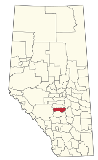
Lacombe County is a municipal district in central Alberta, Canada. It is within in Census Division No. 8 north of the City of Red Deer. Its municipal office is 4 km (2.5 mi) west of Highway 2 and the City of Lacombe, and 6 km (3.7 mi) east of the Summer Village of Gull Lake, at the intersection of Highway 12 and Spruceville Road (Range Road 274).
Lacombe County | |
|---|---|
Municipal district | |
 Location within Alberta | |
| Country | Canada |
| Province | Alberta |
| Region | Central Alberta |
| Census division | 8 |
| Established | 1944 |
| Incorporated | 1995 |
| Government | |
| • Reeve | Paula Law |
| • Governing body | Lacombe County Council
|
| • MP | Blaine Calkins |
| • Administrative office | west of Lacombe |
| Area (2021)[2] | |
| • Land | 2,759.12 km2 (1,065.30 sq mi) |
| Population (2021)[2] | |
| • Total | 10,283 |
| • Density | 3.7/km2 (10/sq mi) |
| Time zone | UTC−7 (MST) |
| • Summer (DST) | UTC−6 (MDT) |
| Website | lacombecounty.com |
Geography
Communities and localities
|
The following urban municipalities are surrounded by Lacombe County.[3][4]
|
The following hamlets are located within Lacombe County.[4]
|
The following localities are located within Lacombe County.[5]
- Localities
|
|
|
|
Demographics
In the 2021 Census of Population conducted by Statistics Canada, Lacombe County had a population of 10,283 living in 3,973 of its 4,616 total private dwellings, a change of -0.6% from its 2016 population of 10,343. With a land area of 2,759.12 km2 (1,065.30 sq mi), it had a population density of 3.7/km2 (9.7/sq mi) in 2021.[2]
In the 2016 Census of Population conducted by Statistics Canada, Lacombe County had a population of 10,343 living in 3,890 of its 4,668 total private dwellings, a 0.3% change from its 2011 population of 10,307. With a land area of 2,765.16 km2 (1,067.63 sq mi), it had a population density of 3.7/km2 (9.7/sq mi) in 2016.[7]
See also
- List of communities in Alberta
- List of municipal districts in Alberta
References
- "Municipal Officials Search". Alberta Municipal Affairs. May 9, 2019. Retrieved October 1, 2021.
- "Population and dwelling counts: Canada, provinces and territories, and census subdivisions (municipalities)". Statistics Canada. February 9, 2022. Retrieved February 9, 2022.
- "Lacombe, City (Census Subdivision), Alberta". Statistics Canada. June 20, 2012. Retrieved August 13, 2012.
- "Specialized and Rural Municipalities and Their Communities" (PDF). Alberta Municipal Affairs. January 12, 2022. Retrieved January 21, 2022.
- "Standard Geographical Classification (SGC) 2006, Economic Regions: 4808022 - Lacombe County, geographical codes and localities, 2006". Statistics Canada. March 5, 2010. Retrieved August 11, 2012.
- Geo-Administrative Areas (Hamlet, Locality and Townsite Culture Points) (Geodatabase layer) (Map). AltaLIS. October 26, 2020. Retrieved October 2, 2021.
{{cite map}}: CS1 maint: date and year (link) - "Population and dwelling counts, for Canada, provinces and territories, and census subdivisions (municipalities), 2016 and 2011 censuses – 100% data (Alberta)". Statistics Canada. February 8, 2017. Retrieved February 8, 2017.
External links
Другой контент может иметь иную лицензию. Перед использованием материалов сайта WikiSort.org внимательно изучите правила лицензирования конкретных элементов наполнения сайта.
WikiSort.org - проект по пересортировке и дополнению контента Википедии
