world.wikisort.org - Canada
Amherst (/ˈæmɜːrst/ AM-urst)[3] is a town in northwestern Nova Scotia, Canada, located at the northeast end of the Cumberland Basin, an arm of the Bay of Fundy, and 22 km (14 mi) south of the Northumberland Strait. The town sits on a height of land at the eastern boundary of the Isthmus of Chignecto and Tantramar Marshes, 3 km (1.9 mi) east of the interprovincial border with New Brunswick and 65 km (40 mi) southeast of the city of Moncton. It is 60 km (37 mi) southwest of the New Brunswick abutment of the Confederation Bridge to Prince Edward Island at Cape Jourimain.
Amherst | |
|---|---|
Town | |
 Downtown Amherst, Nova Scotia in the morning | |
 Flag  Coat of arms | |
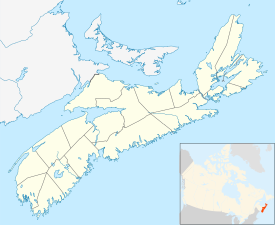 Amherst Location of Amherst, Nova Scotia  Amherst Amherst (Canada) | |
| Coordinates: 45°50′00″N 64°12′47″W | |
| Country | Canada |
| Province | Nova Scotia |
| County | Cumberland |
| Founded | 1764 |
| Incorporated | December 18, 1889 |
| Government | |
| • Mayor | David Kogon |
| • Deputy Mayor | Sheila Christie |
| • Councillors | List of Members
|
| • MLA | Elizabeth Smith-McCrossin PC Party of Nova Scotia |
| • MP | Stephen Ellis Conservative Party of Canada |
| Area (2021)[1] | |
| • Land | 12.07 km2 (4.66 sq mi) |
| • Urban | 12.38 km2 (4.78 sq mi) |
| Elevation | 22.11 m (72.54 ft) |
| Population (2021)[1] | |
| • Town | 9,404 |
| • Density | 779.4/km2 (2,019/sq mi) |
| • Urban | 9,550 |
| • Urban density | 770/km2 (2,000/sq mi) |
| • Change 2016-21 | |
| • Census Ranking | 452 of 5,162 |
| Demonym | Amherstonian |
| Time zone | UTC−04:00 (AST) |
| • Summer (DST) | UTC−03:00 (ADT) |
| Postal code(s) | B4H |
| Area codes | 902
|
| Access Routes | |
| Dwellings | 4,745 |
| Median Income* | $36,539 CAD |
| NTS Map | 21H16 Amherst |
| GNBC Code | CAAOO[2] |
| Website | www.amherst.ca |
| |
History

According to Dr. Graham P. Hennessey, "The Micmac name was Nemcheboogwek meaning 'going up rising ground', in reference to the higher land to the east of the Tantramar Marshes. The Acadians who settled here as early as 1672 called the village Les Planches. The village was later renamed Amherst by Colonel Joseph Morse in honour of Lord Amherst, the commander-in-chief of the British Army in North America during the Seven Years' War."
The town was first settled in 1764 by immigrants from Yorkshire following the expulsion of the Acadians, with the original settlement being located 3 kilometres (1.9 mi) southwest of the present town on the shore of the Bay of Fundy.[citation needed] These settlers were joined by United Empire Loyalists (Loyalists who fled the American colonies during the American Revolution). A mill was built on the current townsite, and the residents moved there to be closer to work.
During the 19th century, Amherst became an important regional centre for shipbuilding and other services to outlying communities. An indication of the town's importance in Canadian history is seen with its four Fathers of Confederation: Edward B. Chandler, Robert B. Dickey, Jonathan McCully, and Sir Charles Tupper.
During the late 19th century, local industrialists and entrepreneurs constructed many fine Victorian and Edwardian homes along Victoria Street East, leading toward the farming hamlet of East Amherst. Many notable residents have lived in this district, including Tupper, Senator Thomas R. Black, the Barker Family, the Lamy Family, the Pugsley Family and Mary (Molly) Simmons Critchley.
Amherst gained brief notoriety in the late 19th century as the location of alleged poltergeist phenomena afflicting Amherst resident Esther Cox in 1878 and 1879, which became known as the Great Amherst Mystery after the publication of a popular book on the affair.[4]

Amherst experienced unprecedented industrialization in the late 1870s after the Intercolonial Railway of Canada constructed its main line from Halifax to Quebec through the town in 1872. The location of the railway line away from the Bay of Fundy coast further consolidated the town at its present location as industry and commercial activity centred around this important transportation link. The economic boom created by the arrival of the Intercolonial Railway lasted through World War I and numerous foundries, factories and mills opened, giving rise to the nickname "Busy Amherst".
In 1908, the manufacturing output of Amherst's industries was not exceeded by any centre in the Maritime Provinces. Many of the fine old buildings along Victoria Street are considered industrial artifacts because they were constructed during a period of tremendous industry growth. Local contractors employed local craftsmen, who used local materials. Notice the emphasis on sandstone and brick, both locally produced and delightful detail which reflects the skilled craftsmanship prevalent in the 19th century.
Amherst's prosperity would not last as the failed economic policies of the federal and provincial governments, coupled with World War I, saw the town's industrial economy begin a slow decline during the 1910s. The Amherst Internment Camp for prisoners of war and enemy aliens was set up at Malleable Iron Foundry in Amherst from April 1915 to September 1919,[5] and Russian revolutionary Leon Trotsky was incarcerated there for one month after he was arrested in Halifax, Nova Scotia in April 1917.[6]
During the Amherst general strike in 1919, worker unrest over social and economic conditions led to mass protests in sympathy with the Winnipeg general strike.
The eventual closure of companies such as Robb Engineering & Manufacturing (purchased by Canada Car and Foundry and then closed) and Amherst Pianos, among others led to a resignation of lost dreams as the town was overtaken by other newer manufacturing centres in central Canada during the 20th century. Amherst had a modest-sized industrial park constructed during the 1960s when the Trans-Canada Highway was being developed. Today the majority of the town's major employers are located there, including Emmerson Packaging and IMP Aerospace.
During the Second World War, the Royal Canadian Navy named a Flower-class corvette HMCS Amherst.
The town is currently served by Via Rail's Halifax-to-Montreal train Ocean.

Businesses
Amherst is the retail centre for the Cumberland region and the southeastern part of Westmorland County (New Brunswick). The town has several national retailers including Walmart, Sobeys, Atlantic Superstore, Canadian Tire, Kent Building Supplies, Giant Tiger, Dollarama, Home Hardware, and Hart, in addition to various fast food restaurants and seven auto dealerships. The Amherst Centre Mall is home to retailers Coles, Northern Reflections, Mark's, Eclipse, Charm Diamonds, Bell Aliant, Telus, and EastLink, as well as the Amherst Artisan Gallery.
The heritage downtown draws visitors to speciality retailers Deanne Fitzpatrick Studio, Mrs. Pugsley's Emporium, and Birkinshaw's Tea Room. Dayle's Grand Market houses several businesses in a historic department store with a grand staircase and tin ceilings. Shops include an antique coin dealer, a vintage clothing shop, a ladies clothing and shoe store, and a collaboration of more than 100 local artisans.
Sports
Amherst is home of the Amherst Ramblers, a Junior A Hockey League team from the Maritime Hockey League. All home games are played out of the 2,500 seat Amherst Stadium. The season usually runs from mid-September to early March every year. The Ramblers draw some of the largest crowds in the Maritime Hockey League, and have placed third in average attendance over the past few years. They won the Atlantic Championship in 1989 advancing to the Centennial Cup tournament in BC. They also hosted the Centennial Cup in 1993 and the Fred Page Cup in 2019.
Every August, Amherst hosts an eight-team little league baseball tournament, featuring four teams from New England.
Climate
Amherst experiences a humid continental climate (Dfb). The highest temperature ever recorded was 34.4 °C (93.9 °F) on 18 August 1935. The coldest temperature ever recorded was −37.2 °C (−35.0 °F) on 18 February 1922.[7] In 2020, Amherst only recorded 800.4 mm (31.51 in) of precipitation.[8]
| Climate data for Nappan, 1981−2010 normals, extremes 1890−present[lower-alpha 1] | |||||||||||||
|---|---|---|---|---|---|---|---|---|---|---|---|---|---|
| Month | Jan | Feb | Mar | Apr | May | Jun | Jul | Aug | Sep | Oct | Nov | Dec | Year |
| Record high °C (°F) | 16.8 (62.2) |
16.2 (61.2) |
24.2 (75.6) |
26.1 (79.0) |
30.0 (86.0) |
31.7 (89.1) |
32.7 (90.9) |
34.4 (93.9) |
32.2 (90.0) |
27.0 (80.6) |
23.5 (74.3) |
18.5 (65.3) |
34.4 (93.9) |
| Average high °C (°F) | −2.7 (27.1) |
−1.4 (29.5) |
2.5 (36.5) |
8.8 (47.8) |
15.7 (60.3) |
20.7 (69.3) |
24.0 (75.2) |
23.8 (74.8) |
19.5 (67.1) |
13.3 (55.9) |
6.8 (44.2) |
1.0 (33.8) |
11.0 (51.8) |
| Daily mean °C (°F) | −7.7 (18.1) |
−6.5 (20.3) |
−2.1 (28.2) |
4.1 (39.4) |
10.2 (50.4) |
15.0 (59.0) |
18.5 (65.3) |
18.2 (64.8) |
14.2 (57.6) |
8.5 (47.3) |
3.0 (37.4) |
−3.4 (25.9) |
6.0 (42.8) |
| Average low °C (°F) | −12.6 (9.3) |
−11.5 (11.3) |
−6.8 (19.8) |
−0.6 (30.9) |
4.6 (40.3) |
9.2 (48.6) |
12.9 (55.2) |
12.5 (54.5) |
8.9 (48.0) |
3.6 (38.5) |
−0.8 (30.6) |
−7.7 (18.1) |
1.0 (33.8) |
| Record low °C (°F) | −36.7 (−34.1) |
−37.2 (−35.0) |
−29.5 (−21.1) |
−21.1 (−6.0) |
−6.7 (19.9) |
−3.3 (26.1) |
−1.1 (30.0) |
0.0 (32.0) |
−4.5 (23.9) |
−12.2 (10.0) |
−18.9 (−2.0) |
−34.0 (−29.2) |
−37.2 (−35.0) |
| Average precipitation mm (inches) | 106.1 (4.18) |
82.7 (3.26) |
104.7 (4.12) |
91.6 (3.61) |
100.7 (3.96) |
82.6 (3.25) |
89.0 (3.50) |
74.4 (2.93) |
102.1 (4.02) |
102.8 (4.05) |
110.8 (4.36) |
107.3 (4.22) |
1,154.8 (45.46) |
| Average rainfall mm (inches) | 47.9 (1.89) |
36.1 (1.42) |
49.1 (1.93) |
62.7 (2.47) |
91.7 (3.61) |
79.6 (3.13) |
89.0 (3.50) |
74.4 (2.93) |
98.4 (3.87) |
97.2 (3.83) |
95.9 (3.78) |
64.2 (2.53) |
886.0 (34.88) |
| Average snowfall cm (inches) | 62.4 (24.6) |
51.2 (20.2) |
49.9 (19.6) |
23.9 (9.4) |
5.2 (2.0) |
0.0 (0.0) |
0.0 (0.0) |
0.0 (0.0) |
0.0 (0.0) |
0.2 (0.1) |
15.6 (6.1) |
45.8 (18.0) |
254.2 (100.1) |
| Average precipitation days (≥ 0.2 mm) | 14.3 | 11.9 | 13.2 | 13.0 | 14.7 | 14.2 | 13.1 | 12.3 | 11.7 | 13.6 | 15.1 | 14.0 | 161.2 |
| Average rainy days (≥ 0.2 mm) | 5.3 | 4.9 | 6.9 | 10.0 | 13.8 | 13.6 | 12.7 | 12.1 | 11.4 | 12.8 | 12.3 | 6.9 | 122.6 |
| Average snowy days (≥ 0.2 cm) | 10.4 | 8.4 | 7.3 | 3.6 | 0.52 | 0.0 | 0.0 | 0.0 | 0.0 | 0.09 | 2.8 | 7.6 | 40.7 |
| Mean monthly sunshine hours | 93.9 | 108.6 | 137.9 | 146.5 | 186.0 | 208.5 | 229.7 | 218.0 | 161.1 | 130.7 | 76.2 | 79.3 | 1,776.1 |
| Percent possible sunshine | 33.1 | 37.2 | 37.4 | 36.2 | 40.2 | 44.4 | 48.4 | 49.8 | 42.7 | 38.4 | 26.7 | 29.3 | 38.6 |
| Source: Environment Canada[7][9][10][11][12][13] | |||||||||||||
Demographics
| Year | Pop. | ±% |
|---|---|---|
| 1871 | 1,839 | — |
| 1881 | 2,274 | +23.7% |
| 1891 | 3,781 | +66.3% |
| 1901 | 4,964 | +31.3% |
| 1911 | 8,973 | +80.8% |
| 1921 | 9,998 | +11.4% |
| 1931 | 7,450 | −25.5% |
| 1941 | 8,620 | +15.7% |
| 1951 | 9,870 | +14.5% |
| 1956 | 10,301 | +4.4% |
| 1961 | 10,788 | +4.7% |
| 1971 | 9,966 | −7.6% |
| 1981 | 9,684 | −2.8% |
| 1986 | 9,671 | −0.1% |
| 1991 | 9,742 | +0.7% |
| 1996 | 9,669 | −0.7% |
| 2001 | 9,470 | −2.1% |
| 2006 | 9,505 | +0.4% |
| 2011 | 9,717 | +2.2% |
| 2016 | 9,413 | −3.1% |
| 2021 | 9,404 | −0.1% |
| [14][15][16][17][18][19][20][21][22][23] | ||
In the 2021 Census of Population conducted by Statistics Canada, Amherst had a population of 9,404 living in 4,480 of its 4,799 total private dwellings, a change of -0.1% from its 2016 population of 9,413. With a land area of 12.07 km2 (4.66 sq mi), it had a population density of 779.1/km2 (2,017.9/sq mi) in 2021.[24]
| Canada 2006 Census[25] | ||
|---|---|---|
| Ethnic Origin | Population | % of Total Population |
| Canadian | 4,215 | 45.4 |
| English | 3,625 | 39.1 |
| Scottish | 2,745 | 29.6 |
| Irish | 2,040 | 22.0 |
| French | 1,840 | 19.8 |
| German | 655 | 7.1 |
| Dutch (Netherlands) | 385 | 4.1 |
In the period between 1996 and 2006, Amherst lost over half of its Black population.[26][27] The African Nova Scotian community has lived in the area since 1783, largely settled around the south end of the town in an area called Sand Hill.[28]
Notable citizens
- George Cove, inventor
- John Greer, sculptor
- Willard Boyle, co-inventor of the charge-coupled device (CCD), for which he shared a 2009 Nobel Prize in Physics
- Alfred Paul Rogers, American Orthodontist
- Roger Stuart Bacon, former Premier of Nova Scotia
- Bill Casey, politician
- Edward Barron Chandler, politician
- Robert C. Coates, politician
- Alex Colville, Painter
- George Barton Cutten, university president
- Robert Barry Dickey, politician
- Leslie Feist, musician
- Carly Jackson, professional ice hockey player
- Rocky Johnson, professional wrestler, WWE Hall of Fame inductee, father of Dwayne "The Rock" Johnson
- Jonathan McCully, politician
- Willard M. Mitchell, artist and architect
- William Thomas Pipes, former Premier of Nova Scotia
- Edgar Nelson Rhodes, former Premier of Nova Scotia
- Bill Riley, third Black player to play in the NHL
- Norman McLeod Rogers, politician
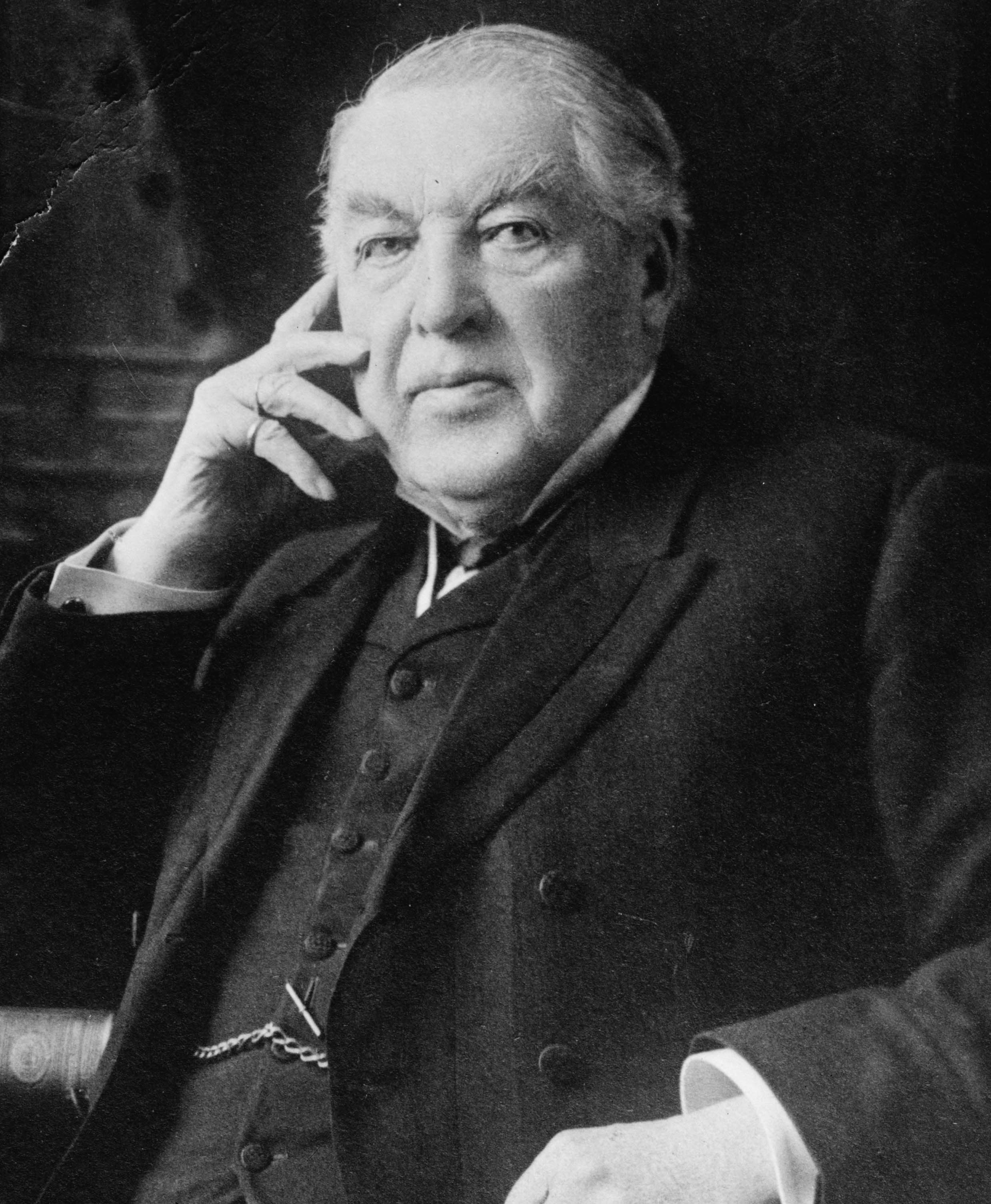
- Sir Charles Tupper, 6th Prime Minister of Canada
Media
Television
Amherst is served locally by EastLink TV. The station also serves the communities of Springhill, Oxford, and others in the county, as well as Sackville, New Brunswick.
Radio
- 90.1 FM CFNS
- 99.1 FM CITA
- 101.7 FM CKDH
- 107.9 FM CFTA (Tantramar FM)
Newspapers
- Amherst News (weekly)
- Citizen - Record (weekly)
See also
- List of municipalities in Nova Scotia
References
- "Population and dwelling counts, for Canada, provinces and territories, and census subdivisions (municipalities), 2016 and 2011 censuses – 100% data (Nova Scotia)". Statistics Canada. 8 February 2017. Retrieved 12 February 2017.
- "Amherst". Geographical Names Data Base. Natural Resources Canada.
- The Canadian Press (2017), The Canadian Press Stylebook (18th ed.), Toronto: The Canadian Press
- Hubbell, Walter (1882). The Haunted House: A True Ghost Story. New York: Brentano. Archived from the original on 2009-07-14.
- "Internment Camps in Canada during the First and Second World Wars, Library and Archives Canada".
- Trotsky, Leon. "My Life. Chapter 23 In a concentration camp (Archived copy)". Archived from the original on 2015-05-08. Retrieved 2020-03-05.
Leon Trotsky's description of his month in Nova Scotia April 1917
- "Nappan CDA, Nova Scotia". 1981–2010 Canadian Climate Normals. Environment Canada. 25 September 2013. Retrieved March 24, 2015.
- Daily Data Report for December 2020
- "Daily Data Report for December 2008". Canadian Climate Data. Environment Canada. 31 October 2011. Retrieved 2 September 2016.
- "Daily Data Report for October 2010". Canadian Climate Data. Environment Canada. 31 October 2011. Retrieved 2 September 2016.
- "Daily Data Report for March 2012". Canadian Climate Data. Environment Canada. 31 October 2011. Retrieved 2 September 2016.
- "Daily Data Report for February 2016". Canadian Climate Data. Environment Canada. 31 October 2011. Retrieved 2 September 2016.
- "Nappan Auto". Canadian Climate Data. Environment Canada. 31 October 2011. Retrieved 2 September 2016.
- , Censuses 1871-1941
- , Census 1941-1951
- 104.pdf Archived 2016-04-23 at the Wayback Machine, Canada Year Book 1932
- 140.pdf Archived 2016-01-14 at the Wayback Machine, Canada Year Book 1955
- 126.pdf Archived 2016-03-04 at the Wayback Machine, Canada Year Book 1957–58
- , Canada Year Book 1967
- [permanent dead link], E-STAT Table
- , 1996 Census of Canada: Electronic Area Profiles
- , Community Profiles from the 2006 Census, Statistics Canada
- , Census Profile - Census Subdivision
- "Population and dwelling counts: Canada, provinces and territories, census divisions and census subdivisions (municipalities), Nova Scotia". Statistics Canada. February 9, 2022. Retrieved March 12, 2022.
- , Ethnocultural Portrait from the 2006 Census, Statistics Canada
- Statistics Canada. "1996 Census". Census of Canada. Retrieved 2 July 2021.
- Statistics Canada (13 March 2007). "2006 Census". Census of Canada. Retrieved 2 July 2021.
- Affairs, Darlene Strong with research support from African Nova Scotian. "Sand Hill - An Early Black Settlement". Historic Nova Scotia. Retrieved 2 July 2021.
Notes
- Climate data was recorded at Nappan, located approximately 9 km (5.6 mi) southwest of Amherst.
External links
Places adjacent to Amherst, Nova Scotia | ||||||||||||||||
|---|---|---|---|---|---|---|---|---|---|---|---|---|---|---|---|---|
| ||||||||||||||||
Subdivisions of Nova Scotia | |
|---|---|
| Counties |
|
| County municipalities | |
| Regional municipalities | |
| District municipalities | |
| Towns | |
| Villages | |
| Economic regions | |
| Lists |
|
| |
Authority control | |
|---|---|
| General | |
| National libraries | |
| Other |
|
На других языках
[de] Amherst (Nova Scotia)
Amherst ist eine Stadt im Westen der südöstlichen kanadischen Provinz Nova Scotia und etwa drei Kilometer entfernt von der Grenze zur Provinz New Brunswick. Amherst ist die größte Stadt des Cumberland County und Sitz der Countyverwaltung.- [en] Amherst, Nova Scotia
[ru] Амхерст (Новая Шотландия)
А́мхерст[1] — город на юго-западе канадской провинции Новая Шотландия, примерно в 3 километрах от границы провинции Нью-Брансуик. Амхерст является крупнейшим городом округа Камберленд и административным центром округа.Другой контент может иметь иную лицензию. Перед использованием материалов сайта WikiSort.org внимательно изучите правила лицензирования конкретных элементов наполнения сайта.
WikiSort.org - проект по пересортировке и дополнению контента Википедии