world.wikisort.org - Canada
Cumberland County is a county in the Canadian province of Nova Scotia.
This article's lead section may be too short to adequately summarize the key points. (June 2021) |
Cumberland County | |
|---|---|
County | |
 Flag  Seal | |
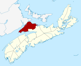 Location of Cumberland County, Nova Scotia | |
| Coordinates: 45.7°N 64.1°W | |
| Country | Canada |
| Province | Nova Scotia |
| Towns | Amherst / Oxford |
| Established | August 17, 1759 |
| Incorporated | April 17, 1879 |
| Electoral Districts Federal | Cumberland—Colchester |
| Provincial | Cumberland North / Cumberland South |
| Government | |
| • Type | Cumberland County Municipal Council |
| • Mayor | Murray Scott |
| • MLA | Elizabeth Smith-McCrossin (Independent) Tory Rushton (PCNS) |
| • MP | Stephen Ellis (CPC) |
| Area | |
| • Land | 4,275.77 km2 (1,650.88 sq mi) |
| Population | |
| • Total | 30,538 |
| • Density | 7.1/km2 (18/sq mi) |
| • Change 2011-16 | |
| Time zone | UTC-4 (AST) |
| • Summer (DST) | UTC-3 (ADT) |
| Area code | 902 |
| Dwellings | 18,445 |
| Median Income* | $38,433 CAD |
| Website | www.cumberland county.ns.ca |
| |
History
The name Cumberland was applied by Lieutenant-Colonel Robert Monckton to the captured Fort Beauséjour on June 18, 1755 in honour of the third son of King George II, William Augustus, Duke of Cumberland, victor at Culloden in 1746 and Commander in Chief of the British forces. The Mi'kmaq name for the area was "Kwesomalegek" meaning "hardwood point".
Cumberland County was founded on August 17, 1759. When the Township of Parrsboro was divided in 1840, one part was annexed to Cumberland County and the other part annexed to Colchester.
The dividing line between Cumberland and Colchester was established in 1840. In 1897, a portion of the boundary line between the Counties of Colchester and Cumberland was fixed and defined. The county thrived in the 19th century with the development of lumbering, shipbuilding and coal mining. Deforestation and rural outmigration in the 20th century led to the abandonment of some communities such as Eatonville and New Yarmouth.
Geography

The county has a total area of 4,271.23 km2 (1,649.13 sq mi).
Cumberland County is rich in natural resources with extensive forest land supporting lumber mills and pulp contractors. It has many mineral resources, including 2 operating salt mines. Until the 1970s it also had several coal mines which extracted coal from seams that run from Joggins to River Hebert and on to Athol and Springhill.
Agriculture is concentrated on wild blueberry harvesting throughout the Cobequid Hills, as well as mixed farms located in the Tantramar Marshes region, the Northumberland Strait coastal plain, and the Wentworth Valley.
The northwestern edge of Cumberland County forms part of the Isthmus of Chignecto, the natural land bridge connecting the Nova Scotia peninsula to North America. As such, the county hosts several important transportation corridors, including Highway 104 (the Trans-Canada Highway) and CN Rail's Halifax-Montreal railway line.
Two towns are located in Cumberland County: Amherst and Oxford.
Demographics
As a census division in the 2021 Census of Population conducted by Statistics Canada, Cumberland County had a population of 30,538 living in 14,139 of its 18,363 total private dwellings, a change of 1.8% from its 2016 population of 30,005. With a land area of 4,275.77 km2 (1,650.88 sq mi), it had a population density of 7.1/km2 (18.5/sq mi) in 2021.[3]
Forming the majority of the Cumberland County census division, the Municipality of the County of Cumberland, including its Subdivisions A, B, C, and D, had a population of 19,964 living in 9,126 of its 12,988 total private dwellings, a change of 2.9% from its 2016 population of 19,402. With a land area of 4,253.04 km2 (1,642.11 sq mi), it had a population density of 4.7/km2 (12.2/sq mi) in 2021.[4]
|
Mother tongue language (2011)[7]
|
Ethnic Groups (2006)[8]
|
Communities
- Towns
- Amherst
- Oxford
- Villages
- County municipality and county subdivisions
- Municipality of the County of Cumberland
- Cumberland Subdivision A
- Cumberland Subdivision B
- Cumberland Subdivision C
- Cumberland Subdivision D
Highways
 Trunk 2
 Trunk 4
 Trunk 6
 Hwy 104 (TCH)
 Hwy 142
 Route 204
 Route 209
 Route 321
See also
- List of municipalities in Nova Scotia
- Central Nova Tourist Association — Tourism Association Representing Cumberland County.
- Royal eponyms in Canada
- Black Lake listings within Nova Scotia.
References
- "Community Profiles from the 2006 Census, Statistics Canada - Census Division".
- Population and dwelling counts, for Canada and census subdivisions (municipalities), 2006 and 2001 censuses - 100% data
- "Population and dwelling counts: Canada and census divisions". Statistics Canada. February 9, 2022. Retrieved April 2, 2022.
- "Population and dwelling counts: Canada, provinces and territories, census divisions and census subdivisions (municipalities), Nova Scotia". Statistics Canada. February 9, 2022. Retrieved April 2, 2022.
- "Canada Year Book 1943-44" (PDF). September 10, 2017. Archived from the original (PDF) on September 10, 2017.
- Statistics Canada: 1996, 2001, 2006 census
- Statistics Canada: 2011 census
- "Ethnocultural Portrait of Canada - Data table".
External links
- Cumberland County official site
- Photographs of the Cumberland County War Memorial monument, Amherst
- Photographs of historic monuments in Cumberland County
Places adjacent to Cumberland County, Nova Scotia | ||||||||||||||||
|---|---|---|---|---|---|---|---|---|---|---|---|---|---|---|---|---|
| ||||||||||||||||
Subdivisions of Nova Scotia | |
|---|---|
| Counties |
|
| County municipalities | |
| Regional municipalities | |
| District municipalities | |
| Towns |
|
| Villages |
|
| Economic regions | |
| Lists |
|
| |
Authority control | |
|---|---|
| General | |
| National libraries | |
На других языках
- [en] Cumberland County, Nova Scotia
[ru] Камберленд (графство, Новая Шотландия)
Камберленд — графство в канадской провинции Новая Шотландия. Графство является переписным районом и административной единицей провинции.Другой контент может иметь иную лицензию. Перед использованием материалов сайта WikiSort.org внимательно изучите правила лицензирования конкретных элементов наполнения сайта.
WikiSort.org - проект по пересортировке и дополнению контента Википедии