world.wikisort.org - Brazil
Tanguá (Portuguese pronunciation: [tɐ̃ˈgwa]) is a municipality located in the Brazilian state of Rio de Janeiro. It covers an area of 145,5 km².[2]
Tanguá | |
|---|---|
Municipality | |
| Município de Tanguá | |
 Flag  Seal | |
| Nickname: Capital Pioneira das Telecomunicações | |
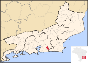 Location of Tanguá in the state of Rio de Janeiro | |
 Tanguá Location of Tanguá in Brazil | |
| Coordinates: 22°43′48″S 42°42′50″W | |
| Country | |
| Region | Southeast |
| State | |
| Government | |
| • Prefeito | Anderson Pereira de Oliveira (Coroné Anderson) |
| Area | |
| • Total | 145.503 km2 (56.179 sq mi) |
| Elevation | 20 m (70 ft) |
| Population (2020 [1]) | |
| • Total | 34,610 |
| Time zone | UTC−3 (BRT) |
| Website | |
Its population is relatively stable, with 29.481 in 2005[3] and 30.732 in 2010,[2] most of them urban.[2] This equates to a population density of 211 inhabitants per km².[2]
The municipality contains part of the Central Rio de Janeiro Atlantic Forest Mosaic of conservation units, created in 2006.[4] It contains the 878 hectares (2,170 acres) Serra do Barbosão Municipal Nature Park, created in 2007 to protect an area of Atlantic Forest.[5]
References
- IBGE 2020
- Tanguá - RJ, Brazilian Institute of Geography and Statistics (IBGE), 2011
- Tanguá - RJ, Brazilian Institute of Geography and Statistics (IBGE), 2005, archived from the original on January 9, 2007
- Costa, Cláudia; Lamas, Ivana; Fernandes, Rosan (December 2010), Planejamento Estratégico do Mosaico Central Fluminense (PDF) (in Portuguese), Reserva da Biosfera da Mata Atlântica, p. 13, retrieved 2016-10-02
- Pereira, Carlos Roberto (23 October 2007), Lei nº. 0633, de 23 de Outubro de 2007 (in Portuguese), retrieved 2016-10-05
Wikimedia Commons has media related to Tanguá.
Capital: Rio de Janeiro | |||||||||||
| Mesoregion Baixadas |
|  | |||||||||
| Mesoregion Centro Fluminense |
| ||||||||||
| Mesoregion Metropolitana do Rio de Janeiro |
| ||||||||||
| Mesoregion Noroeste Fluminense |
| ||||||||||
| Mesoregion Norte Fluminense |
| ||||||||||
| Mesoregion Sul Fluminense |
| ||||||||||
This Rio de Janeiro state, Brazil location article is a stub. You can help Wikipedia by expanding it. |
На других языках
- [en] Tanguá
[ru] Тангуа
Тангуа (порт. Tanguá) — муниципалитет в Бразилии, входит в штат Рио-де-Жанейро. Составная часть мезорегиона Агломерация Рио-де-Жанейро. Входит в экономико-статистический микрорегион Рио-де-Жанейро. Население составляет 28 322 человека на 2007 год. Занимает площадь 146,623 км². Плотность населения — 193,2 чел./км².Текст в блоке "Читать" взят с сайта "Википедия" и доступен по лицензии Creative Commons Attribution-ShareAlike; в отдельных случаях могут действовать дополнительные условия.
Другой контент может иметь иную лицензию. Перед использованием материалов сайта WikiSort.org внимательно изучите правила лицензирования конкретных элементов наполнения сайта.
Другой контент может иметь иную лицензию. Перед использованием материалов сайта WikiSort.org внимательно изучите правила лицензирования конкретных элементов наполнения сайта.
2019-2026
WikiSort.org - проект по пересортировке и дополнению контента Википедии
WikiSort.org - проект по пересортировке и дополнению контента Википедии