world.wikisort.org - Brazil
Barra do Piraí (Portuguese pronunciation: [ˈbaʁɐ du piɾɐˈi]) is a municipality of the Brazilian state of Rio de Janeiro. It is located at latitude 22º28'12" South and longitude 43º49'32" East. Its population is 100,764 (2020) and its area is 578.471 km².[2] It is 114 km from Rio de Janeiro.
Barra do Piraí | |
|---|---|
Municipality | |
| Barra do Piraí | |
 SantAnna's Cathedral | |
 Flag  Seal | |
| Nickname: Valley's pearl | |
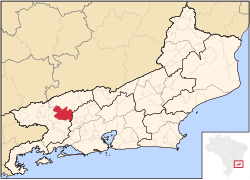 Location of Barra do Piraí in the state of Rio de Janeiro | |
 Barra do Piraí Location of Barra do Piraí in Brazil | |
| Coordinates: 22°28′12″S 43°49′33″W | |
| Country | |
| Region | Southeast |
| State | |
| Government | |
| • Prefeito | Mário Esteves (PRB) |
| Area | |
| • Total | 578.471 km2 (223.349 sq mi) |
| Elevation | 363 m (1,191 ft) |
| Population (2020 [1]) | |
| • Total | 100,764 |
| Time zone | UTC-3 (UTC-3) |
| Website | |
The municipality contains part of the 5,952 hectares (14,710 acres) Serra da Concórdia State Park, created in 2002.[3]
References
- IBGE 2020
- IBGE - "Archived copy". Archived from the original on 2007-01-09. Retrieved 2014-08-03.
{{cite web}}: CS1 maint: archived copy as title (link) - Parque Estadual da Serra da Concórdia (in Portuguese), Inea: Instituto Estadual do Ambiente, retrieved 2017-01-18
Capital: Rio de Janeiro | |||||||||||
| Mesoregion Baixadas |
|  | |||||||||
| Mesoregion Centro Fluminense |
| ||||||||||
| Mesoregion Metropolitana do Rio de Janeiro |
| ||||||||||
| Mesoregion Noroeste Fluminense |
| ||||||||||
| Mesoregion Norte Fluminense |
| ||||||||||
| Mesoregion Sul Fluminense |
| ||||||||||
This Rio de Janeiro state, Brazil location article is a stub. You can help Wikipedia by expanding it. |
На других языках
- [en] Barra do Piraí
[ru] Барра-ду-Пираи
Барра-ду-Пираи (порт. Barra do Piraí) — муниципалитет в Бразилии, входит в штат Рио-де-Жанейро. Составная часть мезорегиона Юг штата Рио-де-Жанейро. Находится в составе крупной городской агломерации . Входит в экономико-статистический микрорегион Барра-ду-Пираи. Население составляет 96 282 человека на 2007 год. Занимает площадь 578,471 км². Плотность населения — 164,9 чел./км².Текст в блоке "Читать" взят с сайта "Википедия" и доступен по лицензии Creative Commons Attribution-ShareAlike; в отдельных случаях могут действовать дополнительные условия.
Другой контент может иметь иную лицензию. Перед использованием материалов сайта WikiSort.org внимательно изучите правила лицензирования конкретных элементов наполнения сайта.
Другой контент может иметь иную лицензию. Перед использованием материалов сайта WikiSort.org внимательно изучите правила лицензирования конкретных элементов наполнения сайта.
2019-2026
WikiSort.org - проект по пересортировке и дополнению контента Википедии
WikiSort.org - проект по пересортировке и дополнению контента Википедии