world.wikisort.org - Brazil
Caseara is a municipality located in the Brazilian state of Tocantins. Its population was 5,442 (2020) and its area is 1,692 km².[2]
Caseara | |
|---|---|
Municipality | |
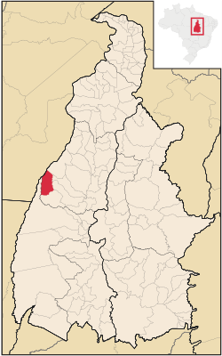 Location in Tocantins state | |
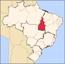
 Caseara Location in Brazil | |
| Coordinates: 9°16′40″S 49°57′21″W | |
| Country | Brazil |
| Region | North |
| State | Tocantins |
| Area | |
| • Total | 1,692 km2 (653 sq mi) |
| Population (2020 [1]) | |
| • Total | 5,442 |
| • Density | 3.2/km2 (8.3/sq mi) |
| Time zone | UTC-03:00 (BRT) |
The municipality contains 10.66% of the 1,678,000 hectares (4,150,000 acres) Ilha do Bananal / Cantão Environmental Protection Area, created in 1997.[3] The headquarters and visitor center of Cantão State Park are located just outside the town of Caseara. The municipality plans to open a hiking/bicycle trail from the town center to the park's visitor center in 2014.
References
- "IBGE 2020". Retrieved 26 January 2021.
- IBGE -
- APA Leandro (Ilha do Bananal/Cantão) (in Portuguese), ISA: Instituto Socioambiental, retrieved 2016-10-31
This Tocantins, Brazil location article is a stub. You can help Wikipedia by expanding it. |
На других языках
- [en] Caseara
[ru] Казеара
Казеара (порт. Caseara) — муниципалитет в Бразилии, входит в штат Токантинс. Составная часть мезорегиона Западный Токантинс. Входит в экономико-статистический микрорегион Мирасема-ду-Токантинс. Население составляет 4 601 человек на 2010 год. Занимает площадь 1 691,632 км². Плотность населения — 2,72 чел./км².Текст в блоке "Читать" взят с сайта "Википедия" и доступен по лицензии Creative Commons Attribution-ShareAlike; в отдельных случаях могут действовать дополнительные условия.
Другой контент может иметь иную лицензию. Перед использованием материалов сайта WikiSort.org внимательно изучите правила лицензирования конкретных элементов наполнения сайта.
Другой контент может иметь иную лицензию. Перед использованием материалов сайта WikiSort.org внимательно изучите правила лицензирования конкретных элементов наполнения сайта.
2019-2026
WikiSort.org - проект по пересортировке и дополнению контента Википедии
WikiSort.org - проект по пересортировке и дополнению контента Википедии