world.wikisort.org - Brazil
Taguatinga is a municipality in the state of Tocantins in Brazil.[2][3][4][5]
Taguatinga | |
|---|---|
Municipality | |
| Município de Taguatinga Municipality of Taguatinga | |
 Flag  Seal | |
| Nickname(s): Taguá | |
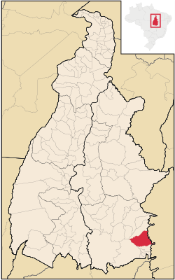 Localization of Taguatinga in Tocantins | |
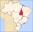
 Taguatinga Localization of Taguatinga in Brazil | |
| Coordinates: 12°24′22″S 46°26′02″W | |
| Country | |
| Region | North Region |
| State | |
| Founded | June 10, 1872 |
| Government | |
| • Mayor | Altamirando Zequinha Gonçalves Taguatinga (PV) (2017-2020) |
| Area | |
| • Total | 2.437386 km2 (0.941080 sq mi) |
| Elevation | 634 m (2,080 ft) |
| Population (2020 [1]) | |
| • Total | 16,825 |
| • Density | 6.18/km2 (16.0/sq mi) |
| Demonym(s) | Taguatinguense |
| Time zone | UTC-3 (UTC-3) |
| • Summer (DST) | UTC-2 (UTC-2) |
| Postal Code (CEP) | 77320-000 |
| Area code(s) | +55 63 |
| Website | www.taguatinga.to.gov.br |
History
This section is empty. You can help by adding to it. (December 2012) |
See also
- List of municipalities in Tocantins
References
- "IBGE 2020". Retrieved 26 January 2021.
- "Divisão Territorial do Brasil" (in Portuguese). Divisão Territorial do Brasil e Limites Territoriais, Instituto Brasileiro de Geografia e Estatística (IBGE). July 1, 2008. Retrieved December 17, 2009.
- "Estimativas da população para 1º de julho de 2009" (PDF) (in Portuguese). Estimativas de População, Instituto Brasileiro de Geografia e Estatística (IBGE). August 14, 2009. Retrieved December 17, 2009.
- "Ranking decrescente do IDH-M dos municípios do Brasil" (in Portuguese). Atlas do Desenvolvimento Humano, Programa das Nações Unidas para o Desenvolvimento (PNUD). 2000. Retrieved December 17, 2009.
- "Produto Interno Bruto dos Municípios 2002-2005" (PDF) (in Portuguese). Instituto Brasileiro de Geografia e Estatística (IBGE). December 19, 2007. Retrieved December 17, 2009.
External links
Wikimedia Commons has media related to Taguatinga, Tocantins.
На других языках
- [en] Taguatinga, Tocantins
[ru] Тагуатинга (Токантинс)
Тагуатинга (порт. Taguatinga) — муниципалитет в Бразилии, входит в штат Токантинс. Составная часть мезорегиона Восточный Токантинс. Входит в экономико-статистический микрорегион Дианополис. Население составляет 15 051 человек на 2010 год. Занимает площадь 2 437,399 км². Плотность населения — 6,18 чел./км².Текст в блоке "Читать" взят с сайта "Википедия" и доступен по лицензии Creative Commons Attribution-ShareAlike; в отдельных случаях могут действовать дополнительные условия.
Другой контент может иметь иную лицензию. Перед использованием материалов сайта WikiSort.org внимательно изучите правила лицензирования конкретных элементов наполнения сайта.
Другой контент может иметь иную лицензию. Перед использованием материалов сайта WikiSort.org внимательно изучите правила лицензирования конкретных элементов наполнения сайта.
2019-2025
WikiSort.org - проект по пересортировке и дополнению контента Википедии
WikiSort.org - проект по пересортировке и дополнению контента Википедии