world.wikisort.org - Brazil
Águas Mornas is a Brazilian municipality in the state of Santa Catarina.
Águas Mornas | |
|---|---|
municipality | |
 Church of Águas Mornas and town square Evaldo Carlos Lehmkuhl | |
 Flag  Seal | |
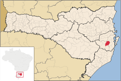 Location of Águas Mornas | |
 Águas Mornas | |
| Coordinates: 27°41′38″S 48°49′26″W | |
| Country | |
| Region | South |
| State | |
| Founded | December 29, 1961 |
| Government | |
| • Mayor | Elmar Antônio Thiesen (PFL) |
| Area | |
| • Total | 360.757 km2 (139.289 sq mi) |
| Elevation | 70 m (230 ft) |
| Population (2020 [1]) | |
| • Total | 6,559 |
| • Density | 12.4/km2 (32/sq mi) |
| Time zone | UTC-3 (UTC-3) |
| • Summer (DST) | UTC-2 (UTC-2) |
| HDI (2000) | 0.783 |
| Website | www.aguasmornas.sc.gov.br |
The municipality contains part of the Rio das Lontras Private Natural Heritage Reserve, a fully protected area of montane rainforest in the Atlantic Forest biome.[2] It also contains part of the 84,130 hectares (207,900 acres) Serra do Tabuleiro State Park, a protected area created in 1975. The lushly-forested park protects the sources of the Vargem do Braço, Cubatão and D'Una rivers, which supply most of the drinking water for greater Florianópolis and the south coast region.[3]
References
- IBGE 2020
- RPPN Reserve Ecologica Rio das Lontras (in Portuguese), Associação dos Proprietários de Reservas Particulares do Patrimônio Natural de Santa Catarina, retrieved 2016-05-18
- Parque Estadual da Serra do Tabuleiro (in Portuguese), FATMA: Fundação do meio Ambiente, retrieved 2016-06-11
| |
| Florianópolis |
|
| Tabuleiro |
|
| Tijucas |
|
Capital: Florianópolis | |||||||||||
| Grande Florianópolis |
|  | |||||||||
| Norte Catarinense |
| ||||||||||
| Oeste Catarinense |
| ||||||||||
| Serrana |
| ||||||||||
| Sul Catarinense |
| ||||||||||
| Vale do Itajai |
| ||||||||||
| Authority control |
|
|---|
This Santa Catarina, Brazil location article is a stub. You can help Wikipedia by expanding it. |
На других языках
- [en] Águas Mornas
[es] Águas Mornas
Águas Mornas es un municipio brasileño del estado de Santa Catarina, estando a una altitud de 70 metros sobre el nivel del mar. Tiene una población estimada al 2020 de 6 559 habitantes.[2] Es conocida por sus balnearios medicinales.[ru] Агуас-Морнас
Агуас-Морнас (порт. Águas Mornas) — муниципалитет в Бразилии, входит в штат Санта-Катарина. Составная часть мезорегиона Гранди-Флорианополис. Входит в экономико-статистический микрорегион Табулейру. Население составляет 5140 человек на 2006 год. Занимает площадь 360,757 км². Плотность населения — 14,2 чел./км².Текст в блоке "Читать" взят с сайта "Википедия" и доступен по лицензии Creative Commons Attribution-ShareAlike; в отдельных случаях могут действовать дополнительные условия.
Другой контент может иметь иную лицензию. Перед использованием материалов сайта WikiSort.org внимательно изучите правила лицензирования конкретных элементов наполнения сайта.
Другой контент может иметь иную лицензию. Перед использованием материалов сайта WikiSort.org внимательно изучите правила лицензирования конкретных элементов наполнения сайта.
2019-2025
WikiSort.org - проект по пересортировке и дополнению контента Википедии
WikiSort.org - проект по пересортировке и дополнению контента Википедии