world.wikisort.org - Brazil
Caçador (Portuguese pronunciation: [kasa'doɾ]) is a municipality in the state of Santa Catarina in the South region of Brazil. [1] [2] [4] [5] [6] [7]
Caçador
Municipality of Caçador Município de Caçador | |
|---|---|
Municipality | |
 São Francisco de Assis Cathedral | |
 Flag  Seal | |
 Location within the state of Santa Catarina | |
 Caçador | |
| Coordinates: 26°46′30″S 51°00′54″W | |
| Country | |
| Region | South |
| State | Santa Catarina |
| Mesoregion | Oeste Catarinense[1] |
| Microregion | Joaçaba |
| Metropolitan area | Contestado Metropolitan Area |
| Government | |
| • Mayor | Saulo Sperotto (PSDB) |
| Area | |
| • Total | 984.285 km2 (380.035 sq mi) |
| IBGE/2017 | |
| Elevation | 920 m (3,020 ft) |
| Highest elevation | 1,390 m (4,560 ft) |
| Lowest elevation | 780 m (2,560 ft) |
| Population (2020 [3]) | |
| • Total | 79,313 |
| • Density | 81/km2 (210/sq mi) |
| IBGE | |
| Time zone | UTC−3 |
| • Summer (DST) | UTC-2 |
| Demonym | caçadorense |
History

The banks of the Rio do Peixe (Fish River) were inhabited by ethnic native groups of Kaingangs and Xoklengs until 1881, when families of European origin settled here and, because of the abundance of hunting, dubbed the place "Rio do Caçador" (Hunter River).
Francisco Correa de Mello, who came from Campos Novos and settled on the banks of Rio do Peixe, in 1881, is considered the first resident of Portuguese origin; he was followed in 1887 by Pedro Ribeiro, and in 1891, Tomaz Gonçalves Padilha, who settled on November 15.
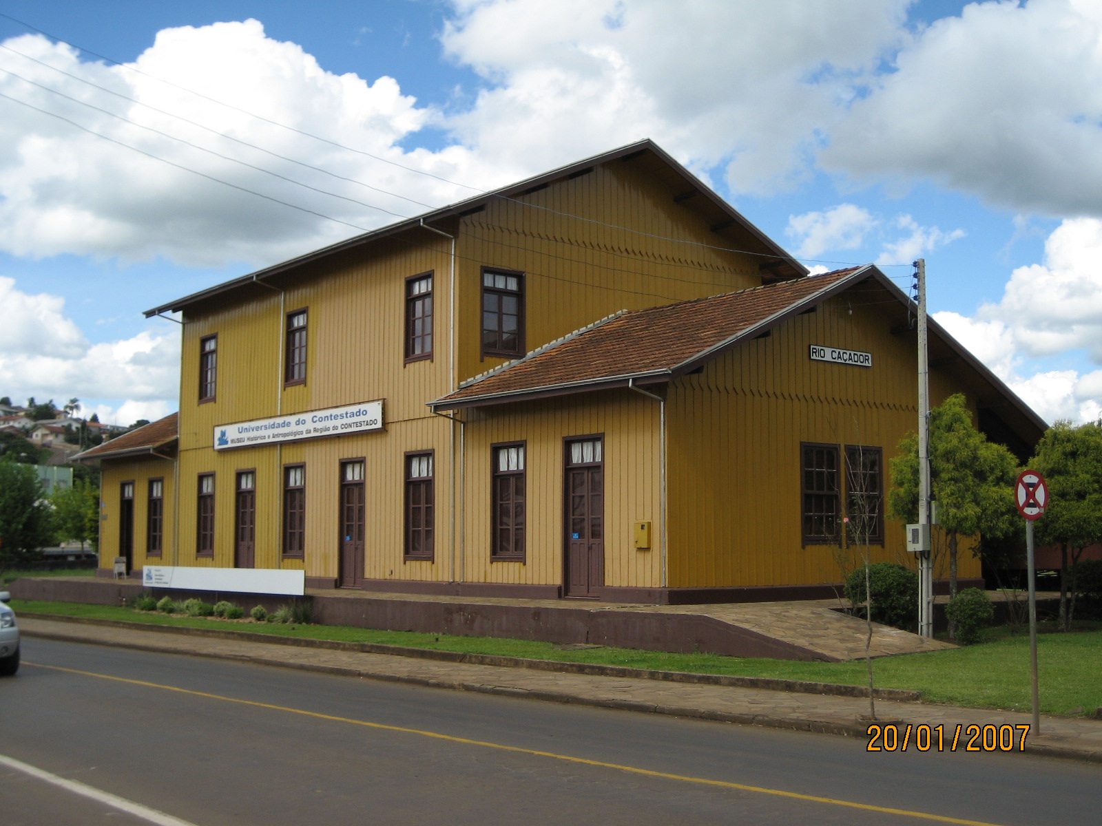
With the construction of the railroad São Paulo to Rio Grande do Sul from 1908 to 1910, the colonization intensified with an influx of Italian, German, Polish and Syrian-Lebanese immigrants . In 1910 the tracks reached Rio Caçador and attracted large numbers of immigrants of Italian origin, mainly from Rio Grande do Sul. With the settlement of the core of Rio das Antas, many Teutonic-Brazilian settlers from the coast of Santa Catarina were established in the municipality by the Brazilian Railway Company.
The town of Caçador is in the heart of the region where, from 1912 to 1916, there was the so-called Contestado War.
In 1918 the first post office was built where there was already a state revenues post. The construction of the Road from Caçador to Curitibanos in 1933 spurred the development of the region. Rio Caçador, which was founded in 1923, came under the auspices of the municipal district of Campos Novos. In the administrative division report for the year of 1933, Rio Caçador district was included in the municipality of Curitibanos.
Population growth and the lumber industry led to the creation of the municipality, established on March 25, 1934 and dis-enchartered the cities of Curitibanos, Campos Novos, Cruzeiro and Porto União.
Caçador's economy has been developed through the harvesting and processing of timber and reforestation. Agriculture emerged as a new option for generating foreign exchange, especially for fresh produce where Caçador is considered the largest producer of tomatoes in southern Brazil.
The name "Caçador" is derived from "Caçadores", a variety of Portuguese infantry created during the 17th century. "Caçadores" means "hunters" in Portuguese.
Climate
The city has a temperate oceanic climate (Köppen climate classification Cfb), with an average annual temperature of 16.0 °C (60.8 degree Fahrenheit), it has hot and humid summers with cold and dry winters. It is known for its below freezing temperatures during winter.
Caçador holds the record minimum temperature of Brazil; -14.0 °C (6.8 degree Fahrenheit) on June 11, 1952.[8] Another record, which is unofficial, of -17.8 °C (-0.04 degree Fahrenheit) in 1996 in Morro da Igreja, Urubici, also in Santa Catarina, would be the record minimum for Brazil.[9]
During the months of May to September, frosts and occasional snowfalls may occur.
| Climate data for Caçador | |||||||||||||
|---|---|---|---|---|---|---|---|---|---|---|---|---|---|
| Month | Jan | Feb | Mar | Apr | May | Jun | Jul | Aug | Sep | Oct | Nov | Dec | Year |
| Average high °C (°F) | 26.7 (80.1) |
26.3 (79.3) |
25.3 (77.5) |
22.2 (72.0) |
19.6 (67.3) |
17.7 (63.9) |
17.8 (64.0) |
19.6 (67.3) |
20.6 (69.1) |
22.3 (72.1) |
24.4 (75.9) |
26.1 (79.0) |
22.4 (72.3) |
| Daily mean °C (°F) | 20.7 (69.3) |
20.5 (68.9) |
19.5 (67.1) |
16.3 (61.3) |
13.6 (56.5) |
11.8 (53.2) |
11.5 (52.7) |
13 (55) |
14.7 (58.5) |
16.4 (61.5) |
18.1 (64.6) |
19.8 (67.6) |
16.3 (61.4) |
| Average low °C (°F) | 14.7 (58.5) |
14.6 (58.3) |
13.7 (56.7) |
10.5 (50.9) |
7.7 (45.9) |
6.0 (42.8) |
5.3 (41.5) |
6.5 (43.7) |
8.8 (47.8) |
10.6 (51.1) |
11.9 (53.4) |
13.5 (56.3) |
10.3 (50.6) |
| Record low °C (°F) | 4.0 (39.2) |
1.0 (33.8) |
0.8 (33.4) |
−3.0 (26.6) |
−6.0 (21.2) |
−14 (7) |
−11.0 (12.2) |
−10.4 (13.3) |
−7.0 (19.4) |
−3.0 (26.6) |
−1.8 (28.8) |
2.0 (35.6) |
−14.0 (6.8) |
| Average precipitation mm (inches) | 154.9 (6.10) |
143.8 (5.66) |
141.2 (5.56) |
113.4 (4.46) |
105.9 (4.17) |
140 (5.5) |
104.3 (4.11) |
109.8 (4.32) |
153.9 (6.06) |
146.7 (5.78) |
120.2 (4.73) |
126.3 (4.97) |
1,560.4 (61.43) |
| Source: Inmet | |||||||||||||
See also
- List of municipalities in Santa Catarina
References
- "Divisão Territorial Brasileira". Instituto Brasileiro de Geografia e Estatística. 2018. Archived from the original (ZIP) on February 15, 2019. Retrieved February 15, 2019.
- "Caçador (SC) / Cidades e Estados" (in Portuguese). IBGE - Instituto Brasileiro de Geografia e Estatística. Archived from the original on February 14, 2019. Retrieved February 14, 2019.
- IBGE 2020
- "Estimativas da população para 1º de julho de 2009" (PDF) (in Portuguese). Estimativas de População, Instituto Brasileiro de Geografia e Estatística (IBGE). August 14, 2009. Archived from the original (PDF) on October 7, 2009. Retrieved December 17, 2009.
- "Ranking decrescente do IDH-M dos municípios do Brasil" (in Portuguese). Atlas do Desenvolvimento Humano, Programa das Nações Unidas para o Desenvolvimento (PNUD). 2000. Archived from the original on October 3, 2009. Retrieved December 17, 2009.
- "Brasil em Síntese / Santa Catarina / Caçȧdor / Pesquisa: Produto Interno Bruto dos Municípios" (in Portuguese). IBGE - Instituto Brasileiro de Geografia e Estatística. Archived from the original on February 14, 2019. Retrieved February 14, 2019.
- "Produto Interno Bruto dos Municípios 2002-2005" (PDF) (in Portuguese). Instituto Brasileiro de Geografia e Estatística (IBGE). December 19, 2007. Archived from the original (PDF) on October 2, 2008. Retrieved December 17, 2009.
- (in Portuguese) Recordes de frio em SC Archived 2012-09-13 at the Wayback Machine, EPAGRI/CIRAM, retrieved May 15, 2013.
- (in Portuguese) Sibéria brasileira no sul do Brasil ("Brazilian Siberia in the South of Brazil"), Fantástico, July 18, 2006.
Capital: Florianópolis | |||||||||||
| Grande Florianópolis |
|  | |||||||||
| Norte Catarinense |
| ||||||||||
| Oeste Catarinense |
| ||||||||||
| Serrana |
| ||||||||||
| Sul Catarinense |
| ||||||||||
| Vale do Itajai |
| ||||||||||
Authority control | |
|---|---|
| General |
|
| National libraries | |
На других языках
- [en] Caçador
[ru] Касадор
Касадор (порт. Caçador) — муниципалитет в Бразилии, входит в штат Санта-Катарина. Составная часть мезорегиона Запад штата Санта-Катарина. Входит в экономико-статистический микрорегион Жоасаба. Население составляет 67 556 человек на 2007 год. Занимает площадь 981,901 км². Плотность населения — 68,80 чел./км².Другой контент может иметь иную лицензию. Перед использованием материалов сайта WikiSort.org внимательно изучите правила лицензирования конкретных элементов наполнения сайта.
WikiSort.org - проект по пересортировке и дополнению контента Википедии