world.wikisort.org - Brazil
Porto União is a city located in the Northern Plateau in the State of Santa Catarina and on the left bank of Iguazu River, bordering the city of União da Vitória, Paraná. In 2020, its population was estimated in 35,543 inhabitants.
Porto União | |
|---|---|
 Flag  Seal | |
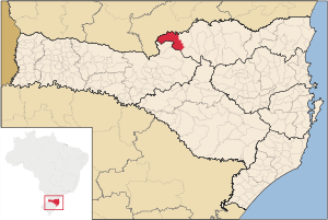 Location in Santa Catarina, Brazil | |
 Porto União | |
| Coordinates: 26°14′16″S 51°04′40″W | |
| Country | Brazil |
| Region | South |
| State | Santa Catarina |
| Government | |
| • Mayor | Anízio de Souza (PT) |
| Area | |
| • Total | 851.24 km2 (328.67 sq mi) |
| Elevation | 752 m (2,467 ft) |
| Population (2020 [1]) | |
| • Total | 35,543 |
| • Density | 38.9/km2 (101/sq mi) |
| Time zone | UTC-3 (UTC-3) |
| • Summer (DST) | UTC-2 (UTC-2) |
| Area code | +55 42 |
| Website | www |
History
The history of Porto União has always been intrinsically connected with the Iguazu River and with what is considered its twin city União da Vitória.
It all began in 1842 with the discovery of the 'Vau do Iguaçu' (literally meaning 'Iguazu Ford'), the best connection between the South and the Southeast Region, where the army troops and people from Rio Grande do Sul known as 'tropeiros' used to cross the river with their oxen in order to sell them in São Paulo and Minas Gerais. It was also an important stop point for those who used the river in transportation, receiving its first name: Porto da União (Harbour of Union). In a few years, the area rapidly developed.
The small village grew and in 1855 its name was changed to Porto União da Vitória. In the same year, immigration began with the influx of Germans, Poles, Ukrainians, Italians, Austrians and Russians. In 1901, its name again changed, this time to União da Vitória.
In 1912, the Contestado War took place and on September 5, 1917 the municipality of Porto União was created.
In the 1950s, both cities, União da Vitória and Porto União, reach their economic and regional importance as the result the growth of the native wood market and of yerba mate.
Nowadays, the city, just like its twin, lives of the non-native wood market and tourism. Porto União has a subtropical Cfa-like climate with hot summers and rainy months
| Climate data for Porto União | |||||||||||||
|---|---|---|---|---|---|---|---|---|---|---|---|---|---|
| Month | Jan | Feb | Mar | Apr | May | Jun | Jul | Aug | Sep | Oct | Nov | Dec | Year |
| Average high °C (°F) | 25.7 (78.3) |
25.6 (78.1) |
24.7 (76.5) |
22.7 (72.9) |
18.9 (66.0) |
18.1 (64.6) |
18.1 (64.6) |
20.3 (68.5) |
21.6 (70.9) |
23.0 (73.4) |
23.8 (74.8) |
25.4 (77.7) |
22.3 (72.1) |
| Daily mean °C (°F) | 22.2 (72.0) |
22.1 (71.8) |
21.2 (70.2) |
19.0 (66.2) |
15.4 (59.7) |
14.3 (57.7) |
13.9 (57.0) |
15.4 (59.7) |
17.1 (62.8) |
19.0 (66.2) |
19.9 (67.8) |
21.5 (70.7) |
18.4 (65.1) |
| Average low °C (°F) | 18.6 (65.5) |
18.6 (65.5) |
17.7 (63.9) |
15.3 (59.5) |
11.8 (53.2) |
10.4 (50.7) |
9.6 (49.3) |
10.5 (50.9) |
12.5 (54.5) |
15.0 (59.0) |
16.0 (60.8) |
17.6 (63.7) |
14.4 (57.9) |
| Average rainfall mm (inches) | 170.0 (6.69) |
156.0 (6.14) |
110.0 (4.33) |
81.0 (3.19) |
100.0 (3.94) |
99.0 (3.90) |
89.0 (3.50) |
78.0 (3.07) |
148.0 (5.83) |
159.0 (6.26) |
123.0 (4.84) |
142.0 (5.59) |
1,455 (57.28) |
| Average relative humidity (%) | 82.0 | 84.0 | 83.0 | 82.0 | 83.0 | 85.0 | 82.0 | 79.0 | 78.0 | 81.0 | 80.0 | 80.0 | 81.6 |
| Source 1: Instituto Nacional de Meteorologia (temperature records: 1975 to 1984 and 1993 to 2013).[2][3] | |||||||||||||
| Source 2: Climate Data (Precipitation and temperature average)[4] and Departamento de Ciências Atmosféricas (relative humidity).[5] | |||||||||||||
References
- IBGE 2020
- "Série Histórica - Dados Diários - Temperatura Mínima (°C) - Porto União". Banco de Dados Meteorológicos para Ensino e Pesquisa. Instituto Nacional de Meteorologia. Retrieved 30 May 2014.
- "BDMEP - Série Histórica - Dados Diários - Temperatura Máxima (°C) - Patos". Banco de Dados Meteorológicos para Ensino e Pesquisa. Instituto Nacional de Meteorologia. Retrieved 30 May 2014.
- "Clima: Patos". Climate Data. Archived from the original on 30 May 2014. Retrieved 30 May 2014.
- "Estado: Santa Catarina - Umidade Relativa do Ar". Departamento de Ciências Atmosféricas. Retrieved 27 October 2014.
| |
| Canoinhas |
|
| Joinville |
|
| São Bento do Sul |
|
Authority control | |
|---|---|
| General |
|
| National libraries | |
This Santa Catarina, Brazil location article is a stub. You can help Wikipedia by expanding it. |
На других языках
- [en] Porto União
[ru] Порту-Униан
Порту-Униан (порт. Porto União) — муниципалитет в Бразилии, входит в штат Санта-Катарина. Составная часть мезорегиона Север штата Санта-Катарина. Входит в экономико-статистический микрорегион Каноиньяс. Население составляет 33 095 человек на 2005 год. Занимает площадь 851,2 км². Плотность населения — 38,89 чел./км².Другой контент может иметь иную лицензию. Перед использованием материалов сайта WikiSort.org внимательно изучите правила лицензирования конкретных элементов наполнения сайта.
WikiSort.org - проект по пересортировке и дополнению контента Википедии