world.wikisort.org - Belgium
Theux (French pronunciation: [tø]; Walloon: Teu) is a municipality of Wallonia located in the province of Liège, Belgium.
Theux
| |
|---|---|
Municipality | |
 Place du Perron | |
 Flag  Coat of arms | |
Location of Theux  | |
 Theux Location in Belgium
Location of Theux in the province of Liège 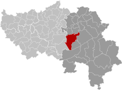 | |
| Coordinates: 50°32′N 05°49′E | |
| Country | Belgium |
| Community | French Community |
| Region | Wallonia |
| Province | Liège |
| Arrondissement | Verviers |
| Government | |
| • Mayor | Pierre Lemarchand |
| • Governing party/ies | Intérêts franchimontois réunis (IFR) |
| Area | |
| • Total | 83.36 km2 (32.19 sq mi) |
| Population (2018-01-01)[1] | |
| • Total | 12,025 |
| • Density | 140/km2 (370/sq mi) |
| Postal codes | 4910 |
| Area codes | 087 |
| Website | www.theux.be |
On 1 January 2006 the municipality had 11,571 inhabitants. The total area is 83.36 km², giving a population density of 139 inhabitants per km².
The municipality consists of the following districts: La Reid, Polleur, and Theux (including the hamlet of Tancrémont).
History
In World War II, the 75th Division of the U.S. Army, 575th Signal Co., maintained its command post in the town from January 10–12, 1945, as it counterattacked against the German army in the Battle of the Bulge.
Notable buildings
- Franchimont Castle is located in Theux municipality.
- A Perron, symbol of the town's status.
- Shrine of Tancrémont, in the hamlet of Tancrémont.
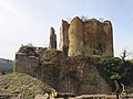 Franchimont Castle
 Theux Perron
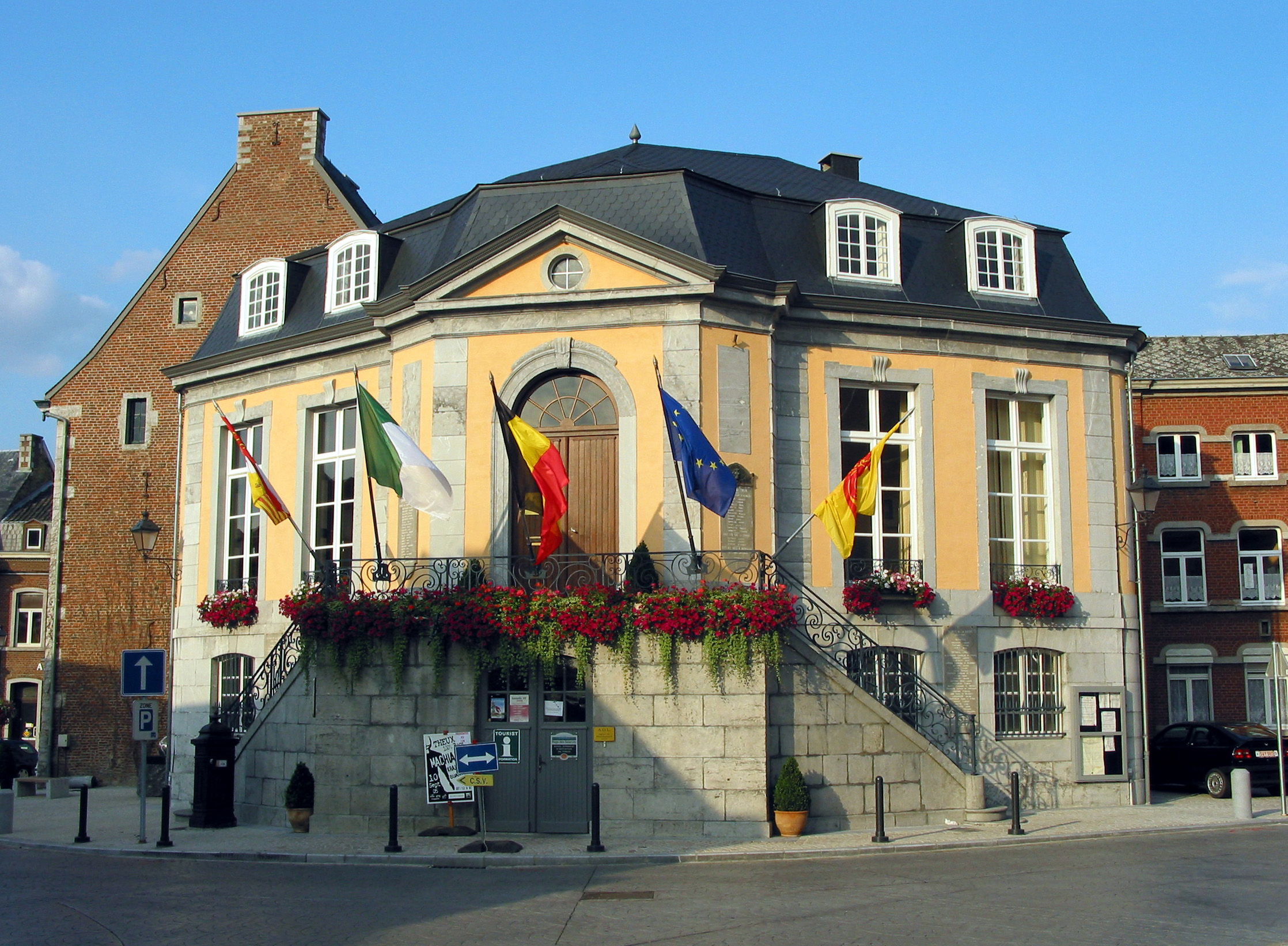
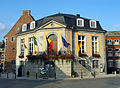 Town Hall of Theux


See also
- List of protected heritage sites in Theux
References
- "Wettelijke Bevolking per gemeente op 1 januari 2018". Statbel. Retrieved 9 March 2019.
External links
 Media related to Theux at Wikimedia Commons
Municipalities in the province of Liège, Wallonia | ||
|---|---|---|
| Huy |  | |
| Liège | ||
| Verviers | ||
| Waremme | ||
Bold indicates cities · Italic indicates municipalities with language facilities | ||
Authority control | |
|---|---|
| General |
|
| Other |
|
This Liège Province location article is a stub. You can help Wikipedia by expanding it. |
На других языках
[de] Theux
Theux ist eine Stadt in der Provinz Lüttich, Verwaltungsbezirk Verviers, Belgien. Sie liegt im Tal der Hoëgne, die im Hohen Venn als Polleur-Bach entspringt. 12.012 Einwohner (Stand: 1. Januar 2020) leben hier auf einer Fläche von 83,36 km².- [en] Theux
[ru] Тё (Бельгия)
Тё — коммуна в Валлонии, расположенная в провинции Льеж, округ Вервье. Принадлежит Французскому языковому сообществу Бельгии. На площади 83,36 км² проживают 11 571 человек (плотность населения — 139 чел./км²), из которых 49,03 % — мужчины и 50,97 % — женщины. Средний годовой доход на душу населения в 2003 году составлял 12 783 евро.Текст в блоке "Читать" взят с сайта "Википедия" и доступен по лицензии Creative Commons Attribution-ShareAlike; в отдельных случаях могут действовать дополнительные условия.
Другой контент может иметь иную лицензию. Перед использованием материалов сайта WikiSort.org внимательно изучите правила лицензирования конкретных элементов наполнения сайта.
Другой контент может иметь иную лицензию. Перед использованием материалов сайта WikiSort.org внимательно изучите правила лицензирования конкретных элементов наполнения сайта.
2019-2026
WikiSort.org - проект по пересортировке и дополнению контента Википедии
WikiSort.org - проект по пересортировке и дополнению контента Википедии