world.wikisort.org - Belgium
Pepinster (French pronunciation: [pepɛ̃stɛʁ] or [pəpɛ̃stɛʁ]) is a municipality of Wallonia located in the province of Liège, Belgium.
Pepinster
| |
|---|---|
Municipality | |
 | |
 Coat of arms | |
Location of Pepinster  | |
 Pepinster Location in Belgium
Location of Pepinster in the province of Liège  | |
| Coordinates: 50°34′N 05°49′E | |
| Country | Belgium |
| Community | French Community |
| Region | Wallonia |
| Province | Liège |
| Arrondissement | Verviers |
| Government | |
| • Mayor | Philippe Godin |
| • Governing party/ies | PEPIN |
| Area | |
| • Total | 24.79 km2 (9.57 sq mi) |
| Population (2018-01-01)[1] | |
| • Total | 9,765 |
| • Density | 390/km2 (1,000/sq mi) |
| Postal codes | 4860-4861 |
| Area codes | 087 |
| Website | www.pepinster.be |
On 1 January 2006 Pepinster had a total population of 9,560. The total area is 24.79 km2 which gives a population density of 386 inhabitants per km2. Pepinster is situated at the confluence of the rivers Hoëgne and Vesdre.
The municipality consists of the following districts: Cornesse, Pepinster (including the hamlet of Tancrémont), Soiron, and Wegnez.
Pepinster was hit extremely hard by the 2021 European floods, the village was temporarily cut off from roads.[2]
Image gallery
 Pepinster town hall
 Romanesque Christ (11th century)
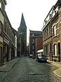
 Vesdre river


See also
- Fort de Tancrémont, a companion to Fort Eben-Emael, located just outside the town
- List of protected heritage sites in Pepinster
- Shrine of Tancrémont
References
- "Wettelijke Bevolking per gemeente op 1 januari 2018". Statbel. Retrieved 9 March 2019.
- Belgium village of Pepinster cut off after extreme flooding on YouTube, 17 July 2021, Sky News. Archived at Ghostarchive and the Wayback Machine
External links
 Media related to Pepinster at Wikimedia Commons
Municipalities in the province of Liège, Wallonia | ||
|---|---|---|
| Huy |  | |
| Liège | ||
| Verviers | ||
| Waremme | ||
Bold indicates cities · Italic indicates municipalities with language facilities | ||
Authority control | |
|---|---|
| General |
|
| National libraries | |
| Other |
|
This Liège Province location article is a stub. You can help Wikipedia by expanding it. |
На других языках
[de] Pepinster
Pepinster ist eine Gemeinde in der Provinz Lüttich in der Wallonischen Region in Belgien. Sie liegt an der Weser, die in die Ourthe fließt, und befindet sich ca. 35 km südwestlich von Aachen. Sie gehört der Euregio Maas-Rhein an. Die Einwohnerzahl beträgt 9693 (Stand 1. Januar 2020), die Fläche 24,79 km².- [en] Pepinster
[ru] Пепенстер
Пепенсте́р — коммуна в Валлонии, расположенная в провинции Льеж, округ Вервье. Принадлежит Французскому языковому сообществу Бельгии. На площади 24,79 км² проживают 9560 человек (плотность населения — 386 чел./км²), из которых 48,33 % — мужчины и 51,67 % — женщины. Средний годовой доход на душу населения в 2003 году составлял 11 485 евро.Текст в блоке "Читать" взят с сайта "Википедия" и доступен по лицензии Creative Commons Attribution-ShareAlike; в отдельных случаях могут действовать дополнительные условия.
Другой контент может иметь иную лицензию. Перед использованием материалов сайта WikiSort.org внимательно изучите правила лицензирования конкретных элементов наполнения сайта.
Другой контент может иметь иную лицензию. Перед использованием материалов сайта WikiSort.org внимательно изучите правила лицензирования конкретных элементов наполнения сайта.
2019-2026
WikiSort.org - проект по пересортировке и дополнению контента Википедии
WikiSort.org - проект по пересортировке и дополнению контента Википедии