world.wikisort.org - Australia
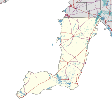
Sandilands is a locality in the Australian state of South Australia located on the east coast of Yorke Peninsula immediately adjoining Gulf St Vincent about 88 kilometres (55 mi) north-west of the state capital of Adelaide and about 18 kilometres (11 mi) south-east of the municipal seat in Maitland.[4][1][8]
| Sandilands South Australia | |||||||||||||||
|---|---|---|---|---|---|---|---|---|---|---|---|---|---|---|---|
 Sandilands | |||||||||||||||
| Coordinates | 34°30′51″S 137°46′49″E[1] | ||||||||||||||
| Population | 470 (shared with other localities within the “State Suburb of Price”) (2011 census)[2] | ||||||||||||||
| Established | 1999[3] | ||||||||||||||
| Postcode(s) | 5571[4] | ||||||||||||||
| Time zone | ACST (UTC+9:30) | ||||||||||||||
| • Summer (DST) | ACST (UTC+10:30) | ||||||||||||||
| Location | |||||||||||||||
| LGA(s) | Yorke Peninsula Council | ||||||||||||||
| Region | Yorke and Mid North[1] | ||||||||||||||
| County | Fergusson[1] | ||||||||||||||
| State electorate(s) | Narungga[5] | ||||||||||||||
| Federal division(s) | Grey[6] | ||||||||||||||
| |||||||||||||||
| |||||||||||||||
| Footnotes | Adjoining localities[1] | ||||||||||||||
Its boundaries which were created in May 1999 for the “long established name.”[1][3] The locality's name is derived from Robert Hamilton Sandilands (1841-1923) who lived there during the 1880s.[9][10]
As of 2014, the majority land use within the locality is “primary production.”[8]
Sandilands is located within the federal division of Grey, the state electoral district of Narungga and the local government area of the Yorke Peninsula Council.[6][5][1]
References
- "Search results for 'Sandilands, LOCB' with the following datasets selected - 'Suburbs and localities', 'Counties', 'Local Government Areas', 'SA Government Regions' and 'Gazetteer'". Location SA Map Viewer. South Australian Government. Retrieved 22 May 2020.
- Australian Bureau of Statistics (31 October 2012). "Price". 2011 Census QuickStats. Retrieved 27 February 2016.
- Kentish, Peter McLaren (27 May 1999), "GEOGRAPHICAL NAMES ACT 1991, Notice to Assign Boundaries and Names to Places (in the District Council of Yorke Peninsula)" (PDF), The South Australian Government Gazette: 2696, retrieved 21 May 2020 – via AustLII
- "Sandilands, South Australia (Postcode)". postcodes-australia.com. Retrieved 27 February 2016.
- Narungga (Map). Electoral District Boundaries Commission. 2016. Retrieved 1 March 2018.
- "Federal electoral division of Grey" (PDF). Australian Electoral Commission. Retrieved 24 July 2015.
- "Monthly climate statistics: Summary statistics PRICE". Commonwealth of Australia , Bureau of Meteorology. Retrieved 27 February 2016.
- "Development Plan - Yorke Peninsula Council" (PDF). Department of Planning, Transport and Infrastructure. pp. 153, 231–232 & 323. Archived from the original (PDF) on 4 June 2015. Retrieved 25 February 2016.
- "OBITUARY". Observer. Vol. LXXX, no. 5, 983. South Australia. 29 September 1923. p. 39. Retrieved 27 February 2016 – via National Library of Australia.
- "Sandilands, Nomenclature". State Library of South Australia. Retrieved 25 February 2016.
Другой контент может иметь иную лицензию. Перед использованием материалов сайта WikiSort.org внимательно изучите правила лицензирования конкретных элементов наполнения сайта.
WikiSort.org - проект по пересортировке и дополнению контента Википедии