world.wikisort.org - Australia
Noosa Heads is a coastal town and suburb in the Shire of Noosa, Queensland, Australia.[2][3] In the 2016 census, the suburb of Noosa Heads had a population of 4,484 people.[1] It is a popular holiday destination.[4]
| Noosa Heads Noosa, Queensland | |||||||||||||||
|---|---|---|---|---|---|---|---|---|---|---|---|---|---|---|---|
 Noosa main beach | |||||||||||||||
 Noosa Heads | |||||||||||||||
| Coordinates | 26.3870°S 153.0913°E | ||||||||||||||
| Population | 4,484 (2016 census)[1] | ||||||||||||||
| • Density | 344.9/km2 (893/sq mi) | ||||||||||||||
| Postcode(s) | 4567 | ||||||||||||||
| Elevation | 21 m (69 ft) | ||||||||||||||
| Area | 13.0 km2 (5.0 sq mi) | ||||||||||||||
| Time zone | AEST (UTC+10:00) | ||||||||||||||
| Location |
| ||||||||||||||
| LGA(s) | Shire of Noosa | ||||||||||||||
| State electorate(s) | Noosa | ||||||||||||||
| Federal division(s) | Wide Bay | ||||||||||||||
| |||||||||||||||
Geography
The suburb is bounded to the west by Weyba Creek and the Noosa River and to the north and east by the Coral Sea. The northeast of the locality is within the Noosa National Park. Noosa Heads, Noosaville and Tewantin form a continuous urban area at the northern end of the Sunshine Coast.[5]
Noosa Hill in the national park is the highest point of the suburb (26.3840°S 153.1053°E) at 146 metres (479 ft) above sea level.[6][7] There is also Laguna Lookout (26.3910°S 153.0957°E) on a low hill near the town.[8]
Coastal features
There are a number of headlands, lookouts, bays, and other coastal features along the Noosa Heads coastline, many of them on the coastal walking track through the national park, including (from north to south):
- Noosa Inlet, the mouth of the Noosa River (26.385°S 153.0758°E)[9]
- Laguna Bay (26.3801°S 153.0853°E)[10]
- Noosa Beach (26.3846°S 153.0867°E)[11]
- Boiling Pot Lookout (26.3794°S 153.1010°E)[8]
- Tea Tree Bay (26.3788°S 153.1046°E)[10]
- Dolphin Point, a headland (26.3772°S 153.1077°E)[12]
- Dolphin Point Lookout (26.3775°S 153.1081°E)[8]
- Granite Bay (26.3777°S 153.1119°E)[10]
- Fairy Pools, a rockhole (26.3766°S 153.1155°E)[13]
- Noosa Head (also known as Low Bluff), a headland (26.3777°S 153.1177°E)[14]
- Hell's Gates Lookout (26.3792°S 153.1194°E)[8]
- Hells Gates (26.3797°S 153.1192°E)[10]
- Alexandria Bay (26.3853°S 153.1176°E)[10]
- Alexandria Beach (26.3856°S 153.1155°E)[11]
- Roaring Cave (also known as the Blowhole) (26.3906°S 153.1176°E)[6]
- Harrys Lookout (26.3920°S 153.1167°E)[8]
- Devils Kitchen (26.3929°S 153.1175°E)[10]
- Paradise Caves (26.3954°S 153.1169°E)[15]
History

Gubbi Gubbi (Kabi Kabi, Cabbee, Carbi, Gabi Gabi) is an Australian Aboriginal language spoken on Gubbi Gubbi country. The Gubbi Gubbi language region includes the landscape within the local government boundaries of the Sunshine Coast Region and Gympie Region, particularly the towns of Caloundra, Noosa Heads, Gympie and extending north towards Maryborough and south to Caboolture.[16]
The name Noosa is a corruption of the Kabi word nuthuru, meaning a ghost or a shadow.[2]
The beach at Noosa Heads has remained a popular tourist attraction since the 1890s. The Shire's tourism exponentially grew shortly after the Second World War.[17]
In the 1800s, Noosa's early wealth came from the timber and milling industries with tourism developing in the late 1920s. In this decade cafes and tourist accommodation was built along the beachfront.[17] The town has been the site of many tussles between developers and those seeking to preserve the town.[citation needed]
A fatal shark attack of a 22-year-old surfer was recorded at Noosa in 1961.[18]
Since the seventies, people have continued to migrate from southern states.[citation needed]
In 1988, Noosa was renamed Noosa Heads.[17]
In 2009 as part of the Q150 celebrations, Noosa was announced as one of the Q150 Icons of Queensland for its role as a "location".[19]
In the 2016 census, the suburb of Noosa Heads had a population of 4,484 people.[1]
The local print newspaper was the Noosa News. Along with many other regional Australian newspapers owned by NewsCorp, the newspaper ceased print editions in June 2020 and became an online-only publication from 26 June 2020.[20]
In May 2021, Noosa was named as the top tourism town in Queensland.[4]
Heritage listings
Noosa Heads has a number of heritage-listed sites, including:
- 17 Noosa Drive: Halse Lodge[21]
Education
There are no schools in Noosa Heads. The nearest government primary and secondary schools are Sunshine Beach State School and Sunshine Beach State High School in neighbouring Sunshine Beach to the east.[5]
Amenities
The Noosa Shire Council operates a mobile library service which visits Lanyana Way at Noosa Junction.[22]
There are two jetties, managed by the Noosa Shire Council:
- Woods Bay jetty at Claude Batten Drive (26.3869°S 153.0856°E)[23]
- Ravenwood Drive jetty at Ravenwood Park (26.3892°S 153.0833°E)[23]
Attractions

Noosa Heads hosts a population of koalas, which are often seen in and around Noosa National Park. The koala population in Noosa is in decline.[24] Native black and grey-headed flying foxes (tree pollinators and seed dispersal agents) can be heard in local trees if they are flowering or fruiting. Micro-bat species are also common and aid in insect control.[citation needed]
Noosa Lions Park is an open, grassed area which used as a staging area for several large community events including the Noosa Triathlon, Noosa Food and Wine Festival, Noosa Winter Festival and Noosa Classic Car Show.[25]
To overcome severe beach erosion at Noosa's main beach a sand pumping system has been built. It operates when necessary during off peak hours, supplying sand via a pipeline built underneath the boardwalk.[26]
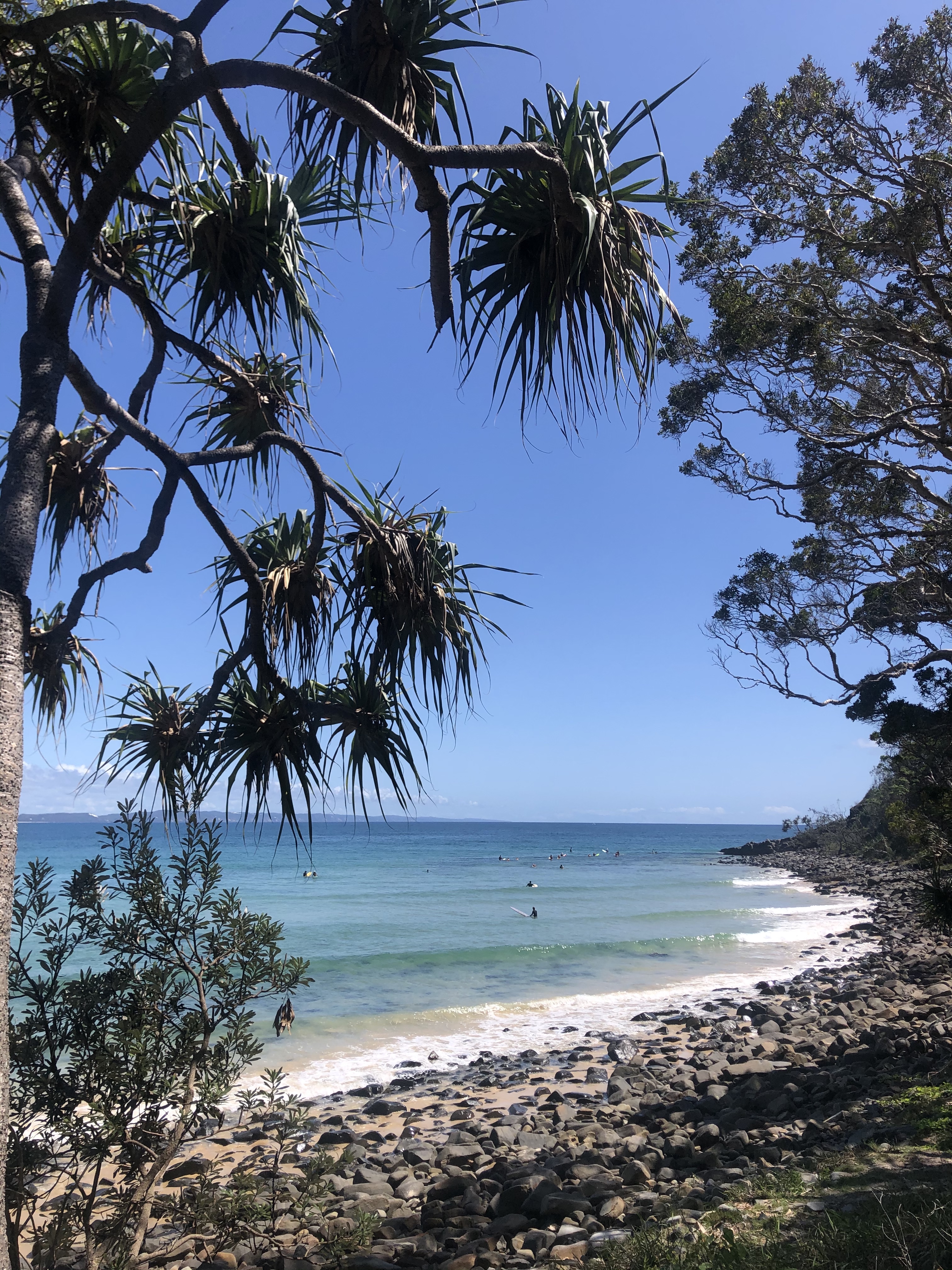
Noosa Heads' main attraction is its beaches. Its main beach and its small bays around the headland are common surfing locations which are known on world surfing circuits. One of its major surfing contests involves the Noosa Festival of Surfing. This festival attracts large numbers of longboarders.[citation needed]
Media
The local newspaper is the Noosa News, an online-only publication of NewsCorp.[20]
Transport
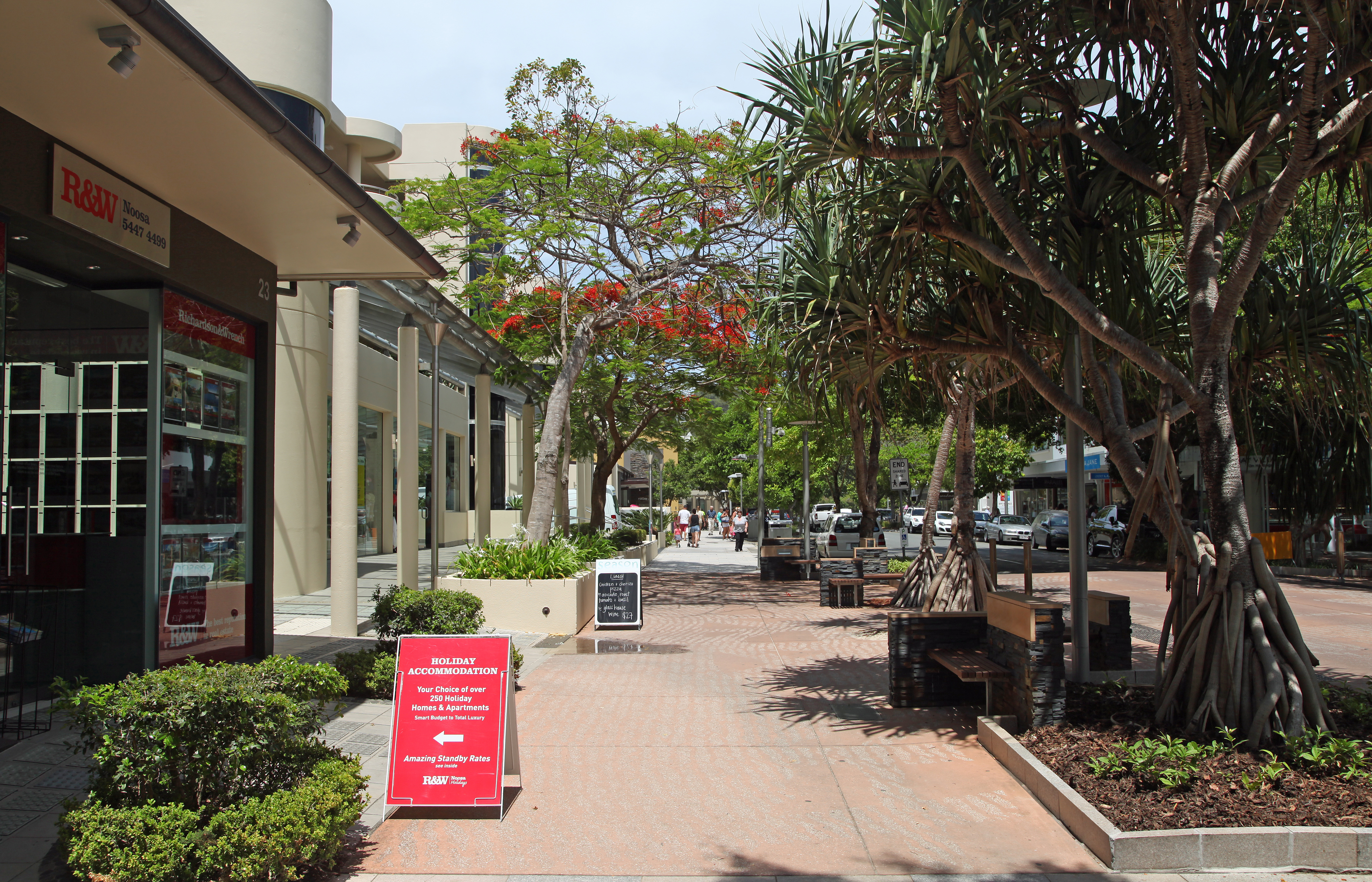
Noosa Heads is the tourist heart of Noosa district, with many restaurants and hotels. The main street is Hastings Street, which lies directly behind the seashore. Buses to elsewhere in the Sunshine Coast depart from Noosa Heads bus station.[citation needed]
There are dedicated bike lanes throughout the shire. Push bikes are an easy way to get around. Bike racks are provided in all shopping and beach precincts.[citation needed]
Motor scooter is another option. There are scooter parking bays on Hastings Street, Noosa Heads, and on many shopping strips.[citation needed]
There is a taxi rank in Hastings Street and at Noosa Fair shopping centre.[citation needed]
Notable residents
- Bob Ansett - entrepreneur, actor and writer
See also
References
- Australian Bureau of Statistics (27 June 2017). "Noosa Heads (SSC)". 2016 Census QuickStats. Retrieved 20 October 2018.
- "Noosa Heads – town in Shire of Noosa (entry 24497)". Queensland Place Names. Queensland Government. Retrieved 28 December 2020.
- "Noosa Heads – suburb in Shire of Noosa (entry 48808)". Queensland Place Names. Queensland Government. Retrieved 28 December 2020.
- "Have you visited Queensland's newly awarded top tourism towns?". ABC News. 20 May 2021. Archived from the original on 23 October 2021. Retrieved 8 February 2022.
- "Queensland Globe". State of Queensland. Retrieved 8 February 2022.
- "Mountain peaks and capes - Queensland". Queensland Open Data. Queensland Government. 12 November 2020. Archived from the original on 25 November 2020. Retrieved 25 November 2020.
- "Noosa Hill – mountain in Noosa Shire (entry 24500)". Queensland Place Names. Queensland Government. Retrieved 25 November 2020.
- "Tourist points - Queensland". Queensland Open Data. Queensland Government. 18 November 2020. Archived from the original on 24 November 2020. Retrieved 24 November 2020.
- "Noosa Inlet – inlet in Shire of Noosa (entry 24501)". Queensland Place Names. Queensland Government. Retrieved 28 December 2020.
- "Bays - Queensland". Queensland Open Data. Queensland Government. 12 November 2020. Archived from the original on 25 November 2020. Retrieved 25 November 2020.
- "Mountain ranges beaches and sea passages - Queensland". Queensland Open Data. Queensland Government. 12 November 2020. Archived from the original on 25 November 2020. Retrieved 25 November 2020.
- "Dolphin Point – point in Shire of Noosa (entry 10282)". Queensland Place Names. Queensland Government. Retrieved 28 December 2020.
- "Fairy Pools – rockhole in Shire of Noosa (entry 12151)". Queensland Place Names. Queensland Government. Retrieved 28 December 2020.
- "Noosa Head – cape in Shire of Noosa (entry 24499)". Queensland Place Names. Queensland Government. Retrieved 28 December 2020.
- "Paradise Caves – cave in Shire of Noosa (entry 26026)". Queensland Place Names. Queensland Government. Retrieved 28 December 2020.
-
 This Wikipedia article incorporates CC-BY-4.0 licensed text from: "Gubbi Gubbi". Queensland Aboriginal and Torres Strait Islander languages map. State Library of Queensland. Retrieved 23 January 2020.
- Environmental Protection Agency (Queensland) (2000). Heritage Trails of the Great South East. State of Queensland. p. 141. ISBN 0-7345-1008-X.
- Sydney Morning Herald 20 December 1961
- Bligh, Anna (10 June 2009). "PREMIER UNVEILS QUEENSLAND'S 150 ICONS". Queensland Government. Archived from the original on 24 May 2017. Retrieved 24 May 2017.
- "Future is digital: News announces major changes". Gatton Star. 28 May 2020. Archived from the original on 22 December 2020. Retrieved 22 December 2020.
- "Halse Lodge (entry 601393)". Queensland Heritage Register. Queensland Heritage Council. Retrieved 14 July 2013.
- "Mobile Library". Noosa Shire Council. Archived from the original on 30 January 2018. Retrieved 30 January 2018.
- "Recreational Boating Facilities Queensland". Queensland Open Data. Queensland Government. 12 November 2020. Archived from the original on 22 November 2020. Retrieved 22 November 2020.
- (17 November 2010) Where the bloody hell are Noosa's koalas?. Brian Williams. The Courier Mail. Archived 14 April 2012 at the Wayback Machine
- "Lions Park Noosa Parade Noosa Heads". Sunshine Coast Regional Council. 11 April 2012. Archived from the original on 22 August 2012. Retrieved 17 September 2012.
- "Noosa Beach Erosion and Sand Recycling". Sunshine Coast Regional Council. 20 March 2012. Archived from the original on 22 August 2012. Retrieved 17 September 2012.
External links
- "Noosa Heads and Noosaville". Queensland Places. University of Queensland.
- Official Tourism Noosa Website
Authority control | |
|---|---|
| General | |
| National libraries | |
Другой контент может иметь иную лицензию. Перед использованием материалов сайта WikiSort.org внимательно изучите правила лицензирования конкретных элементов наполнения сайта.
WikiSort.org - проект по пересортировке и дополнению контента Википедии