world.wikisort.org - Australia
Airville is a rural locality in the Shire of Burdekin, Queensland, Australia.[2] In the 2016 census, Airville had a population of 338 people.[1]
| Airville Queensland | |||||||||||||||
|---|---|---|---|---|---|---|---|---|---|---|---|---|---|---|---|
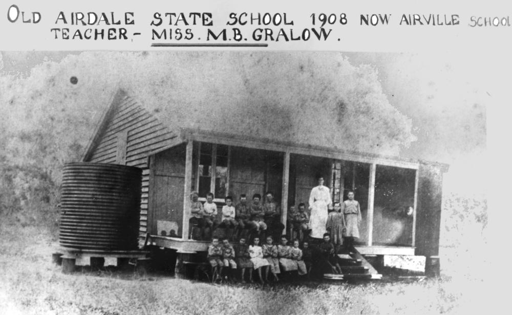 Teacher Miss M.B. Gralow and students, Airdale School, 1908 | |||||||||||||||
 Airville | |||||||||||||||
| Coordinates | 19.6322°S 147.3452°E | ||||||||||||||
| Population | 338 (2016 census)[1] | ||||||||||||||
| • Density | 7.699/km2 (19.94/sq mi) | ||||||||||||||
| Postcode(s) | 4807 | ||||||||||||||
| Area | 43.9 km2 (16.9 sq mi) | ||||||||||||||
| Time zone | AEST (UTC+10:00) | ||||||||||||||
| Location |
| ||||||||||||||
| LGA(s) | Shire of Burdekin | ||||||||||||||
| State electorate(s) | Burdekin | ||||||||||||||
| Federal division(s) | Dawson | ||||||||||||||
| |||||||||||||||
Geography
Airville is bounded on the south-east by the Burdekin River. It is flat low-lying land (about 10 metres above sea level) used predominantly for sugarcane plantations. There is a network of cane tramways to deliver the harvested sugar to the local sugar mills.[3]
Maida Vale is a neighbourhood in the north-east of the locality (19.6°S 147.35°E).[4]
Labatt Lagoon is a waterhole (19.6166°S 147.3166°E).[5]
History
Airdale Provisional School opened in the south-west of the locality on 2 September 1890, becoming Airdale State School on 1 January 1909. In 1926, it was renamed Airville State School.[6]
Maidavale State School opened in the north-east of the locality on 27 April 1910.[6]
In the 2016 census, Airville had a population of 338 people.[1]
Education
Airville State School is a government primary (Prep-6) school for boys and girls at Old Clare Road (19.6551°S 147.3476°E).[7][8] In 2016, the school had an enrolment of 23 students who come from the local rural community with 3 teachers (2 full-time equivalent) and 5 non-teaching staff (3 full-time equivalent).[9] In 2018, the school had an enrolment of 9 students with 2 teachers (1 full-time equivalent) and 4 non-teaching staff (3 full-time equivalent).[10]
Maidavale State School is a government primary (Prep-6) school for boys and girls at Maidavale Road (19.6025°S 147.3599°E).[7][11] In 2016, the school had an enrolment of 10 students with 2 teachers (1 full-time equivalent) and 5 non-teaching staff (2 full-time equivalent).[12] In 2018, the school had an enrolment of 6 students with 2 teachers (1 full-time equivalent) and 4 non-teaching staff (2 full-time equivalent).[10]
There is no secondary school in Airville. The nearest secondary schools are Ayr State High School in Ayr to the north-east and Home Hill State High School in neighbouring Home Hill to the south-east.[3]
References
- Australian Bureau of Statistics (27 June 2017). "Airville (SSC)". 2016 Census QuickStats. Retrieved 20 October 2018.
- "Airville – locality in Shire of Burdekin (entry 44663)". Queensland Place Names. Queensland Government. Retrieved 18 September 2020.
- "Queensland Globe". State of Queensland. Retrieved 18 October 2020.
- "Maida Vale – locality unbounded in Shire of Burdekin (entry 20596)". Queensland Place Names. Queensland Government. Retrieved 18 September 2020.
- "Labatt Lagoon – waterhole in Shire of Burdekin (entry 18704)". Queensland Place Names. Queensland Government. Retrieved 18 September 2020.
- Queensland Family History Society (2010), Queensland schools past and present (Version 1.01 ed.), Queensland Family History Society, ISBN 978-1-921171-26-0
- "State and non-state school details". Queensland Government. 9 July 2018. Archived from the original on 21 November 2018. Retrieved 21 November 2018.
- "Airville State School". Archived from the original on 3 April 2021. Retrieved 25 March 2021.
- "Annual Report 2016" (PDF). Airville State School. Archived (PDF) from the original on 4 October 2017. Retrieved 4 October 2017.
- "ACARA School Profile 2018". Australian Curriculum, Assessment and Reporting Authority. Archived from the original on 27 August 2020. Retrieved 28 January 2020.
- "Maidavale State School". Archived from the original on 9 March 2021. Retrieved 25 March 2021.
- "Annual Report 2016" (PDF). Maidavale State School. Archived (PDF) from the original on 13 October 2017. Retrieved 13 October 2017.
External links
![]() Media related to Airville, Queensland at Wikimedia Commons
Media related to Airville, Queensland at Wikimedia Commons
Другой контент может иметь иную лицензию. Перед использованием материалов сайта WikiSort.org внимательно изучите правила лицензирования конкретных элементов наполнения сайта.
WikiSort.org - проект по пересортировке и дополнению контента Википедии