world.wikisort.org - Armenia
Arpeni (Armenian: Արփենի) is a village and rural community (municipality) in the Shirak Province of Armenia. Within the village is a 19th-century church. The Statistical Committee of Armenia reported its population was 397 in 2010,[1] up from 373 at the 2001 census.[2]
Arpeni
Արփենի | |
|---|---|
community | |
 The village of Arpeni. | |
 Arpeni 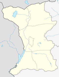 Arpeni | |
| Coordinates: 40°55′N 43°53′E | |
| Country | |
| Marz (Province) | Shirak |
| Elevation | 1,920 m (6,300 ft) |
| Population (2010) | |
| • Total | 397 |
| Time zone | UTC+4 ( ) |
| Arpeni at GEOnet Names Server | |
Population
Population per years is the following.[3]
| Year | 1897 | 1926 | 1970 | 1980 | 2001 | 2004 | 2012 | 2014 |
|---|---|---|---|---|---|---|---|---|
| Pop. | 598 | 479 | 404 | 369 | 373 | 454 | 402 | 410 |


References
- "Marzes of Armenia and Yerevan City in Figures, 2010" (PDF). Statistical Committee of Armenia.
- Report of the results of the 2001 Armenian Census, Statistical Committee of Armenia
- "Dictionary of Armenian residences (Հայաստանի բնակավայրերի բառարան), page 39" (PDF). Archived from the original (PDF) on September 12, 2014. Retrieved April 18, 2014.

This article about a location in Shirak Province, Armenia is a stub. You can help Wikipedia by expanding it. |
На других языках
[de] Arpeni
Arpeni (armenisch Արփենի) ist ein Dorf in Armenien. Es liegt auf einer Höhe von 1900 bis 1970 Metern. Informell ist es in Alt- und Neu-Arpeni unterteilt. Das neue Dorf wurde nach dem Erdbeben von 1988 erbaut. Bis 1978 hieß der Ort Palutli oder Palutlu.- [en] Arpeni
[ru] Арпени
Арпени́ (арм. Արփենի) — село в Ширакской области, Армения. Население — 399 человек[1]. До 1978 года носило название Палутли (арм. Փալութլի)[2]. С октября 2016 года входит в состав общины Сарапат [3].Текст в блоке "Читать" взят с сайта "Википедия" и доступен по лицензии Creative Commons Attribution-ShareAlike; в отдельных случаях могут действовать дополнительные условия.
Другой контент может иметь иную лицензию. Перед использованием материалов сайта WikiSort.org внимательно изучите правила лицензирования конкретных элементов наполнения сайта.
Другой контент может иметь иную лицензию. Перед использованием материалов сайта WikiSort.org внимательно изучите правила лицензирования конкретных элементов наполнения сайта.
2019-2026
WikiSort.org - проект по пересортировке и дополнению контента Википедии
WikiSort.org - проект по пересортировке и дополнению контента Википедии