world.wikisort.org - Algeria
Hassi Gara (Arabic: حاسي قارة) is a town and commune in El Ménia District, Ghardaïa Province, Algeria. According to the 2008 census it has a population of 17,801,[1] up from 13,911 in 1998,[2] with an annual growth rate of 2.5%.[1] It is effectively a suburb of the larger town El Goléa.
Hassi Gara
حاسي قارة | |
|---|---|
Commune and town | |
 Location of Hassi Gara commune within Ghardaïa Province | |
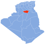
 Hassi Gara Location of Hassi Gara within Algeria | |
| Coordinates: 30°33′8″N 2°54′54″E | |
| Country | |
| Province | Ghardaïa Province |
| District | El Ménia District |
| Elevation | 380 m (1,250 ft) |
| Population (2008)[1] | |
| • Total | 17,801 |
| Time zone | UTC+1 (CET) |
Geography
Hassi Gara is located almost at the center of Algeria, lying at the eastern border of the Grand Erg Occidental at an elevation of 380 metres (1,250 ft). The town is centered in the El Goléa oasis; to the east dramatic cliffs rise up to 200 metres (660 ft) above the town.
Climate
Hassi Gara has a hot desert climate (Köppen climate classification BWh), with very hot summers and cool winters. There is very little rain throughout the year, and summers are especially dry.
Transportation
Hassi Gara is very close to El Goléa and there are many local roads that connect the two towns. The N1 runs through Hassi Gara, connecting Ghardaïa to the north to In Salah and Tamanrasset to the south.
Education
6.1% of the population has a tertiary education, and another 15.9% has completed secondary education.[3] The overall literacy rate is 81.1%, and is 85.3% among males and 76.9% among females.[4]
Localities
The commune of Hassi Gara is composed of six localities:[5]
- Quartiers El Borr
- Hassi El Gara Ouest
- Hassi El Gara Est
- El Ouadjda
- Edjraïf
- Nebka
References
- "Population: Ghardaïa Wilaya" (PDF) (in French). Office National des Statistiques Algérie. Retrieved 13 February 2013.
- "Algeria Communes". Statoids. Retrieved 9 March 2013.
- "Structure relative de la population résidente des ménages ordinaires et collectifs âgée de 6 ans et plus selon le niveau d'instruction et la commune de résidence" (PDF) (in French). Office National des Statistiques Algérie. Retrieved 13 February 2013.
- "Taux d'analphabétisme et taux d'alphabétisation de la population âgée de 15 ans et plus, selon le sexe et la commune de résidence " (PDF) (in French). Office National des Statistiques Algérie. Retrieved 13 February 2013.
- "Décret n° 84-365, fixant la composition, la consistance et les limites territoriale des communes. Wilaya d'El Oued" (PDF) (in French). Journal officiel de la République Algérienne. 19 December 1984. p. 1579. Archived from the original (PDF) on 2013-04-12. Retrieved 2 March 2013.
Places adjacent to Hassi Gara | |
|---|---|
Capital: Ghardaïa | ||
| Ghardaïa District |
|  |
| Bérianne District |
| |
| Bounoura District | ||
| Dhayat Ben Dhahoua District | ||
| El Guerrara District |
| |
| El Ménia District |
| |
| Mansourah District | ||
| Métlili District | ||
| Zelfana District | ||
Другой контент может иметь иную лицензию. Перед использованием материалов сайта WikiSort.org внимательно изучите правила лицензирования конкретных элементов наполнения сайта.
WikiSort.org - проект по пересортировке и дополнению контента Википедии