world.wikisort.org - Algeria
Hassi Fehal (Arabic: حاسي لفحل) (also written Hassi Lefhal) is a town and commune in Mansoura District, Ghardaïa Province, Algeria. According to the 2008 census it has a population of 3,651,[1] up from 2,164 in 1998,[2] and a growth rate of 5.5%, the highest in the province.[1]
Hassi Fehal
حاسي لفحل | |
|---|---|
Commune and town | |
 Location of Hassi Fehal commune within Ghardaïa Province | |
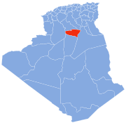
 Hassi Fehal Location of Hassi Fehal within Algeria | |
| Coordinates: 31°36′19″N 3°40′27″E | |
| Country | |
| Province | Ghardaïa Province |
| District | Mansoura District |
| Elevation | 379 m (1,243 ft) |
| Population (2008)[1] | |
| • Total | 3,651 |
| Time zone | UTC+1 (CET) |
Transportation
Hassi Fehal lies on the Trans-Sahara Highway just south of Mansoura, between Ghardaïa to the north and El Goléa to the south.
Education
4.0% of the population has a tertiary education, and another 15.3% has completed secondary education.[3] The overall literacy rate is 68.0%, and is 72.4% among males and 63.2% among females, all three figures being the lowest for any commune in the province.[4]
Localities
The commune of Hassi Fehal is composed of one locality:[5]
- Centre de Hassi Lefhal
References
- "Population: Ghardaïa Wilaya" (PDF) (in French). Office National des Statistiques Algérie. Retrieved 13 February 2013.
- "Algeria Communes". Statoids. Retrieved 9 March 2013.
- "Structure relative de la population résidente des ménages ordinaires et collectifs âgée de 6 ans et plus selon le niveau d'instruction et la commune de résidence" (PDF) (in French). Office National des Statistiques Algérie. Retrieved 13 February 2013.
- "Taux d'analphabétisme et taux d'alphabétisation de la population âgée de 15 ans et plus, selon le sexe et la commune de résidence " (PDF) (in French). Office National des Statistiques Algérie. Retrieved 13 February 2013.
- "Décret n° 84-365, fixant la composition, la consistance et les limites territoriale des communes. Wilaya d'El Oued" (PDF) (in French). Journal officiel de la République Algérienne. 19 December 1984. p. 1579. Archived from the original (PDF) on 2013-04-12. Retrieved 2 March 2013.
Neighbouring towns and cities
Places adjacent to Hassi Fehal | |
|---|---|
Capital: Ghardaïa | ||
| Ghardaïa District |
|  |
| Bérianne District |
| |
| Bounoura District |
| |
| Dhayat Ben Dhahoua District |
| |
| El Guerrara District |
| |
| El Ménia District |
| |
| Mansourah District |
| |
| Métlili District |
| |
| Zelfana District |
| |
Текст в блоке "Читать" взят с сайта "Википедия" и доступен по лицензии Creative Commons Attribution-ShareAlike; в отдельных случаях могут действовать дополнительные условия.
Другой контент может иметь иную лицензию. Перед использованием материалов сайта WikiSort.org внимательно изучите правила лицензирования конкретных элементов наполнения сайта.
Другой контент может иметь иную лицензию. Перед использованием материалов сайта WikiSort.org внимательно изучите правила лицензирования конкретных элементов наполнения сайта.
2019-2026
WikiSort.org - проект по пересортировке и дополнению контента Википедии
WikiSort.org - проект по пересортировке и дополнению контента Википедии