world.wikisort.org - Algeria
El Menia (Arabic: المنيعة) is an oasis town and commune, and capital of El Ménia District, in Ghardaïa Province, Algeria. The former name is El Goléa (Arabic: القليعة); together in Arabic, the two names mean Impregnable Castle. According to the 2008 census it has a population of 40,195,[1] up from 28,848 in 1998,[2] with an annual growth rate of 3.4%.[1] The area is inhabited by the Zenete Berbers. El Menia oasis grows many agricultural products. The grave of the French priest Charles de Foucauld is located in the town.
El Menia
المنيعة | |
|---|---|
Commune and town | |
 View of El Menia | |
 Location of El Menia commune within Ghardaïa Province | |
 El Menia Location of El Menia within Algeria | |
| Coordinates: 30°35′N 2°53′E | |
| Country | |
| Province | Ghardaïa Province |
| District | El Ménia District |
| Elevation | 380 m (1,250 ft) |
| Population (2008)[1] | |
| • Total | 40,195 |
| Time zone | UTC+1 (CET) |


Geography
El Menia is located almost at the center of Algeria, lying at the eastern border of the Grand Erg Occidental at an elevation of 380 metres (1,250 ft). The town is a gateway to the Sahara in the south, and has an estimated 180,000 palm trees within the oasis area.[citation needed] The oasis itself lies beneath an escarpment rising up to 200 metres (660 ft) above. Some of the largest continuous areas of Saharan sand dunes begin just a few kilometres to the west of the oasis.
Climate
El Menia has a hot desert climate (Köppen climate classification BWh), with long, extremely hot summers and short, warm winters. There is very little rain throughout the year, and summers are especially dry. Summer daytime temperatures are known to consistently approach 45 °C (113.0 °F). The sky is clear throughout the year and sunny, bright days are guaranteed. On July 7, 2021, the record high temperature of 49.1 °C (120.4 °F) was registered.[3]
| Climate data for El Menia (1981-2010) | |||||||||||||
|---|---|---|---|---|---|---|---|---|---|---|---|---|---|
| Month | Jan | Feb | Mar | Apr | May | Jun | Jul | Aug | Sep | Oct | Nov | Dec | Year |
| Average high °C (°F) | 17.0 (62.6) |
20.3 (68.5) |
24.4 (75.9) |
28.9 (84.0) |
33.9 (93.0) |
39.4 (102.9) |
41.9 (107.4) |
41.4 (106.5) |
36.7 (98.1) |
30.4 (86.7) |
22.9 (73.2) |
18.2 (64.8) |
29.6 (85.3) |
| Daily mean °C (°F) | 10.0 (50.0) |
12.8 (55.0) |
16.8 (62.2) |
21.3 (70.3) |
26.2 (79.2) |
31.5 (88.7) |
34.0 (93.2) |
33.5 (92.3) |
29.4 (84.9) |
23.3 (73.9) |
15.8 (60.4) |
11.2 (52.2) |
22.2 (71.9) |
| Average low °C (°F) | 2.9 (37.2) |
5.2 (41.4) |
9.2 (48.6) |
13.6 (56.5) |
18.5 (65.3) |
23.5 (74.3) |
26.1 (79.0) |
25.5 (77.9) |
22.1 (71.8) |
16.1 (61.0) |
8.7 (47.7) |
4.1 (39.4) |
14.6 (58.3) |
| Average precipitation mm (inches) | 4.8 (0.19) |
1.3 (0.05) |
7.2 (0.28) |
1.6 (0.06) |
4.7 (0.19) |
0.3 (0.01) |
0.2 (0.01) |
0.4 (0.02) |
4.3 (0.17) |
4.9 (0.19) |
4.0 (0.16) |
2.3 (0.09) |
36 (1.42) |
| Average precipitation days (≥ 1.0 mm) | 0.8 | 0.5 | 1.1 | 0.5 | 0.3 | 0.1 | 0.1 | 0.1 | 0.8 | 1.1 | 1.1 | 0.8 | 7.3 |
| Source: Meteo-Climat [4] | |||||||||||||
Transportation
El Menia has good road connections along the N1 highway to Ghardaïa to the north and In Salah to the south. El Golea Airport is located 3 kilometres (1.9 mi) west of the town's center.
Education
6.9% of the population has a tertiary education, and another 17.3% has completed secondary education.[5] The overall literacy rate is 81.4%, and is 85.4% among males and 77.2% among females.[6]
Localities
The commune of El Menia is composed of 12 localities:[7]
- Centre-ville
- Taghit
- Belbachir
- Hoffrat El Abbas
- Vieux Ksar
- Badriane
- Belaïd
- Zouitel
- Ouled Zid
- Tin Bouzid
- Ksar Belkacem
- Ouled Feradj
References
- "Population: Ghardaïa Wilaya" (PDF) (in French). Office National des Statistiques Algérie. Archived from the original (PDF) on 16 May 2013. Retrieved 13 February 2013.
- "Algeria Communes". Statoids. Retrieved 9 March 2013.
- "60590: El Golea (Algeria)". ogimet.com. OGIMET. 7 July 2021. Retrieved 8 July 2021.
- "moyennes 1981/2010". Meteo-Climat-Bhz. Retrieved 17 February 2016.
- "Structure relative de la population résidente des ménages ordinaires et collectifs âgée de 6 ans et plus selon le niveau d'instruction et la commune de résidence" (PDF) (in French). Office National des Statistiques Algérie. Archived from the original (PDF) on 16 May 2013. Retrieved 13 February 2013.
- "Taux d'analphabétisme et taux d'alphabétisation de la population âgée de 15 ans et plus, selon le sexe et la commune de résidence " (PDF) (in French). Office National des Statistiques Algérie. Archived from the original (PDF) on 16 May 2013. Retrieved 13 February 2013.
- "Décret n° 84-365, fixant la composition, la consistance et les limites territoriale des communes. Wilaya d'El Oued" (PDF) (in French). Journal officiel de la République Algérienne. 19 December 1984. p. 1579. Archived from the original (PDF) on 2013-04-12. Retrieved 2 March 2013.
Places adjacent to El Menia | |
|---|---|
Capital: Ghardaïa | ||
| Ghardaïa District | 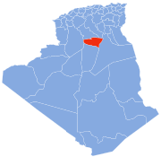 | |
| Bérianne District | ||
| Bounoura District | ||
| Dhayat Ben Dhahoua District | ||
| El Guerrara District | ||
| El Ménia District |
| |
| Mansourah District | ||
| Métlili District | ||
| Zelfana District | ||
На других языках
[de] El Meniaa
El Meniaa (arabisch المنيعة, DMG al-Manīʿa), früher El Golea (arabisch القليعة, DMG al-Qulaiʿa), ist eine Oasenstadt in der Sahara in Algerien mit rund 15.000 Einwohnern an der Transsaharastraße Algier–Tamanrasset in 377 m Höhe gelegen. Sie ist die Hauptstadt der gleichnamigen Provinz. Die Stadt mit botanischem Garten und eigenem Flughafen liegt 270 km südlich von Ghardaia und wird „Stadt der einhunderttausend Palmen“ genannt. Neben Dattelpalmen werden Obst, Gemüse und Getreide angebaut. Artesische Brunnen sichern die Wasserversorgung der Menschen und Gärten.- [en] El Menia
Другой контент может иметь иную лицензию. Перед использованием материалов сайта WikiSort.org внимательно изучите правила лицензирования конкретных элементов наполнения сайта.
WikiSort.org - проект по пересортировке и дополнению контента Википедии