world.wikisort.org - Norway
Surnadal (![]() pronunciation (help·info)) is a municipality in Møre og Romsdal county, Norway. It is part of the Nordmøre region. The administrative centre is the village of Skei. Other villages in Surnadal include Glærem, Mo, Stangvik, Surnadalsøra, Sylte, Todalsøra, and Åsskard.
pronunciation (help·info)) is a municipality in Møre og Romsdal county, Norway. It is part of the Nordmøre region. The administrative centre is the village of Skei. Other villages in Surnadal include Glærem, Mo, Stangvik, Surnadalsøra, Sylte, Todalsøra, and Åsskard.
Surnadal kommune | |
|---|---|
Municipality | |
 View of Skei in Surnadal | |
 Flag  Coat of arms  Møre og Romsdal within Norway | |
 Surnadal within Møre og Romsdal | |
| Coordinates: 62°56′51″N 08°46′12″E | |
| Country | Norway |
| County | Møre og Romsdal |
| District | Nordmøre |
| Established | 1 Jan 1838 |
| • Created as | Formannskapsdistrikt |
| Administrative centre | Skei |
| Government | |
| • Mayor (2019) | Margrethe Svinvik (Sp) |
| Area | |
| • Total | 1,366.04 km2 (527.43 sq mi) |
| • Land | 1,315.05 km2 (507.74 sq mi) |
| • Water | 50.99 km2 (19.69 sq mi) 3.7% |
| • Rank | #68 in Norway |
| Population (2022) | |
| • Total | 5,849 |
| • Rank | #163 in Norway |
| • Density | 4.4/km2 (11/sq mi) |
| • Change (10 years) | |
| Demonym | Surndaling[1] |
| Official language | |
| • Norwegian form | Nynorsk |
| Time zone | UTC+01:00 (CET) |
| • Summer (DST) | UTC+02:00 (CEST) |
| ISO 3166 code | NO-1566 |
| Website | Official website |
A mild climate and rich soil make Surnadal well suited for agriculture. The local economy is based on agriculture, forestry, and industrial production, in addition to services.[3]
The 1,366-square-kilometre (527 sq mi) municipality is the 68th largest by area out of the 356 municipalities in Norway. Surnadal is the 163rd most populous municipality in Norway with a population of 5,849. The municipality's population density is 4.4 inhabitants per square kilometre (11/sq mi) and its population has decreased by 1.7% over the previous 10-year period.[4][5]
General information
The parish of Surnadal was established as a municipality on 1 January 1838 (see formannskapsdistrikt law). In 1858, the eastern district (population: 2,684) was separated from Surnadal to form the new Rindal Municipality. This left Surnadal with 3,105 residents. On 1 January 1877, part of Stangvik Municipality (population: 50) was transferred to Surnadal. In 1879, part of Surnadal (population: 83) was transferred to the neighboring Stangvik Municipality. On 1 January 1886, the Møklegjerdet farm (population: 29), just west of the village of Glærem, was transferred from Stangvik to Surnadal. On 1 January 1897, the Sjøflot farm (population: 27) was also transferred from Stangvik to Surnadal. During the 1960s, there were many municipal mergers across Norway due to the work of the Schei Committee. On 1 January 1965, all of Åsskard Municipality (population: 1,014) and most of Stangvik Municipality (population: 1,386) were merged with Surnadal Municipality (population: 3,534) to create a new, larger municipality of Surnadal with a total population of 5,934.[6]
Name
The Old Norse form of the name was Súrnardalr. The first element is the genitive case of the river name Surna and the last element is dalr which means "valley" or "dale". The meaning of the river name is unknown. Before 1918, the name was written Surendalen.[7]
Coat of arms
The coat of arms was granted in 1989. It shows two silver or white wavy lines on a green background. The wavy lines represent the many rivers in the municipality, the most notable one being the Surna.[3][8]
Churches
The Church of Norway has five parishes (sokn) within the municipality of Surnadal. It is part of the Indre Nordmøre prosti (deanery) in the Diocese of Møre.
| Parish (sokn) | Church name | Location of the church | Year built |
|---|---|---|---|
| Mo | Mo Church | Mo | 1728 |
| Stangvik | Stangvik Church | Stangvik | 1896 |
| Todalen | Todalen Church | Todalsøra | 1861 |
| Øye og Ranes | Ranes Church | Ranes | 1869 |
| Øye Church | Skei | 1871 | |
| Åsskard | Åsskard Church | Åsskard | 1876 |
Geography
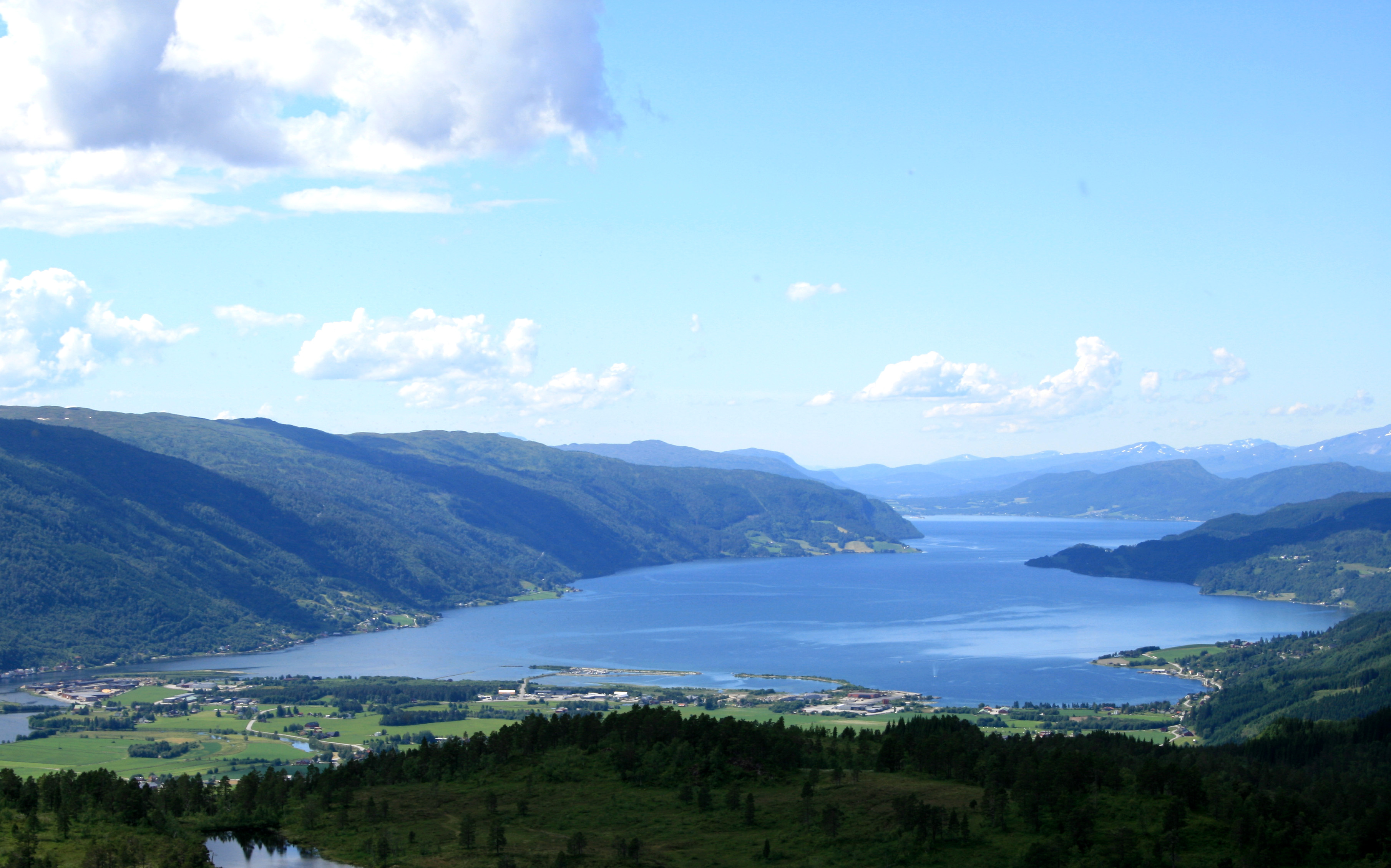
The municipality is made up by the main valley, Surnadalen through which the river Surna runs. There are also many smaller side valleys including Stor-Bæverdalen, Settemsdalen, Øvstbødalen, Todalen, and Vinddøldalen. The municipality is bordered by the Trollheimen mountain range and Sunndal Municipality to the south, the neighboring Rindal Municipality to the east, Halsa Municipality to the north, and several fjords to the west: Trongfjorden, Stangvikfjorden, and Todalsfjorden. There are three main fjords that cut into the municipality: Åsskardfjorden, Hamnesfjorden, and Surnadalsfjorden.
The landscape is a combination of forests, fjords, and mountains. The highest mountain peak is Snota at 1,668 metres (5,472 ft) above sea level. Other mountains include Vassnebba, Indre Sula and Ytre Sula, Neådalssnota, and Trollhetta. The river Surna runs through the valley from the east to the west, and forms a large delta where it enters the fjord near Surnadalsøra and Skei. This river is rich in salmon, which attract tourists from the rest of the country and abroad. The lakes Foldsjøen and Gråsjøen lie along the border with the municipality of Rindal in the east. The Grønkjølen Nature Reserve lies in the extreme northeast of the municipality.[9]
Climate
Surnadal is situated at the head of a long fjord some distance from the coast and has an oceanic climate or humid continental climate, depending on winter threshold used (−3 °C (27 °F)) gives oceanic, 0 °C (32 °F) gives humid continental). The wettest season is August–December, while Feb - May is the driest. The record high 33.6 °C (92.5 °F) recorded 27 July 2018. The warmest night was 29 July 2018 with low 24.5 °C (76.1 °F). On 14 October 2018 a high of 25.5 °C (77.9 °F) was recorded in Surnadal, the second warmest October temperature in Norway. Winter temperatures can get below −20 °C (−4 °F), although that is rare. February 2010 a low of −23.4 °C (−10.1 °F) was recorded.
| Climate data for Surnadal - Sylte 1991-2020 (5 m) | |||||||||||||
|---|---|---|---|---|---|---|---|---|---|---|---|---|---|
| Month | Jan | Feb | Mar | Apr | May | Jun | Jul | Aug | Sep | Oct | Nov | Dec | Year |
| Daily mean °C (°F) | −2.4 (27.7) |
−2.3 (27.9) |
0.2 (32.4) |
4.6 (40.3) |
9 (48) |
12.7 (54.9) |
15 (59) |
14.2 (57.6) |
10.4 (50.7) |
4.3 (39.7) |
0.5 (32.9) |
−1.7 (28.9) |
5.4 (41.7) |
| Average precipitation mm (inches) | 103 (4.1) |
73 (2.9) |
96 (3.8) |
69 (2.7) |
80 (3.1) |
100 (3.9) |
99 (3.9) |
121 (4.8) |
142 (5.6) |
132 (5.2) |
104 (4.1) |
129 (5.1) |
1,248 (49.2) |
| Source: yr.no [10] | |||||||||||||
Government
All municipalities in Norway, including Surnadal, are responsible for primary education (through 10th grade), outpatient health services, senior citizen services, unemployment and other social services, zoning, economic development, and municipal roads. The municipality is governed by a municipal council of elected representatives, which in turn elect a mayor.[11] The municipality falls under the Møre og Romsdal District Court and the Frostating Court of Appeal.
Municipal council
The municipal council (Kommunestyre) of Surnadal is made up of 27 representatives that are elected to four year terms. The party breakdown of the council is as follows:
| Party Name (in Nynorsk) | Number of representatives | |
|---|---|---|
| Labour Party (Arbeidarpartiet) | 8 | |
| Progress Party (Framstegspartiet) | 2 | |
| Green Party (Miljøpartiet Dei Grøne) | 1 | |
| Conservative Party (Høgre) | 2 | |
| Centre Party (Senterpartiet) | 13 | |
| Socialist Left Party (Sosialistisk Venstreparti) | 1 | |
| Total number of members: | 27 | |
| Party Name (in Nynorsk) | Number of representatives | |
|---|---|---|
| Labour Party (Arbeidarpartiet) | 12 | |
| Progress Party (Framstegspartiet) | 1 | |
| Green Party (Miljøpartiet Dei Grøne) | 1 | |
| Conservative Party (Høgre) | 3 | |
| Christian Democratic Party (Kristeleg Folkeparti) | 1 | |
| Centre Party (Senterpartiet) | 9 | |
| Total number of members: | 27 | |
| Party Name (in Nynorsk) | Number of representatives | |
|---|---|---|
| Labour Party (Arbeidarpartiet) | 13 | |
| Progress Party (Framstegspartiet) | 2 | |
| Conservative Party (Høgre) | 2 | |
| Christian Democratic Party (Kristeleg Folkeparti) | 1 | |
| Centre Party (Senterpartiet) | 8 | |
| Socialist Left Party (Sosialistisk Venstreparti) | 1 | |
| Total number of members: | 27 | |
| Party Name (in Nynorsk) | Number of representatives | |
|---|---|---|
| Labour Party (Arbeidarpartiet) | 10 | |
| Progress Party (Framstegspartiet) | 2 | |
| Conservative Party (Høgre) | 3 | |
| Christian Democratic Party (Kristeleg Folkeparti) | 2 | |
| Centre Party (Senterpartiet) | 9 | |
| Socialist Left Party (Sosialistisk Venstreparti) | 1 | |
| Total number of members: | 27 | |
| Party Name (in Nynorsk) | Number of representatives | |
|---|---|---|
| Labour Party (Arbeidarpartiet) | 8 | |
| Conservative Party (Høgre) | 2 | |
| Christian Democratic Party (Kristeleg Folkeparti) | 2 | |
| Centre Party (Senterpartiet) | 13 | |
| Socialist Left Party (Sosialistisk Venstreparti) | 2 | |
| Total number of members: | 27 | |
| Party Name (in Nynorsk) | Number of representatives | |
|---|---|---|
| Labour Party (Arbeidarpartiet) | 12 | |
| Conservative Party (Høgre) | 2 | |
| Christian Democratic Party (Kristeleg Folkeparti) | 2 | |
| Centre Party (Senterpartiet) | 16 | |
| Socialist Left Party (Sosialistisk Venstreparti) | 1 | |
| Total number of members: | 33 | |
| Party Name (in Nynorsk) | Number of representatives | |
|---|---|---|
| Labour Party (Arbeidarpartiet) | 14 | |
| Conservative Party (Høgre) | 3 | |
| Christian Democratic Party (Kristeleg Folkeparti) | 2 | |
| Centre Party (Senterpartiet) | 12 | |
| Socialist Left Party (Sosialistisk Venstreparti) | 1 | |
| Liberal Party (Venstre) | 1 | |
| Total number of members: | 33 | |
| Party Name (in Nynorsk) | Number of representatives | |
|---|---|---|
| Labour Party (Arbeidarpartiet) | 13 | |
| Progress Party (Framstegspartiet) | 1 | |
| Conservative Party (Høgre) | 2 | |
| Christian Democratic Party (Kristeleg Folkeparti) | 3 | |
| Centre Party (Senterpartiet) | 11 | |
| Socialist Left Party (Sosialistisk Venstreparti) | 2 | |
| Liberal Party (Venstre) | 1 | |
| Total number of members: | 33 | |
| Party Name (in Nynorsk) | Number of representatives | |
|---|---|---|
| Labour Party (Arbeidarpartiet) | 16 | |
| Conservative Party (Høgre) | 3 | |
| Christian Democratic Party (Kristeleg Folkeparti) | 3 | |
| Centre Party (Senterpartiet) | 9 | |
| Liberal Party (Venstre) | 2 | |
| Total number of members: | 33 | |
| Party Name (in Nynorsk) | Number of representatives | |
|---|---|---|
| Labour Party (Arbeidarpartiet) | 16 | |
| Conservative Party (Høgre) | 3 | |
| Christian Democratic Party (Kristeleg Folkeparti) | 2 | |
| Centre Party (Senterpartiet) | 10 | |
| Liberal Party (Venstre) | 2 | |
| Total number of members: | 33 | |
| Party Name (in Nynorsk) | Number of representatives | |
|---|---|---|
| Labour Party (Arbeidarpartiet) | 15 | |
| Conservative Party (Høgre) | 3 | |
| Christian Democratic Party (Kristeleg Folkeparti) | 3 | |
| Centre Party (Senterpartiet) | 10 | |
| Liberal Party (Venstre) | 2 | |
| Total number of members: | 33 | |
| Party Name (in Nynorsk) | Number of representatives | |
|---|---|---|
| Labour Party (Arbeidarpartiet) | 14 | |
| Conservative Party (Høgre) | 2 | |
| Christian Democratic Party (Kristeleg Folkeparti) | 4 | |
| Centre Party (Senterpartiet) | 12 | |
| Liberal Party (Venstre) | 1 | |
| Total number of members: | 33 | |
| Party Name (in Nynorsk) | Number of representatives | |
|---|---|---|
| Labour Party (Arbeidarpartiet) | 17 | |
| Christian Democratic Party (Kristeleg Folkeparti) | 3 | |
| Centre Party (Senterpartiet) | 11 | |
| Joint List(s) of Non-Socialist Parties (Borgarlege Felleslister) | 2 | |
| Total number of members: | 33 | |
| Party Name (in Nynorsk) | Number of representatives | |
|---|---|---|
| Labour Party (Arbeidarpartiet) | 17 | |
| Conservative Party (Høgre) | 2 | |
| Christian Democratic Party (Kristeleg Folkeparti) | 3 | |
| Centre Party (Senterpartiet) | 10 | |
| Liberal Party (Venstre) | 1 | |
| Total number of members: | 33 | |
| Party Name (in Nynorsk) | Number of representatives | |
|---|---|---|
| Labour Party (Arbeidarpartiet) | 11 | |
| Conservative Party (Høgre) | 2 | |
| Christian Democratic Party (Kristeleg Folkeparti) | 2 | |
| Centre Party (Senterpartiet) | 5 | |
| Liberal Party (Venstre) | 1 | |
| Total number of members: | 21 | |
| Party Name (in Nynorsk) | Number of representatives | |
|---|---|---|
| Labour Party (Arbeidarpartiet) | 12 | |
| Conservative Party (Høgre) | 1 | |
| Christian Democratic Party (Kristeleg Folkeparti) | 2 | |
| Centre Party (Senterpartiet) | 5 | |
| Liberal Party (Venstre) | 1 | |
| Total number of members: | 21 | |
| Party Name (in Nynorsk) | Number of representatives | |
|---|---|---|
| Labour Party (Arbeidarpartiet) | 11 | |
| Conservative Party (Høgre) | 1 | |
| Christian Democratic Party (Kristeleg Folkeparti) | 3 | |
| Farmers' Party (Bondepartiet) | 5 | |
| Liberal Party (Venstre) | 1 | |
| Total number of members: | 21 | |
| Party Name (in Nynorsk) | Number of representatives | |
|---|---|---|
| Labour Party (Arbeidarpartiet) | 11 | |
| Christian Democratic Party (Kristeleg Folkeparti) | 2 | |
| Joint List(s) of Non-Socialist Parties (Borgarlege Felleslister) | 7 | |
| Total number of members: | 20 | |
| Party Name (in Nynorsk) | Number of representatives | |
|---|---|---|
| Labour Party (Arbeidarpartiet) | 8 | |
| Christian Democratic Party (Kristeleg Folkeparti) | 3 | |
| Joint List(s) of Non-Socialist Parties (Borgarlege Felleslister) | 5 | |
| Total number of members: | 16 | |
| Party Name (in Nynorsk) | Number of representatives | |
|---|---|---|
| Labour Party (Arbeidarpartiet) | 10 | |
| Joint List(s) of Non-Socialist Parties (Borgarlege Felleslister) | 6 | |
| Total number of members: | 16 | |
| Party Name (in Nynorsk) | Number of representatives | |
|---|---|---|
| Labour Party (Arbeidarpartiet) | 8 | |
| Farmers' Party (Bondepartiet) | 3 | |
| Liberal Party (Venstre) | 1 | |
| Joint list of the Farmers' Party (Bondepartiet) and the Liberal Party (Venstre) | 1 | |
| Local List(s) (Lokale lister) | 3 | |
| Total number of members: | 16 | |
| Note: Due to the German occupation of Norway during World War II, no elections were held for new municipal councils until after the war ended in 1945. | ||
Mayor
The mayors of Surnadal (incomplete list):
- 2019–present: Margrethe Svinvik (Sp)
- 2014-2019: Lilly Gunn Nyheim (Ap)
- 2007-2014: Mons Otnes (Ap)
- 1997-2007: Bergsvein Brøske (Sp)
- 1995-1996: Asbjørn Ørsal (Ap)
- 1992-1995: Ola O. Fiske (Sp)
- 1987-1991: Helge Vold (Ap)
- 1984-1986: Helge Røv (Ap)
- 1976-1983: Nils Magnar Torvik (Sp)
Transportation
Transportation services include ferries to the southwest and the northwest, which lead to the coastal areas of Møre og Romsdal, and a highway to the city of Trondheim to the east.
Notable residents
- Ole Andreas Lindeman (1769–1857) a musician, organist, composer and music educator
- Hans Hyldbakk (1898–2001) a Norwegian folklore poet
- Anders Sæterøy (1901–1991) a politician and Mayor of Surnadal three times after WWII
- Kaare Espolin Johnson (1907–1994) a Norwegian artist and illustrator
- Helge Seip (1919–2004) politician, leader of the Liberal party
- Alf Ramsøy (1925–2014) a long-distance runner, cross-country skier, actor and farmer
- Sverre Årnes (born 1949) a writer serial novels, short stories and articles
- Henning Sommerro (born 1952) a Norwegian musician, composer and academic
- Lars Steinar Ansnes (born 1956) a Norwegian editor
- Euronymous (1968–1993) real name Øystein Aarseth, early Norwegian black metal scene
- Rune Gjeldnes (born 1971) a Norwegian adventurer and explorer
- Ivar Loe Bjørnstad (born 1981) a Norwegian jazz and rock musician
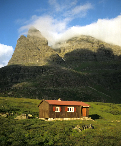
Gallery
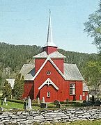 Mo kirke, Surnadal
 Giklingdalshytta
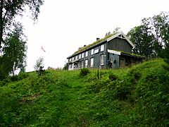 Markagården Vaulen
 Todalshytta


References
- "Navn på steder og personer: Innbyggjarnamn" (in Norwegian). Språkrådet.
- "Forskrift om målvedtak i kommunar og fylkeskommunar" (in Norwegian). Lovdata.no.
- Store norske leksikon. "Surnadal" (in Norwegian). Retrieved 20 April 2013.
- Statistisk sentralbyrå. "Table: 06913: Population 1 January and population changes during the calendar year (M)" (in Norwegian).
- Statistisk sentralbyrå. "09280: Area of land and fresh water (km²) (M)" (in Norwegian).
- Jukvam, Dag (1999). "Historisk oversikt over endringer i kommune- og fylkesinndelingen" (PDF) (in Norwegian). Statistisk sentralbyrå.
- Rygh, Oluf (1908). Norske gaardnavne: Romsdals amt (in Norwegian) (13 ed.). Kristiania, Norge: W. C. Fabritius & sønners bogtrikkeri. p. 410.
- "Civic heraldry of Norway - Norske Kommunevåpen". Heraldry of the World. Retrieved 19 October 2017.
- "Grønkjølen". Mijlø-direktoratet. Retrieved 7 August 2017.
- "yr.no/met.no".
- Hansen, Tore, ed. (12 May 2016). "kommunestyre". Store norske leksikon (in Norwegian). Kunnskapsforlaget. Retrieved 22 April 2019.
- "Tall for Norge: Kommunestyrevalg 2019 - Møre og Romsdal" (in Norwegian). Statistics Norway. Retrieved 19 October 2019.
- "Table: 04813: Members of the local councils, by party/electoral list at the Municipal Council election (M)" (in Norwegian). Statistics Norway.
- "Tall for Norge: Kommunestyrevalg 2011 - Møre og Romsdal" (in Norwegian). Statistics Norway. Retrieved 19 October 2019.
- "Kommunestyrevalget 1995" (PDF) (in Norwegian). Oslo-Kongsvinger: Statistisk sentralbyrå. 1996. Retrieved 26 April 2020.
- "Kommunestyrevalget 1991" (PDF) (in Norwegian). Oslo-Kongsvinger: Statistisk sentralbyrå. 1993. Retrieved 26 April 2020.
- "Kommunestyrevalget 1987" (PDF) (in Norwegian). Oslo-Kongsvinger: Statistisk sentralbyrå. 1988. Retrieved 26 April 2020.
- "Kommunestyrevalget 1983" (PDF) (in Norwegian). Oslo-Kongsvinger: Statistisk sentralbyrå. 1984. Retrieved 26 April 2020.
- "Kommunestyrevalget 1979" (PDF) (in Norwegian). Oslo: Statistisk sentralbyrå. 1979. Retrieved 26 April 2020.
- "Kommunevalgene 1975" (PDF) (in Norwegian). Oslo: Statistisk sentralbyrå. 1977. Retrieved 26 April 2020.
- "Kommunevalgene 1972" (PDF) (in Norwegian). Oslo: Statistisk sentralbyrå. 1973. Retrieved 26 April 2020.
- "Kommunevalgene 1967" (PDF) (in Norwegian). Oslo: Statistisk sentralbyrå. 1967. Retrieved 26 April 2020.
- "Kommunevalgene 1963" (PDF) (in Norwegian). Oslo: Statistisk sentralbyrå. 1964. Retrieved 26 April 2020.
- "Kommunevalgene og Ordførervalgene 1959" (PDF) (in Norwegian). Oslo: Statistisk sentralbyrå. 1960. Retrieved 26 April 2020.
- "Kommunevalgene og Ordførervalgene 1955" (PDF) (in Norwegian). Oslo: Statistisk sentralbyrå. 1957. Retrieved 26 April 2020.
- "Kommunevalgene og Ordførervalgene 1951" (PDF) (in Norwegian). Oslo: Statistisk sentralbyrå. 1952. Retrieved 26 April 2020.
- "Kommunevalgene og Ordførervalgene 1947" (PDF) (in Norwegian). Oslo: Statistisk sentralbyrå. 1948. Retrieved 26 April 2020.
- "Kommunevalgene og Ordførervalgene 1945" (PDF) (in Norwegian). Oslo: Statistisk sentralbyrå. 1947. Retrieved 26 April 2020.
- "Kommunevalgene og Ordførervalgene 1937" (PDF) (in Norwegian). Oslo: Statistisk sentralbyrå. 1938. Retrieved 26 April 2020.
External links
 Media related to Surnadal at Wikimedia Commons
 Møre og Romsdal travel guide from Wikivoyage
- Municipal fact sheet from Statistics Norway (in Norwegian)
Møre og Romsdal county, Norway | |||||||||||
|---|---|---|---|---|---|---|---|---|---|---|---|
| |||||||||||
 | Towns and cities |
|  | ||||||||
| Municipalities |
| ||||||||||
| Authority control |
|
|---|
На других языках
[de] Surnadal
Surnadal?/i ist eine Kommune im norwegischen Fylke Møre og Romsdal. Die Verwaltung von Surnadal befindet sich in der Ortschaft Skei.- [en] Surnadal
[ru] Сурнадал
Сурнадал (норв. Surnadal) — коммуна в губернии Мёре-ог-Ромсдал в Норвегии. Административный центр коммуны — город Скей. Официальный язык коммуны — нюнорск. Население коммуны на 2007 год составляло 6039 чел. Площадь коммуны Сурнадал — 1364,78 км², код-идентификатор — 1566.Другой контент может иметь иную лицензию. Перед использованием материалов сайта WikiSort.org внимательно изучите правила лицензирования конкретных элементов наполнения сайта.
WikiSort.org - проект по пересортировке и дополнению контента Википедии