world.wikisort.org - USA
Wytheville is a town in, and the county seat of, Wythe County, in southwestern Virginia, United States. It is named after George Wythe, a signer of the United States Declaration of Independence, and mentor to Thomas Jefferson. Wytheville's population was 8,211 at the 2010 census.[6] Interstate Highways 77 and 81 were constructed to intersect at the town, long a crossroads for travelers.
Wytheville, Virginia | |
|---|---|
Town | |
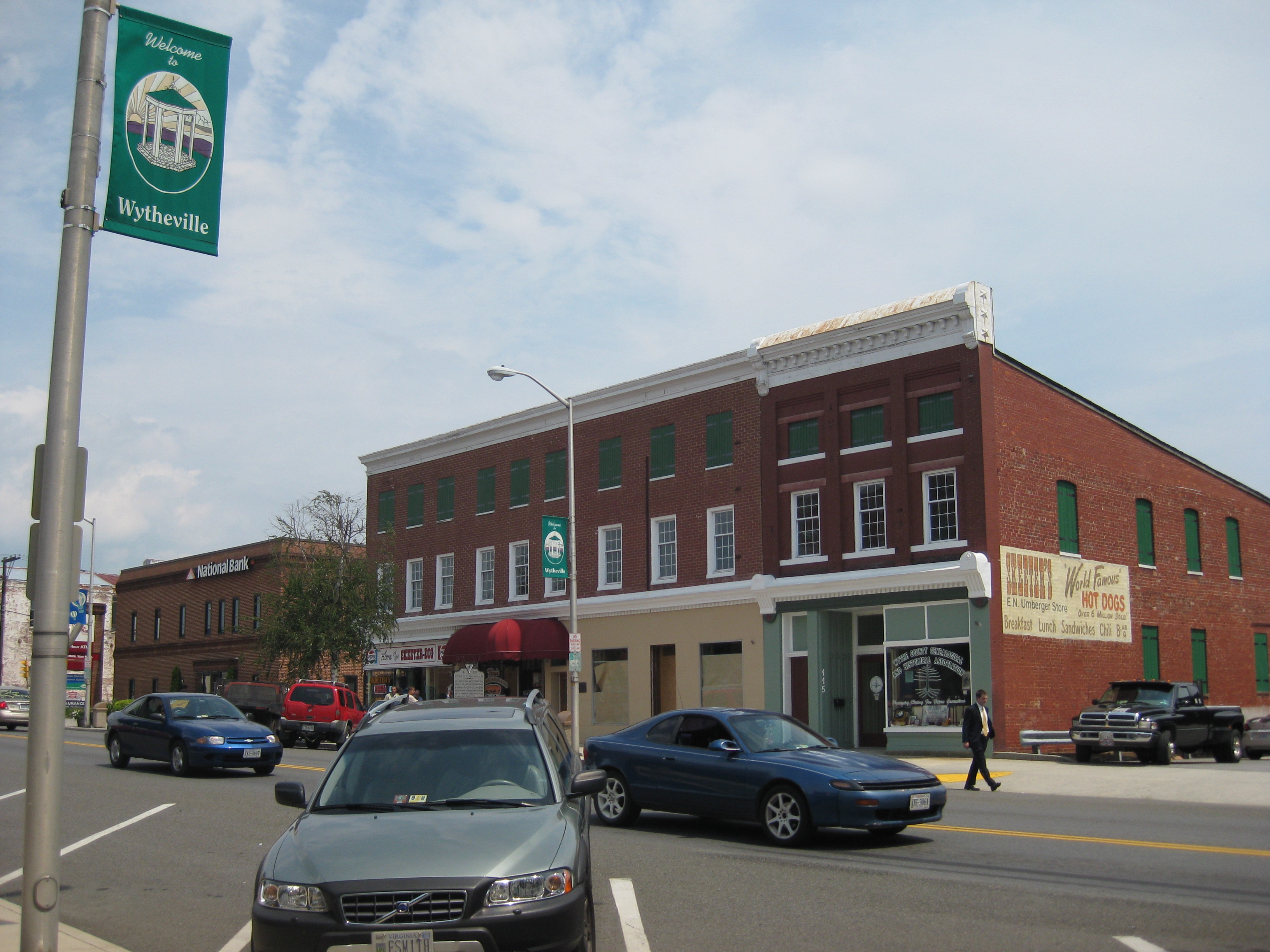 Main Street in Wytheville | |
 Location in the Commonwealth of Virginia | |
| Coordinates: 36°56′52″N 81°05′13″W | |
| Country | United States |
| State | Virginia |
| County | Wythe |
| Government | |
| • Mayor | Beth A. Taylor[1] |
| Area | |
| • Town | 14.58 sq mi (37.77 km2) |
| • Land | 14.49 sq mi (37.53 km2) |
| • Water | 0.09 sq mi (0.24 km2) |
| Elevation | 2,287 ft (697 m) |
| Population (2010) | |
| • Town | 8,211 |
| • Estimate (2019)[3] | 7,921 |
| • Density | 546.69/sq mi (211.07/km2) |
| • Metro | 29,119 |
| U.S. Census Bureau, 2010 Census | |
| Time zone | UTC−5 (EST) |
| • Summer (DST) | UTC−4 (EDT) |
| ZIP code | 24382 |
| Area code | 276 |
| FIPS code | 51-88000[4] |
| GNIS feature ID | 1498537[5] |
| Website | http://www.wytheville.org/ |
During the American Civil War, Wytheville had a strategic importance. It was attacked in 1863 (Toland's Raid) and 1865 (Stoneman's 1865 Raid). The town is the birthplace of Edith Bolling Wilson, second wife of President Woodrow Wilson.
History

Wythe County was created in 1789 and named for George Wythe, the "father of American Jurisprudence" and signer of the Declaration of Independence. In May 1790, Chris Simmerman donated 90 acres, along with John Davis's 10 acres, to establish a town and county seat. Robert Adams completed a town survey in November of that year, dividing the area into half-acre lots. The town did not have an official name yet, but was generally known as Wythe Court House.[7]
Two years later, in October 1792, the town was officially named Evansham, for prominent local citizen Jesse Evans. After a disastrous fire in March 1839, the town was renamed Wytheville. At that time, it was home to about 500 residents.[7]
Lynching of Raymond Bird
In 1926 the last documented lynching in Virginia took place here, when Raymond Bird, an African-American man, was murdered by a large group of masked and costumed men while under arrest in the local jail. Bird was accused of raping or assaulting the three white daughters of Grover Grubb, his employer. The two older sisters, both of which bore Bird's children, were of age and revealed that the relationship was consensual and thus did not constitute a crime. However, he was eventually arrested on the accusation that he assaulted the minor daughter. Bird was shot and killed by the mob in his jail cell, dragged a few miles behind a truck, then put his body in the boot of a car, and then his dead body hanged from a tree on Charley Brown's land hear St. Paul Lutheran Church.[8] The event provoked outrage and national coverage by newspapers.[9]
Bird's death was a catalyst for Virginia's passing an anti-lynching law in 1928, largely because of a campaign led by Louis I. Jaffé, editor of the Norfolk Virginian-Pilot. It was supported by Governor Harry Flood Byrd Sr., who linked the bill to his efforts to attract new businesses to the state.[9][8]
Polio epidemic
A few cases of polio during the summer of 1950 swelled into an epidemic of hundreds. It was known to cause infantile and even adult paralysis. Of the 5,513 inhabitants of the town,[10] 184 people contracted the disease, resulting in 17 fatalities.[11] From the beginning of June until the end of August, parents kept children inside, and large gatherings were cancelled to diminish the chance of infection.[12]
As the epidemic progressed, ambulances drove victims approximately 80 miles (130 km) to Memorial Crippled Children's Hospital in Roanoke, Virginia. Hearses from local funeral homes were used when ambulances were unavailable. African-American patients with polio were repeatedly denied admission to Roanoke's hospital and were forced to drive approximately 300 miles (480 km) to St. Philip's Hospital in Richmond, the closest hospital to serve blacks.[13]
The Town Council erected billboards at all five entrances to the county, warning potential visitors of the epidemic and urging tourists to return the following year. By the end of the summer, all five billboards were stolen or demolished. Though the Town Council offered a reward for information, no one came forward.[13][14]
Historic sites
The Crockett's Cove Presbyterian Church, Haller-Gibboney Rock House, Loretto, St. John's Episcopal Church, St. John's Lutheran Church and Cemetery, Wythe County Poorhouse Farm, and Wytheville Historic District are listed on the National Register of Historic Places.[15]
Geography
Wytheville is located at 36°56′52″N 81°5′13″W (36.947679, −81.086955).[16]
According to the United States Census Bureau, the town has a total area of 14.3 sq mi (37.0 km2), of which 0.04 sq mi (0.1 km2) (0.14%) is water.
Wytheville is an important point on both I-77 and I-81 and lies amidst a wrong-way concurrency of I-77 and I-81. It is located about halfway between Bristol, Tennessee/Virginia and Roanoke. On the I-77 corridor, it is located about halfway between Charleston, West Virginia and Charlotte, North Carolina. The nearby community of Fort Chiswell is the control city for the northbound traffic on I-77 coming from Charlotte, Statesville, Elkin, and Mount Airy, North Carolina. In the near future, Interstate 74 will go through Wytheville in addition to the two other interstates.

Due to the confluence of I-77, I-81 and several U.S. Highways, and its location in the foothills of the Blue Ridge Mountains, Wytheville is known as "The Hub of Southwest Virginia" and "The Crossroads of the Blue Ridge".
Climate
Due to its elevation, the climate of Wytheville is either classified as mountain temperate or humid subtropical (Köppen Cfb or Cfa, respectively), and the town straddles the border between USDA Plant Hardiness Zones 6B and 7A.[17] Summers are warm and humid, although significantly cooler than low-elevation places within the state, with only 4.6 days of 90 °F (32 °C)+ highs annually, and winters are generally cool to cold with occasional intervening warm periods and 11 nights of sub-10 °F (−12 °C) lows. Monthly mean temperatures range from 32.9 °F (0.5 °C) in January to 71.7 °F (22.1 °C) in July. Snowfall averages 20.5 inches (52 cm) per season and generally occurs from December to March.
| Climate data for Wytheville, Virginia, elev. 2,458 feet (749 m) (1991–2020 normals, extremes 1893–present) | |||||||||||||
|---|---|---|---|---|---|---|---|---|---|---|---|---|---|
| Month | Jan | Feb | Mar | Apr | May | Jun | Jul | Aug | Sep | Oct | Nov | Dec | Year |
| Record high °F (°C) | 78 (26) |
78 (26) |
83 (28) |
88 (31) |
91 (33) |
98 (37) |
98 (37) |
98 (37) |
97 (36) |
90 (32) |
80 (27) |
76 (24) |
98 (37) |
| Average high °F (°C) | 42.2 (5.7) |
45.9 (7.7) |
54.0 (12.2) |
64.5 (18.1) |
72.5 (22.5) |
79.3 (26.3) |
82.8 (28.2) |
81.8 (27.7) |
76.5 (24.7) |
66.6 (19.2) |
55.5 (13.1) |
45.8 (7.7) |
63.9 (17.7) |
| Daily mean °F (°C) | 32.9 (0.5) |
35.7 (2.1) |
42.6 (5.9) |
51.9 (11.1) |
60.5 (15.8) |
68.0 (20.0) |
71.7 (22.1) |
70.6 (21.4) |
64.6 (18.1) |
53.7 (12.1) |
43.2 (6.2) |
36.2 (2.3) |
52.6 (11.4) |
| Average low °F (°C) | 23.5 (−4.7) |
25.6 (−3.6) |
31.2 (−0.4) |
39.2 (4.0) |
48.5 (9.2) |
56.7 (13.7) |
60.6 (15.9) |
59.5 (15.3) |
52.8 (11.6) |
40.7 (4.8) |
31.0 (−0.6) |
26.6 (−3.0) |
41.3 (5.2) |
| Record low °F (°C) | −20 (−29) |
−9 (−23) |
0 (−18) |
12 (−11) |
23 (−5) |
30 (−1) |
39 (4) |
35 (2) |
25 (−4) |
12 (−11) |
2 (−17) |
−13 (−25) |
−20 (−29) |
| Average precipitation inches (mm) | 3.16 (80) |
2.88 (73) |
3.60 (91) |
3.75 (95) |
4.30 (109) |
4.06 (103) |
4.22 (107) |
3.63 (92) |
3.36 (85) |
2.92 (74) |
2.62 (67) |
3.18 (81) |
41.68 (1,059) |
| Average snowfall inches (cm) | 5.9 (15) |
4.9 (12) |
2.9 (7.4) |
0.5 (1.3) |
0.0 (0.0) |
0.0 (0.0) |
0.0 (0.0) |
0.0 (0.0) |
0.0 (0.0) |
0.0 (0.0) |
0.4 (1.0) |
3.8 (9.7) |
18.4 (47) |
| Average precipitation days (≥ 0.01 in) | 11.1 | 10.8 | 11.9 | 12.0 | 13.5 | 12.8 | 12.4 | 11.1 | 9.9 | 9.0 | 9.2 | 11.3 | 135.0 |
| Average snowy days (≥ 0.1 in) | 2.8 | 2.5 | 1.5 | 0.3 | 0.0 | 0.0 | 0.0 | 0.0 | 0.0 | 0.0 | 0.4 | 2.1 | 9.6 |
| Source: NOAA[18][19] | |||||||||||||
Demographics
| Historical population | |||
|---|---|---|---|
| Census | Pop. | %± | |
| 1860 | 1,111 | — | |
| 1870 | 1,671 | 50.4% | |
| 1880 | 1,885 | 12.8% | |
| 1890 | 2,570 | 36.3% | |
| 1900 | 3,003 | 16.8% | |
| 1910 | 3,054 | 1.7% | |
| 1920 | 2,947 | −3.5% | |
| 1930 | 3,327 | 12.9% | |
| 1940 | 4,653 | 39.9% | |
| 1950 | 5,513 | 18.5% | |
| 1960 | 5,634 | 2.2% | |
| 1970 | 6,069 | 7.7% | |
| 1980 | 7,135 | 17.6% | |
| 1990 | 8,038 | 12.7% | |
| 2000 | 7,804 | −2.9% | |
| 2010 | 8,211 | 5.2% | |
| 2019 (est.) | 7,921 | [3] | −3.5% |
| U.S. Decennial Census[20] | |||
As of the census[4] of 2000, there were 7,804 people, 3,504 households, and 2,112 families residing in the town. The population density was 546.8 people per square mile (211.2/km2). There were 3,776 housing units at an average density of 264.6 per square mile (102.2/km2). The racial makeup of the town was 90.76% White, 7.19% African American, 0.13% Native American, 0.70% Asian, 0.03% Pacific Islander, 0.33% from other races, and 0.86% from two or more races. Hispanic or Latino of any race were 0.82% of the population.
There were 3,504 households, out of which 22.9% had children under the age of 18 living with them, 43.4% were married couples living together, 13.6% had a female householder with no husband present, and 39.7% were non-families. 36.2% of all households were made up of individuals, and 16.3% had someone living alone who was 65 years of age or older. The average household size was 2.11 and the average family size was 2.72.
In the town, the population was spread out, with 19.3% under the age of 18, 6.9% from 18 to 24, 25.3% from 25 to 44, 25.6% from 45 to 64, and 22.8% who were 65 years of age or older. The median age was 44 years. For every 100 females, there were 78.1 males. For every 100 females age 18 and over, there were 75.2 males.
The median income for a household in the town was $28,043, and the median income for a family was $41,513. Males had a median income of $28,160 versus $21,282 for females. The per capita income for the town was $20,223. About 10.0% of families and 14.6% of the population were below the poverty line, including 21.5% of those under age 18 and 9.6% of those age 65 or over.
Media
WYVE 1280 on the AM dial signed-on in 1949. In August 2018, WYVE acquired FM Translator dial position 99.9FM. Three Rivers Media Corp. owns WYVE and its sister stations, WXBX and WLOY with towers in Wythe County and studio space adjacent to Downtown Wytheville.
Places of interest
- The Edith Bolling Wilson Birthplace
- Big Walker Lookout Tower, a 100-foot observation tower located 12 miles to the north of Wytheville
- The town is home to a Chautauqua Festival, held the third weekend in June every year since 1985. The Festival features live concerts, stage magic, arts and crafts, hot air ballooning, dance, children's activities and diverse carnival-style food. The presence of the hot air balloons for the yearly festival inspired the balloon-themed painting of the town's water tower, visible to I-81 travellers near the I-77 interchange. The Festival is held at Elizabeth Brown Memorial Park and is cosponsored by the county, town and the Wythe Arts Council.[21][22]
Notable people
- David French Boyd, president of Louisiana State University, 1877–1880; 1884–1886, born in Wytheville in 1834
- Thomas Duckett Boyd, president of LSU from 1886 (interim) and 1896 to 1926, born in Wytheville in 1854, brother of David French Boyd
- William Gibson, writer, spent much of his childhood there
- William Nauns Ricks, poet
- E. Lee Trinkle, Governor of Virginia
- James Walker, Lt. Governor of Virginia; Confederate General
- Edith Bolling Wilson, second wife of President Woodrow Wilson
- Robert E. Withers, former U.S. Senator, Lt. Governor of Virginia, first American Ambassador to China
References
- "Mayor and Council Members". Town of Wytheville. Retrieved August 24, 2018.
- "2019 U.S. Gazetteer Files". United States Census Bureau. Retrieved August 7, 2020.
- "Population and Housing Unit Estimates". United States Census Bureau. May 24, 2020. Retrieved May 27, 2020.
- "U.S. Census website". United States Census Bureau. Retrieved January 31, 2008.
- "US Board on Geographic Names". United States Geological Survey. October 25, 2007. Retrieved January 31, 2008.
- "Find a County". National Association of Counties. Archived from the original on May 31, 2011. Retrieved June 7, 2011.
- "Wythe County History". Wythe County Genealogical and Historical Association. Retrieved April 28, 2014.
- J. Douglas Smith, Managing White Supremacy: Race, Politics, and Citizenship in Jim Crow Virginia, University of North Carolina Press, 2002
- Sterling Giles, "Shameful chapter in Virginia history: Lynchings", News-Leader, May 16, 2016; Accessed March 15, 2018
- U.S. Department of Commerce, "Characteristics of the Population," Census of Population: 1950, vol. 2, part 46 (Washington D.C.: U.S. Government Printing Office, 1953)
- J. Robert Anderson, ed., Virginia Health Bulletin 3, no. 12, series 2 (Richmond, VA: Virginia State Department of Health, April 1951)
- Maisel, Albert Q. (July 3, 1951). "Wytheville's Message: Don't Be Afraid of Polio". Look Magazine. 15 (14): 67–74.
- Logan, Linda (2005). A Summer Without Children: An Oral History of Wythe County, Virginia’s 1950 Polio Epidemic. Wytheville, VA: Town of Wytheville Department of Museums.
- "$100 Reward Says Council, Conviction of Person, Persons Tearing Down Signs". Southwest Virginia Enterprise. August 1, 1950.
- "National Register Information System". National Register of Historic Places. National Park Service. July 9, 2010.
- "US Gazetteer files: 2010, 2000, and 1990". United States Census Bureau. February 12, 2011. Retrieved April 23, 2011.
- "What is my arborday.org Hardiness Zone?". The Arbor Day Foundation. Retrieved November 11, 2013.
- "NowData – NOAA Online Weather Data". National Oceanic and Atmospheric Administration. Retrieved July 1, 2021.
- "Station: Wytheville, VA". U.S. Climate Normals 2020: U.S. Monthly Climate Normals (1991-2020). National Oceanic and Atmospheric Administration. Retrieved July 1, 2021.
- "Census of Population and Housing". Census.gov. Retrieved June 4, 2015.
- Fussell, pg. 92
- "Chautauqua Festival - Wytheville, Virginia". Retrieved August 22, 2014.
Further reading
- Fussell, Fred C. (2003). Blue Ridge Music Trails: Finding a Place in the Circle. North Carolina Folklife Institute. 080785459X.
External links
- Visit Wytheville (Visitor's guide, history, and other resources)
Municipalities and communities of Wythe County, Virginia, United States | ||
|---|---|---|
County seat: Wytheville | ||
| Towns | 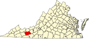 | |
| CDPs |
| |
| Other communities | ||
| ||
Authority control | |
|---|---|
| General | |
| National libraries | |
| Other | |
Другой контент может иметь иную лицензию. Перед использованием материалов сайта WikiSort.org внимательно изучите правила лицензирования конкретных элементов наполнения сайта.
WikiSort.org - проект по пересортировке и дополнению контента Википедии