world.wikisort.org - USA
Clifton Forge is a town in Alleghany County, Virginia, United States which is part of the greater Roanoke Region.[4] The population was 3,555 at the 2020 census. The Jackson River flows through the town, which as a result was once known as Jackson's River Station.
Clifton Forge, Virginia | |
|---|---|
Town | |
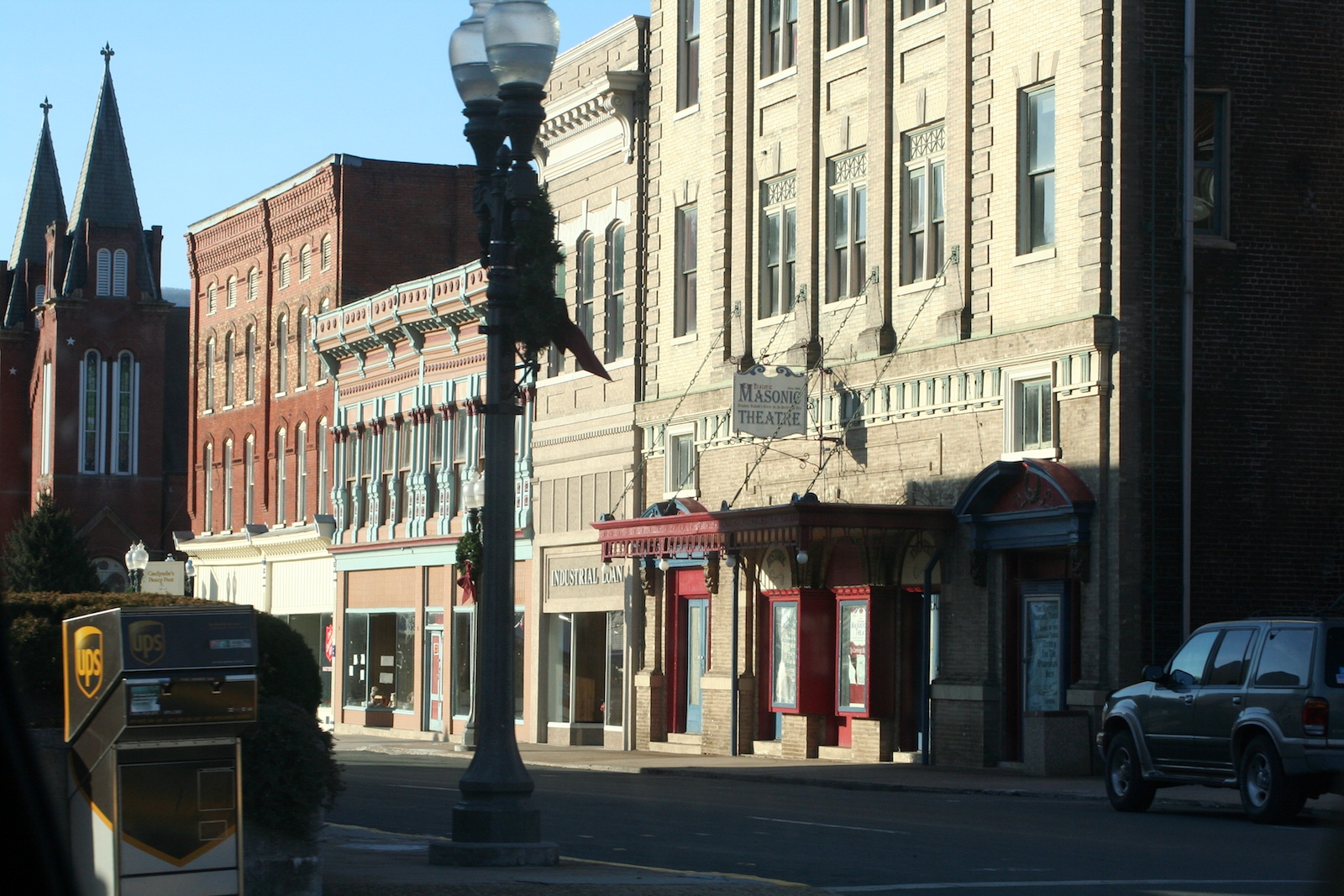 Downtown Clifton Forge | |
 Seal | |
 Clifton Forge  Clifton Forge  Clifton Forge | |
| Coordinates: 37°49′11″N 79°49′25″W | |
| Country | United States |
| State | Virginia |
| County | Alleghany |
| Settlement | 1700s |
| Williamson's Station | February 13, 1861 |
| Incorporated (town) | October 19, 1884 |
| Incorporated (independent city) | March 31, 1906 |
| Incorporated (town) | January 21, 2001 |
| Named for | The Clifton estate in Lexington |
| Government | |
| • Mayor | Jeff Irvine |
| Area | |
| • Total | 3.08 sq mi (7.98 km2) |
| • Land | 3.02 sq mi (7.82 km2) |
| • Water | 0.06 sq mi (0.15 km2) |
| Elevation | 1,083 ft (330 m) |
| Population (2020) | |
| • Total | 3,555 |
| • Density | 1,200/sq mi (450/km2) |
| ZIP code | 24422 |
| Area code | 540 |
| FIPS code | 51-17440[2] |
| GNIS feature ID | 1492780[3] |
| Website | Official website |

Clifton Forge was an independent city during the 2000 census. However, in 2001, Clifton Forge gave up its city status and reverted to a town. In previous decades, the railroad was a major employer. Clifton Forge is known for its mountain views and clear streams.
History
Clifton Forge Commercial Historic District, Clifton Forge Residential Historic District, Clifton Furnace, Jefferson School, and Longdale Furnace Historic District are listed on the National Register of Historic Places.[5][6]
Transportation
Amtrak, the national passenger rail service, provides service to the Clifton Forge station with the Cardinal route. Also Clifton Forge serves a major locomotive fuel facility for CSX Transportation and is home to the Chesapeake & Ohio Historical Society and C&O Railway Heritage Center.
Clifton Forge is serviced by three major highways, Interstate 64, US Route 60, and US Route 220.
Geography
Clifton Forge is located at 37°49′11″N 79°49′24″W (37.819801, -79.823584).[7]
According to the United States Census Bureau, the town had a total area of 3.1 square miles (8.0 km2), all land.
Portions of the town were built upon a bridge, elevating the town above a stream.
Demographics
| Historical population | |||
|---|---|---|---|
| Census | Pop. | %± | |
| 1890 | 1,792 | — | |
| 1900 | 3,579 | 99.7% | |
| 1910 | 5,748 | 60.6% | |
| 1920 | 6,164 | 7.2% | |
| 1930 | 6,839 | 11.0% | |
| 1940 | 6,461 | −5.5% | |
| 1950 | 5,795 | −10.3% | |
| 1960 | 5,268 | −9.1% | |
| 1970 | 5,501 | 4.4% | |
| 1980 | 5,046 | −8.3% | |
| 1990 | 4,679 | −7.3% | |
| 2000 | 4,289 | −8.3% | |
| 2010 | 3,884 | −9.4% | |
| 2020 | 3,555 | −8.5% | |
| U.S. Decennial Census[8] | |||
As of the census[2] of 2010, there were 3,884 people, 1,701 households, and 982 families residing in the town. The population density was 1,252.9 people per square mile (485.5/km2). There were 2,004 housing units at an average density of 646.5 per square mile (225.2/km2). The racial makeup of the city was 84.4% White, 11.8% Black or African American, 0.2% Native American, 0.4% Asian, 0.4% from other races, and 2.8% from two or more races. Hispanic or Latino of any race were 1.7% of the population.
There were 1,701 households, out of which 23.9% had children under the age of 18 living with them, 37.8% were married couples living together, 13.8% had a female householder with no husband present, and 42.3% were non-families. 37.4% of all households were made up of individuals, and 19.1% had someone living alone who was 65 years of age or older. The average household size was 2.18 and the average family size was 2.85.
In the city, the population was spread out, with 21.7% under the age of 18, 6.8% from 18 to 24, 20.4% from 25 to 44, 28.5% from 45 to 64, and 22.6% who were 65 years of age or older. The median age was 45.8 years. For every 100 females, there were 87.2 males. For every 100 females age 18 and over, there were 82.7 males.
The median income for a household in the city was $34,256, and the median income for a family was $53,547. Males had a median income of $38,500 versus $29,630 for females. The per capita income for the city was $20,833. About 14.3% of families and 23.3% of the population were below the poverty line, including 33.4% of those under age 18 and 10.4% of those age 65 or over.
Climate
The climate in this area is characterized by hot, humid summers and generally mild to cool winters. According to the Köppen Climate Classification system, Clifton Forge has a humid subtropical climate, abbreviated "Cfa" on climate maps.[9]
In popular culture
- Mama (2013 horror film) Although the film was produced in Canada, it is set in Clifton Forge.
- The 1985 video for "Driver 8" by R.E.M. was partly filmed in and around the C&O (Chessie System) yards.
- Dopesick (miniseries), based on the book by Beth Macy, was filmed in several different areas of Clifton Forge.
Notable people
Natives
People born in Clifton Forge:
- Gary Ray Bowles (1962-2019) - serial killer
- Dana Brunetti (born 1973) - media executive
- Bray Cary (born 1948) - politician
- Lisa Disbrow (born 1962) - US Air Force secretary
- Oscar L. Heltzen (1882-1968) - lawyer
- Richard L. Hoffman (1927-2012) - zoologist[10]
- Johnny Humphries (1915-1965) - baseball pitcher[11]
- Trudi Lacey, basketball player and coach[12]
- Nancy Massie Meadows (1912-1986) - governor
- Nathan Moore (born 1970) - musician known as "Percy Byrd"
- William Overstreet Jr. (1921-2013) - WW2 pilot
- Ira De Augustine Reid (1901-1968) - sociologist[13][14]
- Denny Riddleberger (born 1945) - baseballer
- Bryan Stinespring (born 1963) - football coach
- James T. Turner (born 1938) - senior judge
- Roger Arliner Young (1899-1964) - scientist
Politics
| Year | Republican | Democratic | Third Parties |
|---|---|---|---|
| 2000 | 40.0% 613 | 56.7% 868 | 3.3% 51 |
| 1996 | 29.6% 486 | 59.4% 974 | 11.0% 181 |
| 1992 | 33.7% 632 | 51.2% 958 | 15.1% 283 |
| 1988 | 43.7% 759 | 55.3% 961 | 1.1% 19 |
| 1984 | 51.4% 965 | 47.8% 896 | 0.8% 15 |
| 1980 | 39.2% 716 | 55.5% 1,012 | 5.3% 97 |
| 1976 | 40.7% 770 | 52.5% 993 | 6.9% 130 |
| 1972 | 63.2% 1,127 | 32.2% 575 | 4.6% 82 |
| 1968 | 43.6% 925 | 34.6% 734 | 21.8% 463 |
| 1964 | 40.4% 850 | 59.6% 1,252 | |
| 1960 | 53.2% 885 | 46.4% 771 | 0.4% 7 |
| 1956 | 61.5% 1,125 | 34.6% 633 | 3.9% 72 |
| 1952 | 53.5% 936 | 46.3% 811 | 0.2% 4 |
| 1948 | 32.1% 451 | 58.2% 818 | 9.7% 136 |
| 1944 | 27.6% 415 | 72.0% 1,082 | 0.3% 5 |
| 1940 | 22.9% 353 | 76.4% 1,179 | 0.7% 11 |
| 1936 | 22.1% 343 | 77.4% 1,199 | 0.5% 8 |
| 1932 | 25.8% 328 | 72.2% 917 | 2.1% 26 |
| 1928 | 56.9% 781 | 43.1% 591 | |
| 1924 | 23.2% 225 | 46.1% 447 | 30.7% 297 |
| 1920 | 26.5% 274 | 70.4% 727 | 3.1% 32 |
| 1916 | 17.0% 104 | 74.4% 455 | 8.7% 53 |
| 1912 | 13.9% 63 | 64.7% 293 | 21.4% 97 |
See also
- Former counties, cities, and towns of Virginia
References
- "2019 U.S. Gazetteer Files". United States Census Bureau. Retrieved August 7, 2020.
- "U.S. Census website". United States Census Bureau. Retrieved 2011-05-14.
- U.S. Geological Survey Geographic Names Information System: Clifton Forge, Virginia
- Roanoke Region of Virginia
- "National Register Information System". National Register of Historic Places. National Park Service. July 9, 2010.
- "National Register of Historic Places Listings". Weekly List of Actions Taken on Properties: 8/13/12 through 8/17/12. National Park Service. 2012-08-24.
- "US Gazetteer files: 2010, 2000, and 1990". United States Census Bureau. 2011-02-12. Retrieved 2011-04-23.
- "Census of Population and Housing". Census.gov. Retrieved June 4, 2015.
- Climate Summary for Clifton Forge, Virginia
- https://www.zobodat.at/pdf/ANNA_114B_0005-0008.pdf [bare URL PDF]
- "Johnny Humphries Stats".
- "NC State Athletic Hall of Fame: Trudi Lacey".
- Gates, Henry Louis Jr.; Higginbotham, Evelyn Brooks (2004). African American Lives. New York: Oxford University Press. ISBN 9780195160246.
- "Ira De Augustine Reid papers". New York Public Library. Retrieved 9 September 2016.
- "Dave Leip's Atlas of U.S. Presidential Elections".
External links
Municipalities and communities of Alleghany County, Virginia, United States | ||
|---|---|---|
County seat: Covington | ||
| Towns |  | |
| CDPs | ||
| Other communities |
| |
| ||
| Authority control |
|
|---|
Другой контент может иметь иную лицензию. Перед использованием материалов сайта WikiSort.org внимательно изучите правила лицензирования конкретных элементов наполнения сайта.
WikiSort.org - проект по пересортировке и дополнению контента Википедии