![The Hitching Post in Whitefish Bay; from a circa 1940s postcard; After Orrin Glidden died in 1933, the Schmock family purchased the resort and later constructed this building as a restaurant. It was managed for a time by their son Tom Schmock.[4]](//upload.wikimedia.org/wikipedia/commons/thumb/5/51/The_Hitching_Post_Whitefish_Bay_Door_County_Wisconsin.jpg/361px-The_Hitching_Post_Whitefish_Bay_Door_County_Wisconsin.jpg) "The Hitching Post" in Whitefish Bay; from a circa 1940s postcard; After Orrin Glidden died in 1933, the Schmock family purchased the resort and later constructed this building as a restaurant. It was managed for a time by their son Tom Schmock.[4]
"The Hitching Post" in Whitefish Bay; from a circa 1940s postcard; After Orrin Glidden died in 1933, the Schmock family purchased the resort and later constructed this building as a restaurant. It was managed for a time by their son Tom Schmock.[4] On January 1, 2017
 Aerial view of the present-day location of the Glidden Lodge Beach Resort condos and vicinity, published 1963
 The shore along Glidden Drive prior to development, published 1963
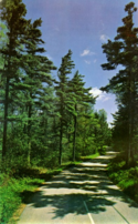 Glidden Drive, published in 1963
 A nearly completed house along Glidden Drive, published 1963
 Trail near Glidden Drive, published 1963
world.wikisort.org - USA
Whitefish Bay is an unincorporated community on the Lake Michigan shoreline in the town of Sevastopol, Door County, Wisconsin.[1][2] Native Americans, likely the Menominee, called Whitefish Bay Ah-Quas-He-Ma-Ganing ("save our lives").[3]
Whitefish Bay, Wisconsin | |
|---|---|
Unincorporated community | |
 The Whitefish Bay Boat Launch (center right) is a Sevastopol Town Park with about 120 feet of beach and also a public dock. | |
 Whitefish Bay Location within the state of Wisconsin | |
| Coordinates: 44°54′21″N 87°13′02″W | |
| Country | |
| State | |
| County | Door |
| Town | Sevastopol |
| Time zone | UTC-6 (Central (CST)) |
| • Summer (DST) | UTC-5 (CDT) |
| Area code(s) | 920 |
| GNIS feature ID | 1577971[1] |
Glidden Drive stretches along the shore in Whitefish Bay. It is named after a banker from Michigan City, Indiana named Orrin Glidden,[4] and is part of Rustic Road 9.[5] Trails connecting to Glidden Drive stretch across public lands to provide access to Arbter and Schwartz lakes,[6] and the Nature Conservancy operates a parking lot off of Glidden Drive.[7]
In 1893, Joe Mardin purchased 43 acres nearby along Shivering Sands Creek. He built a four-story structure out of wood, especially wood he had found washed ashore. Called Castle Romance,[8] the first story housed pigs, the second, geese, and the fourth, ducks. The third story was intended to lodge summer travelers and had several beds and a piano.[9] In 1913, the first summer cottage along what is now Glidden Drive was built out of wood scrapped from Castle Romance.[10]
Sherman Bay is a small bay about a half mile in size located south of Whitefish Bay and north of Lily Bay.[11]
Roads

East Whitefish Bay Road (center) runs east towards Whitefish Bay, making a T intersections with three roads to the south: Lake of the Woods Road (left), Glidden Drive (center), and Moeller Drive (center left). The east end of the road is at Sevastopol Town Park with a beach and dock. Just before reaching the park, East Whitefish Bay Road intersects with Bark Road to the South and South Cave Point Drive to the north. South Cave Point Drive crosses Whitefish Bay Creek just upstream of its mouth (upper right) into Whitefish Bay. Bark Road continues south, ending at a T intersection with Glidden Drive. Glidden Drive extends to the lower border of the photograph at the row of Glidden Lodge Beach Resort condos (right lower border).
Northeastern part

South Cave Point Drive extends north after crossing the mouth of Whitefish Bay Creek (lower left), ending at Whitefish Dunes State Park (far right corner; the state park also includes the wooded area set back from the shore on the left)
Southern part

Glidden Drive runs parallel to the shore south of the row of Glidden Lodge Beach Resort condos (upper left corner). Extensive wooded areas both along the drive and set back further to the west are owned by the Nature Conservancy[12] and the Wisconsin Department Natural Resources[13] and are open to the public.[14]
Climate
| Whitefish Bay (chart is for the body of water) | ||||||||||||||||||||||||||||||||||||||||||||||||||||||||||||
|---|---|---|---|---|---|---|---|---|---|---|---|---|---|---|---|---|---|---|---|---|---|---|---|---|---|---|---|---|---|---|---|---|---|---|---|---|---|---|---|---|---|---|---|---|---|---|---|---|---|---|---|---|---|---|---|---|---|---|---|---|
| Climate chart (explanation) | ||||||||||||||||||||||||||||||||||||||||||||||||||||||||||||
| ||||||||||||||||||||||||||||||||||||||||||||||||||||||||||||
| ||||||||||||||||||||||||||||||||||||||||||||||||||||||||||||
Gallery
![The Hitching Post in Whitefish Bay; from a circa 1940s postcard; After Orrin Glidden died in 1933, the Schmock family purchased the resort and later constructed this building as a restaurant. It was managed for a time by their son Tom Schmock.[4]](http://upload.wikimedia.org/wikipedia/commons/5/51/The_Hitching_Post_Whitefish_Bay_Door_County_Wisconsin.jpg)


References
- "Whitefish Bay". Geographic Names Information System. United States Geological Survey, United States Department of the Interior. Retrieved 2009-07-05.
- "Topographic map". United States Geological Survey. Microsoft Research Maps. Retrieved 2009-07-05.
- Tishler, William (2006). Door County's emerald treasure. Univ of Wisconsin Press. ISBN 0-299-22074-5.
- Glidden Drive - A Chronicle of Historical Events, Glidden Drive Association
- Rustic Road 9, wisconsindot.gov
- Cave Point-Clay Banks (Shivering Sands unit) Site-Specific Management Sheet by Joe Henry, Wisconsin Natural Resources Board June 28, 2017, page 6, (page 16 of the pdf)
- Shivering Sands Preserve Trails and Boundaries, The Nature Conservancy, March 8, 2019, page 2
- 'The Sage of Shivering Sands' by Jim Lundstrom, Door County Living, July 9, 2019
- Holand, Hjalmar R. (1917). "Chapter XXXII: The Sage of Shivering Sands in History of Door County, Wisconsin". p. 327.
- A Chronicle of Historical Events in Recognition of the Thirtieth Anniversary of the Glidden Drive Association, Inc. by Mary Clarke and Joanne Conklin, Glidden Drive Association, c.1993, page 7
- Addendum on Sherman Bay by Henry Scheig, in A Chronicle of Historical Events in Recognition of the Thirtieth Anniversary of the Glidden Drive Association, Inc. Glidden Drive Association, August 4, 1993, page 27
- Places We Protect: Shivering Sands, Wisconsin, The Nature Conservancy
- Cave Point-Clay Banks Shivering Sands Unit State Natural Area Map 559b, Wisconsin Department Natural Resources 2017
- Cave Point-Clay Banks (No. 559), Wisconsin State Natural Areas Program, Wisconsin Department Natural Resources, February 21, 2022
- "NASA EarthData Search". NASA. Retrieved 30 January 2016.
Municipalities and communities of Door County, Wisconsin, United States | ||
|---|---|---|
| City |
|  |
| Villages | ||
| Towns | ||
| CDPs | ||
| Other communities |
| |
| Footnote | ‡Partially located in Kewaunee County | |
| ||
This article about a location in Door County, Wisconsin is a stub. You can help Wikipedia by expanding it. |
Текст в блоке "Читать" взят с сайта "Википедия" и доступен по лицензии Creative Commons Attribution-ShareAlike; в отдельных случаях могут действовать дополнительные условия.
Другой контент может иметь иную лицензию. Перед использованием материалов сайта WikiSort.org внимательно изучите правила лицензирования конкретных элементов наполнения сайта.
Другой контент может иметь иную лицензию. Перед использованием материалов сайта WikiSort.org внимательно изучите правила лицензирования конкретных элементов наполнения сайта.
2019-2025
WikiSort.org - проект по пересортировке и дополнению контента Википедии
WikiSort.org - проект по пересортировке и дополнению контента Википедии