world.wikisort.org - USA
White Plains is a census-designated place and unincorporated community in Calhoun County, Alabama, United States. Its population was 877 as of the 2020 census. The community is located in eastern Calhoun County along Alabama Highway 9.
White Plains, Alabama | |
|---|---|
Census-designated place | |
 White Plains | |
| Coordinates: 33°44′50″N 85°41′21″W | |
| Country | United States |
| State | Alabama |
| County | Calhoun |
| Area | |
| • Total | 12.88 sq mi (33.36 km2) |
| • Land | 12.79 sq mi (33.13 km2) |
| • Water | 0.09 sq mi (0.23 km2) |
| Elevation | 735 ft (224 m) |
| Population (2020) | |
| • Total | 877 |
| • Density | 68.57/sq mi (26.47/km2) |
| Time zone | UTC-6 (Central (CST)) |
| • Summer (DST) | UTC-5 (CDT) |
| Area code(s) | 256 & 938 |
| GNIS feature ID | 160833[2] |
Demographics
| Historical population | |||
|---|---|---|---|
| Census | Pop. | %± | |
| 1880 | 140 | — | |
| 1890 | 202 | 44.3% | |
| 2010 | 811 | — | |
| 2020 | 877 | 8.1% | |
| U.S. Decennial Census[3] | |||
Education
The Calhoun County Schools system operates three schools within the community:
- White Plains High School
- White Plains Middle School
- White Plains Elementary School
White Plains High School's athletic teams are known as the Wildcats and compete in Class 4A of the Alabama High School Athletic Association.
References
- "2020 U.S. Gazetteer Files". United States Census Bureau. Retrieved October 29, 2021.
- "White Plains". Geographic Names Information System. United States Geological Survey, United States Department of the Interior.
- "U.S. Decennial Census". Census.gov. Retrieved June 6, 2013.
Municipalities and communities of Calhoun County, Alabama, United States | ||
|---|---|---|
County seat: Anniston | ||
| Cities | 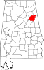 | |
| Towns | ||
| CDPs |
| |
| Unincorporated communities | ||
| Ghost town | ||
| Footnotes | ‡This populated place also has portions in an adjacent county or counties | |
| ||
This Calhoun County, Alabama state location article is a stub. You can help Wikipedia by expanding it. |
Текст в блоке "Читать" взят с сайта "Википедия" и доступен по лицензии Creative Commons Attribution-ShareAlike; в отдельных случаях могут действовать дополнительные условия.
Другой контент может иметь иную лицензию. Перед использованием материалов сайта WikiSort.org внимательно изучите правила лицензирования конкретных элементов наполнения сайта.
Другой контент может иметь иную лицензию. Перед использованием материалов сайта WikiSort.org внимательно изучите правила лицензирования конкретных элементов наполнения сайта.
2019-2026
WikiSort.org - проект по пересортировке и дополнению контента Википедии
WikiSort.org - проект по пересортировке и дополнению контента Википедии