world.wikisort.org - USA
Peaceburg is an unincorporated community in Calhoun County, Alabama, United States.
Peaceburg, Alabama | |
|---|---|
Unincorporated community | |
 Peaceburg, Alabama  Peaceburg, Alabama | |
| Coordinates: 33°44′22″N 85°54′38″W | |
| Country | United States |
| State | Alabama |
| County | Calhoun |
| Elevation | 666 ft (203 m) |
| Time zone | UTC-6 (Central (CST)) |
| • Summer (DST) | UTC-5 (CDT) |
| Area code(s) | 256 & 938 |
| GNIS feature ID | 156861[1] |
History
A post office was established in the former town of Peaceburg, Alabama, in 1885, and remained in operation until it was discontinued in 1905.[2] Peaceburg (as well as the nearby town of Morrisville) was part of a purchase of 26,912.17 acres by the War Department in 1941. The area was evacuated by its residents and served the purpose of training for World War II. Originally it was called the Morrisville Maneuver Area but later was renamed as the Pelham Range Area.[3][4]
Its coordinates are approximately 33.738268 degrees north and -85.904732 degrees west, located in west central Calhoun County, in Alabama, at an altitude of 620 feet.
References
- "Peaceburg". Geographic Names Information System. United States Geological Survey.
- "Calhoun County". Jim Forte Postal History. Retrieved 8 October 2014.
- "PEACEBURG YIELDS TO ARmy's SPREAD; Alabama Folk Sadly Accept Call to Vacate Homes to Permit Artillery Range WISTFUL OVER OLD GRAVES Settled a Century Ago, Place Took Its Name from Soldier in Jeb Stuart's Cavalry Old-Resident Regretful Named for Stuart Rider". The New York Times. 24 November 1940.
- https://www.nrc.gov/docs/ML0527/ML052700341.pdf [bare URL PDF]
Municipalities and communities of Calhoun County, Alabama, United States | ||
|---|---|---|
County seat: Anniston | ||
| Cities | 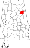 | |
| Towns |
| |
| CDPs |
| |
| Unincorporated communities |
| |
| Ghost town |
| |
| Footnotes | ‡This populated place also has portions in an adjacent county or counties | |
| ||
This Calhoun County, Alabama state location article is a stub. You can help Wikipedia by expanding it. |
Другой контент может иметь иную лицензию. Перед использованием материалов сайта WikiSort.org внимательно изучите правила лицензирования конкретных элементов наполнения сайта.
WikiSort.org - проект по пересортировке и дополнению контента Википедии