world.wikisort.org - USA
Wedderburn is an unincorporated coastal community in Curry County, Oregon, United States. It is to the north of, and across the mouth of the Rogue River from Gold Beach, on U.S. Route 101. The Isaac Lee Patterson Bridge connects Wedderburn with Gold Beach.
Wedderburn, Oregon | |
|---|---|
Unincorporated community | |
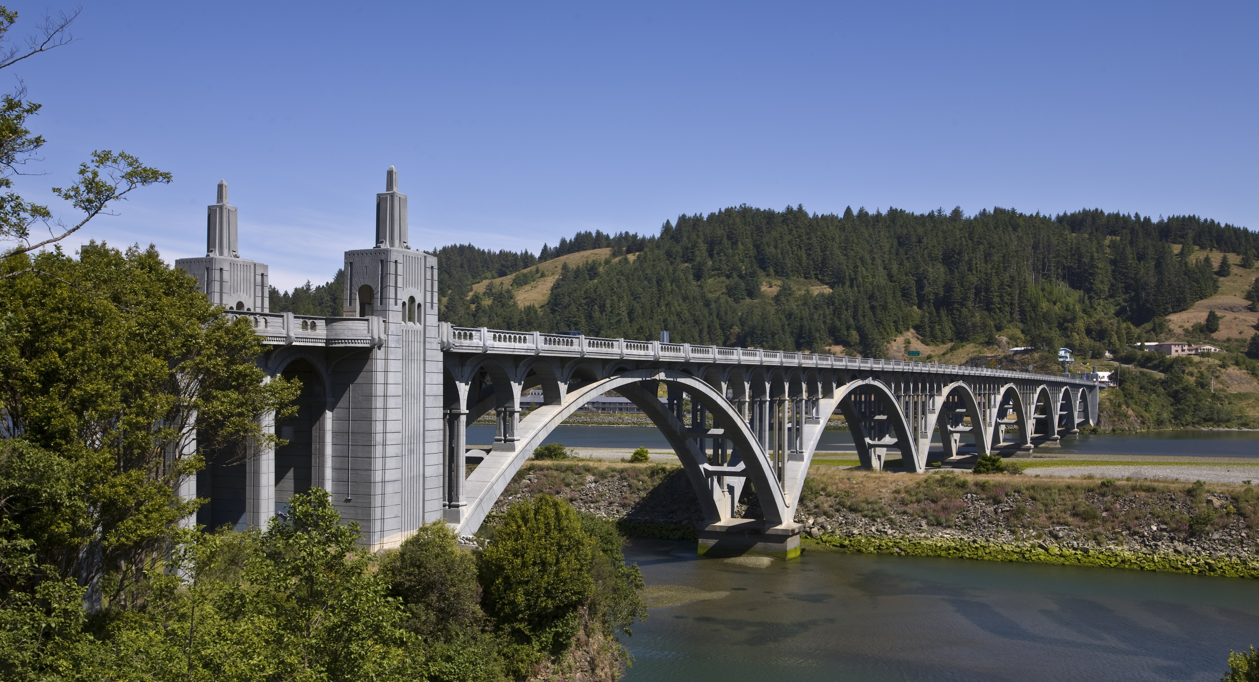 Wedderburn can be seen from across the Isaac Lee Patterson Bridge. | |
 Wedderburn Location within the state of Oregon  Wedderburn Wedderburn (the United States) | |
| Coordinates: 42°25′47″N 124°24′50″W | |
| Country | United States |
| State | Oregon |
| County | Curry |
| Area | |
| • Total | 1.26 sq mi (3.26 km2) |
| • Land | 1.06 sq mi (2.74 km2) |
| • Water | 0.20 sq mi (0.52 km2) |
| Elevation | 39 ft (12 m) |
| Population (2020)[2] | |
| • Total | 426 |
| • Density | 403.03/sq mi (155.62/km2) |
| Time zone | UTC-8 (Pacific (PST)) |
| • Summer (DST) | UTC-7 (PDT) |
| FIPS code | 41-79500 |
| GNIS feature ID | 1151991[3] |
| Coordinates and elevation from Geographic Names Information System | |
Wedderburn was founded by R. D. Hume, a prominent local businessman in the fishing industry, who named the community after the home of his ancestors, Wedderburn Castle in Scotland.[4] Wedderburn post office was established in 1895.[4]
Wedderburn was originally a company town for Hume's salmon fishing monopoly, and besides his fishing fleet, he ran Wedderburn's cannery, store, race track and cold storage plant.[5] Hume had settled at the mouth of the Rogue in 1876, and he eventually owned all the land on both banks of the river from the Pacific Ocean to the head of the tidewater.[5]
Demographics
| Historical population | |||
|---|---|---|---|
| Census | Pop. | %± | |
| 2020 | 426 | — | |
| U.S. Decennial Census[6][2] | |||
Climate
This region experiences warm (but not hot) and dry summers, with no average monthly temperatures above 71.6 °F (22.0 °C). According to the Köppen Climate Classification system, Wedderburn has a warm-summer Mediterranean climate, abbreviated "Csb" on climate maps.[7]
Education
It is in the Central Curry School District,[8] which operates two schools: Riley Creek Elementary School (K-8) and Gold Beach High School.
The entire county is in the Southwestern Oregon Community College district.[9]
References
- "ArcGIS REST Services Directory". United States Census Bureau. Retrieved October 12, 2022.
- "Census Population API". United States Census Bureau. Retrieved Oct 12, 2022.
- "Wedderburn". Geographic Names Information System. United States Geological Survey. November 28, 1980. Retrieved January 4, 2017.
- McArthur, Lewis A.; Lewis L. McArthur (2003) [1928]. Oregon Geographic Names (Seventh ed.). Portland, Oregon: Oregon Historical Society Press. pp. 1018–19. ISBN 0-87595-277-1.
- "Oregon History: Emerging Economies". Oregon Blue Book. Oregon State Archives. Retrieved March 24, 2007.
- "Census of Population and Housing". Census.gov. Retrieved June 4, 2016.
- "Wedderburn, Oregon". Weatherbase. CantyMedia. Retrieved January 4, 2017.
- "2020 CENSUS - SCHOOL DISTRICT REFERENCE MAP: Curry County, OR" (PDF). U.S. Census Bureau. Retrieved 2022-07-16.
- "Oregon Community Colleges and Community College Districts" (PDF). Oregon Department of Community Colleges & Workforce Development. Retrieved 2022-07-17.
Further reading
- Dodds, Gordon B. The Salmon King of Oregon: R. D. Hume and the Pacific Fisheries
- Douthit, Nathan. A Guide to Oregon South Coast History: Traveling the Jedediah Smith Trail
- LaPlante, Margaret. The Town That Floated into Place: Wedderburn, Oregon
External links
- Article on R. D. Hume from The Oregon Encyclopedia
Municipalities and communities of Curry County, Oregon, United States | ||
|---|---|---|
County seat: Gold Beach | ||
| Cities |  | |
| CDPs | ||
| Other communities | ||
| Ghost town | ||
| Indian reservation |
| |
| Footnotes | ‡This populated place also has portions in an adjacent county or counties | |
| ||
Authority control | |
|---|---|
| General | |
| National libraries | |
This Curry County, Oregon state location article is a stub. You can help Wikipedia by expanding it. |
Другой контент может иметь иную лицензию. Перед использованием материалов сайта WikiSort.org внимательно изучите правила лицензирования конкретных элементов наполнения сайта.
WikiSort.org - проект по пересортировке и дополнению контента Википедии