world.wikisort.org - USA
Washington Township is a township in Franklin County, Pennsylvania, United States. The population was 14,009 at the 2010 census,[3] up from 11,559 at the 2000 census.
Washington Township, Franklin County, Pennsylvania | |
|---|---|
Township | |
 The Deer Lick Shelters on the Appalachian Trail in Washington Township | |
 Map of Franklin County, Pennsylvania highlighting Washington Township | |
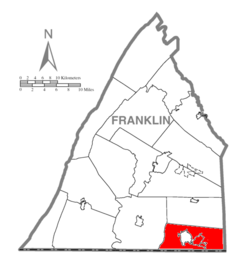
 Map of Franklin County, Pennsylvania | |
| Country | United States |
| State | Pennsylvania |
| County | Franklin |
| Settled | 1735 |
| Incorporated | 1779 |
| Area | |
| • Total | 39.06 sq mi (101.16 km2) |
| • Land | 39.05 sq mi (101.14 km2) |
| • Water | 0.01 sq mi (0.02 km2) |
| Population (2010) | |
| • Total | 14,009 |
| • Estimate (2016)[2] | 14,586 |
| • Density | 373.52/sq mi (144.22/km2) |
| Time zone | UTC-5 (Eastern (EST)) |
| • Summer (DST) | UTC-4 (EDT) |
| Area code(s) | 717 |
| FIPS code | 42-055-81240 |
| Website | www |
History
Washington Township was organized by an order of the Court of Quarter Sessions § United States of Cumberland County, Pennsylvania about April term in 1779.[4] The township was formed out of Antrim Township, Pennsylvania.[4] The township was named in honor of General George Washington.[4]
Handycraft Farmstead, Harbaugh's Reformed Church, Jeremiah Burns Farm, Red Run Lodge, Monterey Historic District, Springdale Mills, Waynesboro Armory, and the Welty's Mill Bridge are listed on the National Register of Historic Places.[5]
Geography
The township occupies the southeast corner of Franklin County, bounded to the east by Adams County and to the south by Washington and Frederick counties in the state of Maryland. The township surrounds the borough of Waynesboro, a separate municipality.
The western two-thirds of the township are in the Great Appalachian Valley, while the eastern third is on the ridges and valleys of South Mountain. The Appalachian Trail traverses South Mountain through the township.
Unincorporated communities in the township include Wayne Heights, Rouzerville, Pen Mar, Blue Ridge Summit, and Monterey.
According to the United States Census Bureau, the township has a total area of 39.1 square miles (101.2 km2), of which 0.01 square miles (0.02 km2), or 0.02%, is water.[3] The township is drained by the East and West Branches of Antietam Creek, a south-flowing tributary of the Potomac River. The extreme east end of the township lies east of the crest of South Mountain and is part of the Monocacy River watershed, another tributary of the Potomac.
Communities
- Beartown
- Blue Ridge Summit
- Buena Vista Springs
- Charmian
- Cress
- Eastland Hills
- Glen Forney
- Midvale
- Monterey
- Pen Mar
- Pennersville
- Polktown
- Roadside
- Rouzerville
- Wayne Heights
- Zullinger
Neighboring Townships
- Antrim Township (west)
- Hamiltonban Township (Adams County), (east)
- Liberty Township (Adams County), (east)
- Quincy Township
Climate
| Climate data for Washington Township, Pennsylvania (Hagerstown Regional Airport), 1981−2010 normals, extremes 1899−present[6] | |||||||||||||
|---|---|---|---|---|---|---|---|---|---|---|---|---|---|
| Month | Jan | Feb | Mar | Apr | May | Jun | Jul | Aug | Sep | Oct | Nov | Dec | Year |
| Record high °F (°C) | 78 (26) |
82 (28) |
88 (31) |
94 (34) |
96 (36) |
102 (39) |
107 (42) |
104 (40) |
101 (38) |
95 (35) |
83 (28) |
75 (24) |
107 (42) |
| Average high °F (°C) | 38.3 (3.5) |
41.4 (5.2) |
50.7 (10.4) |
62.9 (17.2) |
72.2 (22.3) |
81.3 (27.4) |
85.2 (29.6) |
83.0 (28.3) |
75.3 (24.1) |
65.1 (18.4) |
53.5 (11.9) |
41.3 (5.2) |
62.6 (17.0) |
| Average low °F (°C) | 23.3 (−4.8) |
25.8 (−3.4) |
32.3 (0.2) |
42.6 (5.9) |
51.8 (11.0) |
61.4 (16.3) |
65.5 (18.6) |
63.6 (17.6) |
56.2 (13.4) |
44.4 (6.9) |
36.3 (2.4) |
26.8 (−2.9) |
44.3 (6.8) |
| Record low °F (°C) | −27 (−33) |
−20 (−29) |
−7 (−22) |
9 (−13) |
23 (−5) |
30 (−1) |
42 (6) |
39 (4) |
25 (−4) |
18 (−8) |
−4 (−20) |
−13 (−25) |
−27 (−33) |
| Average precipitation inches (mm) | 2.68 (68) |
2.55 (65) |
3.38 (86) |
3.56 (90) |
4.03 (102) |
3.88 (99) |
3.41 (87) |
3.14 (80) |
3.67 (93) |
2.88 (73) |
3.22 (82) |
2.89 (73) |
39.29 (998) |
| Source: NOAA[7][8] | |||||||||||||
Education
Washington Township lies within Waynesboro Area School District.
Schools serving Washington Township
- Fairview Avenue Elementary School
- Hooverville Elementary School
- Mowrey Elementary School
- Summitville Elementary School
- Waynesboro Area Middle School
- Waynesboro Area Senior High School
Infrastructure
Major Highways
 PA 16
PA 16 PA 316
 MD 550
 PA 997
Utilities
- Cable TV - Comcast
- Electric - West Penn Power
- Natural Gas - UGI Corporation
- Telephone - Century Link
- Trash and Recycling Services - Waste Management, IESI, Hoppers, Parks Garbage Service, or Worthy's Refuse Inc.
- Water and Sewer Authorities - Washington Township Municipal Authority
Healthcare
- WellSpan Waynesboro Hospital (located in Waynesboro, PA)
Parks and Recreation
Washington Township owns and maintains six parks and the Rouzerville Community Center located within the Township boundaries.[9]
- Antietam Meadow Park
- Happel's Meadow Wetland
- Pat O'Connor Nature Park
- Pine Hill Recreation Area
- Red Run Park
- Rolando Park
Demographics
| Historical population | |||
|---|---|---|---|
| Census | Pop. | %± | |
| 2000 | 11,559 | — | |
| 2010 | 14,009 | 21.2% | |
| 2016 (est.) | 14,586 | [2] | 4.1% |
| U.S. Decennial Census[10] | |||

As of the census[11] of 2000, there were 11,559 people, 4,577 households, and 3,469 families residing in the township. The population density was 297.2 people per square mile (114.8/km2). There were 4,840 housing units at an average density of 124.4/sq mi (48.1/km2). The racial makeup of the township was 97.08% White, 1.01% African American, 0.15% Native American, 0.90% Asian, 0.03% Pacific Islander, 0.34% from other races, and 0.49% from two or more races. Hispanic or Latino of any race were 0.80% of the population.
There were 4,577 households, out of which 30.5% had children under the age of 18 living with them, 65.6% were married couples living together, 7.1% had a female householder with no husband present, and 24.2% were non-families. 20.5% of all households were made up of individuals, and 9.2% had someone living alone who was 65 years of age or older. The average household size was 2.52 and the average family size was 2.90.
In the township the population was spread out, with 23.2% under the age of 18, 7.0% from 18 to 24, 28.0% from 25 to 44, 26.0% from 45 to 64, and 15.8% who were 65 years of age or older. The median age was 40 years. For every 100 females, there were 96.4 males. For every 100 females age 18 and over, there were 95.1 males.
The median income for a household in the township was $45,165, and the median income for a family was $51,791. Males had a median income of $36,255 versus $25,192 for females. The per capita income for the township was $20,673. About 2.6% of families and 3.9% of the population were below the poverty line, including 3.2% of those under age 18 and 6.2% of those age 65 or over.
References
- "2016 U.S. Gazetteer Files". United States Census Bureau. Retrieved Aug 13, 2017.
- "Population and Housing Unit Estimates". Retrieved June 9, 2017.
- "Geographic Identifiers: 2010 Census Summary File 1 (G001), Washington township, Franklin County, Pennsylvania". American FactFinder. U.S. Census Bureau. Archived from the original on February 13, 2020. Retrieved August 11, 2016.
- M'Cauley, I.H. (1878). Historical Sketch of Franklin County, Pennsylvania. Harrisburg, PA: Patriot Pub. Co. p. 194.
- "National Register Information System". National Register of Historic Places. National Park Service. July 9, 2010.
- Records were kept at the "Hagerstown 1E" COOP station from January 1, 1899 until October 2, 1998, and at Washington County Airport since October 3, 1998.
- "NowData - NOAA Online Weather Data". National Oceanic and Atmospheric Administration. Retrieved 2019-05-29.
- "Station Name: MD HAGERSTOWN WASHINGTON CO AP". National Oceanic and Atmospheric Administration. Retrieved 2013-02-28.
- "Washington Township Parks & Recreation". Washington Township. Retrieved 24 Nov 2020.
- "Census of Population and Housing". Census.gov. Retrieved June 4, 2016.
- "U.S. Census website". United States Census Bureau. Retrieved 2008-01-31.
External links
Municipalities and communities of Franklin County, Pennsylvania, United States | ||
|---|---|---|
County seat: Chambersburg | ||
| Boroughs |
|  |
| Townships |
| |
| CDPs |
| |
| Unincorporated communities |
| |
| Footnotes | ‡This populated place also has portions in an adjacent county or counties | |
| ||
Другой контент может иметь иную лицензию. Перед использованием материалов сайта WikiSort.org внимательно изучите правила лицензирования конкретных элементов наполнения сайта.
WikiSort.org - проект по пересортировке и дополнению контента Википедии