world.wikisort.org - USA
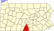
Marion is an unincorporated community and census-designated place (CDP) in Franklin County, Pennsylvania, United States. As of the 2010 census the population was 953.[5]
Marion, Pennsylvania | |
|---|---|
Census-designated place | |
 Marion Location of Marion in Pennsylvania | |
| Coordinates: 39°51′26″N 77°41′43″W | |
| Country | United States |
| State | Pennsylvania |
| County | Franklin |
| Township | Guilford |
| Area | |
| • Total | 1.99 sq mi (5.15 km2) |
| • Land | 1.99 sq mi (5.15 km2) |
| • Water | 0.00 sq mi (0.00 km2) |
| Elevation | 633 ft (193 m) |
| Population (2020)[3] | |
| • Total | 851 |
| • Density | 427.64/sq mi (165.14/km2) |
| Time zone | UTC-5 (Eastern (EST)) |
| • Summer (DST) | UTC-4 (EDT) |
| ZIP code | 17235 |
| Area code | 717 |
| FIPS code | 42-47464 |
| GNIS feature ID | 1180410[2] |
| [4] | |
It lies along U.S. Route 11 6 miles (10 km) south of Chambersburg and 5 miles (8 km) north of Greencastle. Interstate 81 passes along the eastern edge of the community, with access from Exit 10 (Pennsylvania Route 914). I-81 leads northeast 37 miles (60 km) to Carlisle and south 17 miles (27 km) to Hagerstown, Maryland.
Marion was originally called Independence, and under the latter name was laid out in about 1810.[6] A post office called Marion has been in operation since 1833.[7] The present name is after Francis Marion, army officer during the American Revolutionary War, known as the Swamp Fox.[6]
Demographics
| Historical population | |||
|---|---|---|---|
| Census | Pop. | %± | |
| 2020 | 851 | — | |
| U.S. Decennial Census[8] | |||
References
- "ArcGIS REST Services Directory". United States Census Bureau. Retrieved October 12, 2022.
- U.S. Geological Survey Geographic Names Information System: Marion Pennsylvania. Retrieved on 2009-06-17.
- "Census Population API". United States Census Bureau. Retrieved Oct 12, 2022.
- "Marion PA". Zip Code Lookup. Retrieved 2009-06-17.
- "Geographic Identifiers: 2010 Census Summary File 1 (G001), Marion CDP, Pennsylvania". American FactFinder. U.S. Census Bureau. Archived from the original on February 13, 2020. Retrieved August 12, 2016.
- M'Cauley, I. H. (1878). Historical Sketch of Franklin County, Pennsylvania. Patriot. p. 212.
- "Franklin County". Jim Forte Postal History. Retrieved 19 June 2017.
- "Census of Population and Housing". Census.gov. Retrieved June 4, 2016.
Другой контент может иметь иную лицензию. Перед использованием материалов сайта WikiSort.org внимательно изучите правила лицензирования конкретных элементов наполнения сайта.
WikiSort.org - проект по пересортировке и дополнению контента Википедии
