world.wikisort.org - USA
Tolleson /ˈtɒlɪsən/ is a city in Maricopa County, Arizona, United States. According to the U.S. Census Bureau, the population of the city was 7,216 as of the 2020 census,[4] up from 6,545 in 2010.
Tolleson, Arizona | |
|---|---|
City | |
 Seal | |
| Motto(s): "Honoring Our Past, Positioning Our Future"[1] | |
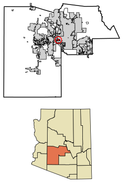 Location in Maricopa County, Arizona | |
 Tolleson  Tolleson  Tolleson | |
| Coordinates: 33°27′00″N 112°15′34″W[2] | |
| Country | United States |
| State | Arizona |
| County | Maricopa |
| Government | |
| • Type | City council |
| • Mayor | Juan F. Rodriguez |
| Area | |
| • Total | 5.73 sq mi (14.85 km2) |
| • Land | 5.73 sq mi (14.85 km2) |
| • Water | 0.00 sq mi (0.00 km2) |
| Elevation | 1,014 ft (309 m) |
| Population (2020)[4] | |
| • Total | 7,216 |
| • Density | 1,258.68/sq mi (485.94/km2) |
| Time zone | UTC-7 (MST (no DST)) |
| ZIP code | 85353 |
| Area code | 623 |
| FIPS code | 04-74190 |
| Website | www |
History
The city was incorporated in 1929[5] and named after founder W.G. Tolleson.[6]
Geography
Tolleson is located on the western side of the Phoenix metropolitan area. The community lies just south of I-10. The city of Avondale lies approximately 6 miles (10 km) to the southwest, and Fowler, a former unincorporated community now within the Phoenix city limits, is 3 miles (5 km) to the east. The Agua Fria River is about 4 miles (6 km) to the west.[7]
According to the United States Census Bureau, the city of Tolleson has a total area of 5.7 square miles (15 km2), all land.[3]
Demographics
| Historical population | |||
|---|---|---|---|
| Census | Pop. | %± | |
| 1930 | 910 | — | |
| 1940 | 1,731 | 90.2% | |
| 1950 | 3,042 | 75.7% | |
| 1960 | 3,886 | 27.7% | |
| 1970 | 3,881 | −0.1% | |
| 1980 | 4,433 | 14.2% | |
| 1990 | 4,434 | 0.0% | |
| 2000 | 4,974 | 12.2% | |
| 2010 | 6,545 | 31.6% | |
| 2020 | 7,216 | 10.3% | |
| U.S. Decennial Census[8] | |||
As of the 2010 census Tolleson had a population of 6,545. The ethnic and racial makeup of the population was 80.1% Hispanic (72.7% of the total population identifying as of Mexican descent, 1.0% identifying as being of Puerto Rican descent), 11.0% non-Hispanic white, 5.8% non-Hispanic blacks, 1.0% non-Hispanic Native American, 0.9% Asian, 0.2% Pacific Islander, 0.2% non-Hispanic reporting some other race and 4.2% reporting two or more races (only 1.1% of the population was non-Hispanics reporting two or more races, however Hispanicness itself is not treated as something one can be partly).[9]
At the 2000 census, there were 4,974 people, 1,432 households, and 1,151 families living in the city. The population density was 894.1 inhabitants per square mile (345.2/km2). There were 1,485 housing units at an average density of 266.9 per square mile (103.1/km2). The racial makeup of the city was 52.2% White, 1.4% Black or African American, 1.2% Native American, 0.5% Asian, 0.2% Pacific Islander, 40.8% from other races, and 3.7% from two or more races. 78.0% of the population were Hispanic or Latino of any race.
Of the 1,432 households 39.3% had children under the age of 18 living with them, 52.7% were married couples living together, 19.8% had a female householder with no husband present, and 19.6% were non-families. 15.9% of households were one person and 7.1% were one person aged 65 or older. The average household size was 3.47 and the average family size was 3.83.
The age distribution was 32.4% under the age of 18, 10.9% from 18 to 24, 27.4% from 25 to 44, 19.4% from 45 to 64, and 9.8% 65 or older. The median age was 29 years. For every 100 females, there were 102.8 males. For every 100 females age 18 and over, there were 100.8 males.
The median household income was $38,773 and the median family income was $43,894. Males had a median income of $26,934 versus $23,511 for females. The per capita income for the city was $13,747. About 9.9% of families and 13.7% of the population were below the poverty line, including 19.4% of those under age 18 and 10.9% of those age 65 or over.
Economy
SK Food Group, in a partnership with Phoenix and Tolleson, expanded operations in 2016. Their food processing plant is projected to bring 550 jobs, with an emphasis on helping unemployed youth ages 16–24 who are not attending school and on attracting talent across the Valley.
Top employers
According to Tolleson's 2021 Comprehensive Annual Financial Report,[10] the top employers in the city are:
| # | Employer | # of Employees |
|---|---|---|
| 1 | JBS Packerland | 1,150 |
| 2 | Papa Johns Salads Produce | 960 |
| 3 | Albertsons, Inc. | 810 |
| 4 | Atlas Retail Services | 650 |
| 5 | SK Food Group | 550 |
| 6 | PepsiCo | 440 |
| 7 | Carvana Co | 400 |
| 8 | Autozone | 380 |
| 9 | Salt River Project | 380 |
| 10 | Sysco Arizona | 370 |
Notable people
- Merle Keagle, baseball player
- Bob Stump, congressman[11]
- Anna Tovar, state legislator and former mayor of Tolleson
Governmental representation
The city is in Arizona's 7th Congressional District, served by Representative Ruben Gallego, and Arizona's 19th State Legislative District, served by Representatives Mark A. Cardenas and Diego Espinoza and Senator Lupe Contreras, all Democrats.
Education
The city is served by Tolleson Union High School District, Tolleson Elementary School District, Littleton Elementary School District, Union Elementary School District and Fowler Elementary School District.
References
- "City of Tolleson, Arizona". City of Tolleson, Arizona. Retrieved August 24, 2012.
- U.S. Geological Survey Geographic Names Information System: Tolleson, Arizona
- "2021 U.S. Gazetteer Files: Arizona". United States Census Bureau. Retrieved May 10, 2022.
- "Tolleson city, Arizona: 2020 DEC Redistricting Data (PL 94-171)". U.S. Census Bureau. Retrieved May 10, 2022.
- "Tolleson, Arizona". City-data.com. Retrieved August 24, 2012.
- "Profile for Tolleson, Arizona, AZ". ePodunk. Retrieved August 24, 2012.
- Arizona Atlas & Gazeteer, DeLorme, 4th edition, 2001, p. 57 ISBN 0899333257
- "Census of Population and Housing". Census.gov. Retrieved June 4, 2016.
- Bureau, U.S. Census. "U.S. Census website". United States Census Bureau. Retrieved April 19, 2018.
- "City of Tolleson CAFR". tollesonaz.org. p. 154. Retrieved August 18, 2022.
- Barone, Michael; Ujifussa, Grant (1999). The Almanac of American Politics 2000. National Journal Group Inc. p. 125.
External links
Municipalities and communities of Maricopa County, Arizona, United States | ||
|---|---|---|
County seat: Phoenix | ||
| Cities |
|  |
| Towns |
| |
| CDPs |
| |
| Populated places |
| |
| Indian reservations |
| |
| Ghost towns/ former populated places |
| |
| Footnotes | ‡This populated place also has portions in an adjacent county or counties | |
| ||
Authority control | |
|---|---|
| General | |
| National libraries | |
| Other | |
На других языках
[de] Tolleson (Arizona)
Tolleson ist eine Kleinstadt im Maricopa County im US-Bundesstaat Arizona. Sie hat etwa 5000 Einwohner (Stand: Volkszählung 2000) auf einer Fläche von 14,4 km². Die Bevölkerungsdichte liegt bei 347,2 Ew./km². Tolleson befindet sich an der Interstate 10.- [en] Tolleson, Arizona
Другой контент может иметь иную лицензию. Перед использованием материалов сайта WikiSort.org внимательно изучите правила лицензирования конкретных элементов наполнения сайта.
WikiSort.org - проект по пересортировке и дополнению контента Википедии