world.wikisort.org - USA
Sunflower is an unincorporated community in Maricopa County, Arizona, United States. Sunflower is located near Arizona State Route 87, 22.8 miles (36.7 km) northeast of Fountain Hills.
Sunflower, Arizona | |
|---|---|
Unincorporated community | |
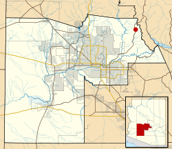 Location of Sunflower in Maricopa County, Arizona | |
| Coordinates: 33°51′51″N 111°28′03″W | |
| Country | United States |
| State | Arizona |
| County | Maricopa |
| Elevation | 3,405 ft (1,038 m) |
| Time zone | UTC-7 (Mountain (MST)) |
| Area code(s) | 480 |
| GNIS feature ID | 34951[1] |
History
The location was a camp site until the 1930s, when Captain Harold Booth led a group of cohorts to the area.[2]
The town saw flooding during when the remnants of Tropical Storm Norma hit the area in 1970.[3]
The community was located near now-abandoned mercury mines, and old maps still refer to the mine as Sunflower Mine.[4]
The community was evacuated in 2005 due to the threat of a nearby fire.[5]
References
- U.S. Geological Survey Geographic Names Information System: Sunflower, Arizona
- "No Sunflower, Arizona, until camp arrives". Grand Junction Daily Sentinel. October 8, 1933.
- "Bob Lindmeier's Weather Facts". The Capital Times. September 4, 2000.
- "Abandoned mercury mine an adventure". Arizona Republic. February 27, 1997.
- "Wildfire threatens tiny town in southwestern Utah". Appleton Post-Crescent. July 23, 2005.
Municipalities and communities of Maricopa County, Arizona, United States | ||
|---|---|---|
County seat: Phoenix | ||
| Cities |
|  |
| Towns | ||
| CDPs | ||
| Populated places |
| |
| Indian reservations |
| |
| Ghost towns/ former populated places |
| |
| Footnotes | ‡This populated place also has portions in an adjacent county or counties | |
| ||
Текст в блоке "Читать" взят с сайта "Википедия" и доступен по лицензии Creative Commons Attribution-ShareAlike; в отдельных случаях могут действовать дополнительные условия.
Другой контент может иметь иную лицензию. Перед использованием материалов сайта WikiSort.org внимательно изучите правила лицензирования конкретных элементов наполнения сайта.
Другой контент может иметь иную лицензию. Перед использованием материалов сайта WikiSort.org внимательно изучите правила лицензирования конкретных элементов наполнения сайта.
2019-2026
WikiSort.org - проект по пересортировке и дополнению контента Википедии
WikiSort.org - проект по пересортировке и дополнению контента Википедии