world.wikisort.org - USA
Sweet Water Village (O'odham: S-iʼovĭ Shu:dagĭ) is a census-designated place (CDP) in Pinal County, Arizona, United States, located in the Gila River Indian Community. The population was 83 at the 2010 census.
Sweet Water Village, Arizona
O'odham: S-iʼovĭ Shu:dagĭ | |
|---|---|
CDP | |
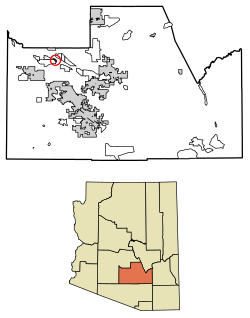 Location of Sweet Water Village in Pinal County, Arizona. | |
 Sweet Water Village, Arizona Location in the United States | |
| Coordinates: 33°7′12″N 111°50′16″W | |
| Country | United States |
| State | Arizona |
| County | Pinal |
| Area | |
| • Total | 0.80 sq mi (2.07 km2) |
| • Land | 0.80 sq mi (2.07 km2) |
| • Water | 0.00 sq mi (0.00 km2) |
| Population (2020) | |
| • Total | 123 |
| • Density | 153.75/sq mi (59.38/km2) |
| Time zone | UTC-7 (MST (no DST)) |
| FIPS code | 04-71642 |
Demographics
| Historical population | |||
|---|---|---|---|
| Census | Pop. | %± | |
| 2020 | 123 | — | |
| U.S. Decennial Census[2] | |||
As of the census[3] of 2010, there were 83 people living in the CDP. The population density was 103.8 inhabitants per square mile (40.1/km2). The racial makeup of the CDP was 1% White, 98% Native American, and 1% from two or more races. 19% of the population were Hispanic or Latino of any race.
Notes
- "2020 U.S. Gazetteer Files". United States Census Bureau. Retrieved October 29, 2021.
- "Census of Population and Housing". Census.gov. Retrieved June 4, 2016.
- United States Census[dead link]
Municipalities and communities of Pinal County, Arizona, United States | ||
|---|---|---|
County seat: Florence | ||
| Cities |
|  |
| Towns | ||
| CDPs |
| |
| Populated places |
| |
| Indian reservations |
| |
| Ghost towns |
| |
| Footnotes | ‡This populated place also has portions in an adjacent county or counties | |
| ||
Текст в блоке "Читать" взят с сайта "Википедия" и доступен по лицензии Creative Commons Attribution-ShareAlike; в отдельных случаях могут действовать дополнительные условия.
Другой контент может иметь иную лицензию. Перед использованием материалов сайта WikiSort.org внимательно изучите правила лицензирования конкретных элементов наполнения сайта.
Другой контент может иметь иную лицензию. Перед использованием материалов сайта WikiSort.org внимательно изучите правила лицензирования конкретных элементов наполнения сайта.
2019-2026
WikiSort.org - проект по пересортировке и дополнению контента Википедии
WikiSort.org - проект по пересортировке и дополнению контента Википедии