world.wikisort.org - USA
Sugar Ridge Township is one of eleven townships in Clay County, Indiana. As of the 2010 census, its population was 939 and it contained 449 housing units.[3]
Sugar Ridge Township | |
|---|---|
Township | |
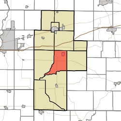 Location of Sugar Ridge Township in Clay County | |
| Coordinates: 39°22′36″N 87°06′05″W | |
| Country | United States |
| State | Indiana |
| County | Clay |
| Government | |
| • Type | Indiana township |
| Area | |
| • Total | 28.21 sq mi (73.1 km2) |
| • Land | 27.72 sq mi (71.8 km2) |
| • Water | 0.5 sq mi (1 km2) |
| Elevation | 581 ft (177 m) |
| Population (2010) | |
| • Total | 939 |
| • Density | 33.9/sq mi (13.1/km2) |
| FIPS code | 18-73988[2] |
| GNIS feature ID | 453887 |
History
Sugar Ridge Township organized in 1854. It was named from a high ridge passing through its central portion.[4]
The Aqueduct Bridge, Feeder Dam Bridge, and Jeffers Bridge are listed on the National Register of Historic Places.[5]
Geography
According to the 2010 census, the township has a total area of 28.21 square miles (73.1 km2), of which 27.72 square miles (71.8 km2) (or 98.26%) is land and 0.5 square miles (1.3 km2) (or 1.77%) is water.[3] Dietz Lake is in this township.
Cities and towns
Unincorporated towns
(This list is based on USGS data and may include former settlements.)
Adjacent townships
- Jackson Township (north)
- Washington Township (east)
- Marion Township, Owen County (southeast)
- Harrison Township (south)
- Perry Township (west)
- Posey Township (northwest)
Major highways
 Indiana State Road 46
 Indiana State Road 59
Cemeteries
The township contains three cemeteries: Gremes, Harris and Moss.
References
- "US Board on Geographic Names". United States Geological Survey. 2007-10-25. Retrieved 2008-01-31.
- "U.S. Census website". United States Census Bureau. Retrieved 2008-01-31.
- "Population, Housing Units, Area, and Density: 2010 - County -- County Subdivision and Place -- 2010 Census Summary File 1". United States Census. Archived from the original on 2020-02-12. Retrieved 2013-05-10.
- Blanchard, Charles (1884). Counties of Clay and Owen, Indiana: Historical and Biographical. F.A. Battey & Company. pp. 83–84.
- "National Register Information System". National Register of Historic Places. National Park Service. July 9, 2010.
External links
Municipalities and communities of Clay County, Indiana, United States | ||
|---|---|---|
County seat: Brazil | ||
| City |
|  |
| Towns | ||
| Townships | ||
| CDP | ||
| Other unincorporated communities |
| |
| Ghost towns |
| |
| Footnotes | ‡This populated place also has portions in an adjacent county or counties | |
| ||
Другой контент может иметь иную лицензию. Перед использованием материалов сайта WikiSort.org внимательно изучите правила лицензирования конкретных элементов наполнения сайта.
WikiSort.org - проект по пересортировке и дополнению контента Википедии