world.wikisort.org - USA
Sterrett is a census-designated place and unincorporated community in Shelby County, Alabama, United States. Its population was 712 as of the 2010 census.[3] Sterrett was named in honor of a prominent local family, which included Alphonso A. Sterrett, who served in the Alabama Legislature.[4] At one point in its history, Sterrett was a center of pottery production in central Alabama. Also known as Jugtown, Sterrett was once home to at least ten potters.[5] The pottery produced here was classified as being part of the East Alabama style of pottery, which used high quality clay and a two-toned glaze decoration.[6] William Hilliard Falkner purchased the Sterrett Pottery Works in 1874 and operated it until 1903. His father, Joel Falkner, was also a potter in Sterrett.[7]
Sterrett, Alabama | |
|---|---|
Census-designated place | |
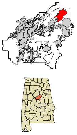 Location of Sterrett in Shelby County, Alabama. | |
 Sterrett, Alabama | |
| Coordinates: 33°26′55″N 86°28′48″W | |
| Country | United States |
| State | Alabama |
| County | Shelby |
| Area | |
| • Total | 23.57 sq mi (61.05 km2) |
| • Land | 22.92 sq mi (59.37 km2) |
| • Water | 0.65 sq mi (1.68 km2) |
| Elevation | 518 ft (158 m) |
| Population (2020) | |
| • Total | 706 |
| • Density | 30.80/sq mi (11.89/km2) |
| Time zone | UTC-6 (Central (CST)) |
| • Summer (DST) | UTC-5 (CDT) |
| ZIP code | 35147 |
| Area code(s) | 205, 659 |
| GNIS feature ID | 127366[2] |
Sterrett was once home to Twin Pines Conference Center, which was founded by Robert "Bob" Saunders. The Bob Saunders Family Covered Bridge is located on the property of the former conference center and is listed in the World Guide to Covered Bridges.[8]
Geography
The community is in the northeastern part of Shelby County. Alabama State Route 25 runs through the community, leading southeast 7 mi (11 km) to Vincent and northwest 13 mi (21 km) on a particularly winding and mountainous route to the city of Leeds.
Demographics
| Historical population | |||
|---|---|---|---|
| Census | Pop. | %± | |
| 2020 | 706 | — | |
| U.S. Decennial Census[9] | |||
References
- "2020 U.S. Gazetteer Files". United States Census Bureau. Retrieved October 29, 2021.
- "Sterrett". Geographic Names Information System. United States Geological Survey, United States Department of the Interior.
- "U.S. Census website". United States Census Bureau. Retrieved 2011-05-14.
- Foscue, Virginia (1989). Place Names in Alabama. Tuscaloosa: The University of Alabama Press. p. 132. ISBN 0-8173-0410-X.
- Gaffney, Dennis (2012-01-16). "Alabama Stoneware — A Jug-full of History | Follow the Stories | Antiques Roadshow". PBS. Retrieved 2014-06-30.
- Salzman, Jack (25 May 1990). American Studies: An Annotated Bibliography - Jack Salzman - Google Books. ISBN 9780521365598. Retrieved 2014-06-29.
- Dubose, Joel Campbell (1904). Notable Men of Alabama: Personal and Genealogical, Volume 1 - Joel Campbell DuBose - Google Books. Retrieved 2014-06-29.
- "Saunders Covered Bridge". Shelby County Tourism. 2012-01-16. Retrieved 2014-11-10.
- "Census of Population and Housing". Census.gov. Retrieved June 4, 2016.
Municipalities and communities of Shelby County, Alabama, United States | ||
|---|---|---|
County seat: Columbiana | ||
| Cities | 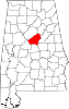 | |
| Towns | ||
| CDPs | ||
| Other unincorporated communities | ||
| Footnotes | ‡This populated place also has portions in an adjacent county or counties | |
| ||
Our Lady of Medjugorje | ||
|---|---|---|
| Apparitions |
|  |
| Local bishops |
| |
| Prominent supporters |
| |
| Connected topics |
| |
| ||
This Shelby County, Alabama state location article is a stub. You can help Wikipedia by expanding it. |
На других языках
- [en] Sterrett, Alabama
[fr] Sterrett
Sterrett est un census-designated place situé dans l’État américain de l'Alabama, dans le comté de Shelby.[it] Sterrett
Sterrett è un census-designated place (CDP) degli Stati Uniti d'America situato nello stato dell'Alabama, nella contea di Shelby.Другой контент может иметь иную лицензию. Перед использованием материалов сайта WikiSort.org внимательно изучите правила лицензирования конкретных элементов наполнения сайта.
WikiSort.org - проект по пересортировке и дополнению контента Википедии