world.wikisort.org - USA
Eagle Point is a census-designated place in Shelby County, Alabama, United States. It was first listed as a CDP prior to the 2020 census and is part of the Birmingham Metropolitan Area. The area was struck by a long-tracked low-end EF3 tornado on March 25, 2021, damaging or destroying several homes and downing trees. Five people were injured by the tornado.[3]
Eagle Point, Alabama | |
|---|---|
Census-designated place | |
 Eagle Point  Eagle Point | |
| Coordinates: 33°23′39″N 86°40′36″W | |
| Country | United States |
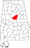
| State | Alabama |
| County | Shelby |
| Area | |
| • Total | 2.25 sq mi (5.84 km2) |
| • Land | 2.21 sq mi (5.72 km2) |
| • Water | 0.04 sq mi (0.11 km2) |
| Elevation | 690 ft (210 m) |
| Population (2020) | |
| • Total | 2,903 |
| • Density | 1,313.57/sq mi (507.19/km2) |
| Time zone | UTC-6 (Central (CST)) |
| • Summer (DST) | UTC-5 (CDT) |
| Area code(s) | 205, 659 |
| GNIS feature ID | 2805893[2] |
| FIPS code | 01-22088[1] |
It was first named as a CDP in the 2020 Census which listed a population of 2,903.[4]
Geography
The community is in northern Shelby County. It is bordered to the north by the city of Birmingham, to the east by Highland Lakes, to the south by Pelham, and to the west by Meadowbrook.
According to the U.S. Census Bureau, the Eagle Point CDP has a total area of 2.2 square miles (5.8 km2), of which 0.04 square miles (0.11 km2), or 1.94%, are water.[1]
Demographics
| Historical population | |||
|---|---|---|---|
| Census | Pop. | %± | |
| 2020 | 2,903 | — | |
| U.S. Decennial Census[5] 2020[6] | |||
2020 census
| Race / Ethnicity | Pop 2020[6] | % 2020 |
|---|---|---|
| White alone (NH) | 2,452 | 84.46% |
| Black or African American alone (NH) | 111 | 3.82% |
| Native American or Alaska Native alone (NH) | 3 | 0.10% |
| Asian alone (NH) | 158 | 5.44% |
| Pacific Islander alone (NH) | 0 | 0.00% |
| Some Other Race alone (NH) | 8 | 0.28% |
| Mixed Race/Multi-Racial (NH) | 95 | 3.27% |
| Hispanic or Latino (any race) | 76 | 2.62% |
| Total | 2,903 | 100.00% |
Note: the US Census treats Hispanic/Latino as an ethnic category. This table excludes Latinos from the racial categories and assigns them to a separate category. Hispanics/Latinos can be of any race.
References
- "2020 U.S. Gazetteer Files". United States Census Bureau. Retrieved October 29, 2021.
- "Eagle Point Census Designated Place". Geographic Names Information System. United States Geological Survey, United States Department of the Interior.
- "ArcGIS Web Application". apps.dat.noaa.gov. Retrieved 26 March 2021.
- "Eagle Point CDP, Alabama". United States Census Bureau. Retrieved March 13, 2022.
- "Decennial Census of Population and Housing by Decades". US Census Bureau.
- "P2 HISPANIC OR LATINO, AND NOT HISPANIC OR LATINO BY RACE - 2020: DEC Redistricting Data (PL 94-171) - Eagle Point CDP, Alabama". United States Census Bureau.
Municipalities and communities of Shelby County, Alabama, United States | ||
|---|---|---|
County seat: Columbiana | ||
| Cities |
|  |
| Towns |
| |
| CDPs | ||
| Other unincorporated communities | ||
| Footnotes | ‡This populated place also has portions in an adjacent county or counties | |
| ||
This Shelby County, Alabama state location article is a stub. You can help Wikipedia by expanding it. |
Другой контент может иметь иную лицензию. Перед использованием материалов сайта WikiSort.org внимательно изучите правила лицензирования конкретных элементов наполнения сайта.
WikiSort.org - проект по пересортировке и дополнению контента Википедии