world.wikisort.org - USA
South Toms River is a borough in Ocean County, New Jersey, United States. As of the 2010 United States Census, the borough's population was 3,684,[17][18][19] reflecting an increase of 50 (+1.4%) from the 3,634 counted in the 2000 Census, which had in turn declined by 235 (−6.1%) from the 3,869 counted in the 1990 Census.[20]
South Toms River, New Jersey | |
|---|---|
Borough | |
| Borough of South Toms River | |
 South Toms River as seen from Dover Road (CR 530) | |
| Motto: "The Little Town With a Big Heart" | |
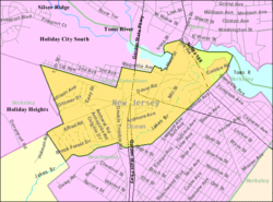
 Map of South Toms River in Ocean County. Inset: Location of Ocean County highlighted in the State of New Jersey. | |
 Census Bureau map of South Toms River, New Jersey | |
 South Toms River Location in Ocean County  South Toms River Location in New Jersey  South Toms River Location in the United States | |
| Coordinates: 39.939132°N 74.207024°W[1][2] | |
| Country | |
| state | |
| County | |
| Incorporated | May 3, 1927 |
| Government | |
| • Type | Borough |
| • Body | Borough Council |
| • Mayor | Gregory Handshy (D, term ends December 31, 2022)[4][5] |
| • Municipal clerk | Joseph Kostecki[6] |
| Area | |
| • Total | 1.21 sq mi (3.13 km2) |
| • Land | 1.16 sq mi (3.00 km2) |
| • Water | 0.05 sq mi (0.13 km2) 4.21% |
| • Rank | 485th of 565 in state 21st of 33 in county[1] |
| Elevation | 52 ft (16 m) |
| Population (2020)[9] | |
| • Total | 3,643 |
| • Rank | 424th of 566 in state 16th of 33 in county[10] |
| • Density | 3,148.66/sq mi (1,215.18/km2) |
| • Rank | 207th of 566 in state 8th of 33 in county[10] |
| Time zone | UTC−05:00 (Eastern (EST)) |
| • Summer (DST) | UTC−04:00 (Eastern (EDT)) |
| ZIP Code | |
| Area code(s) | 732[13] |
| FIPS code | 3402969510[1][14][15] |
| GNIS feature ID | 0885404[1][16] |
| Website | www |
South Toms River was incorporated as a borough by an act of the New Jersey Legislature on March 28, 1927, from portions of Berkeley Township, based on the results of a referendum held on May 3, 1927.[21] The borough was named for the Toms River and the neighboring community of Toms River, which were named for Capt. William Tom.[22][23][24]
Geography
According to the United States Census Bureau, the borough had a total area of 1.21 square miles (3.13 km2), including 1.16 square miles (3.00 km2) of land and 0.05 square miles (0.13 km2) of water (4.21%).[1][2]
The borough borders the Ocean County municipalities of Beachwood, Berkeley Township and Toms River.[25][26][27]
South Toms River sits on the south side of the Toms River, across from Toms River Township. The borough is one of 11 municipalities in Ocean County that are part of the Toms River watershed.[28]
Demographics
| Historical population | |||
|---|---|---|---|
| Census | Pop. | %± | |
| 1930 | 405 | — | |
| 1940 | 445 | 9.9% | |
| 1950 | 492 | 10.6% | |
| 1960 | 1,603 | 225.8% | |
| 1970 | 3,981 | 148.3% | |
| 1980 | 3,954 | −0.7% | |
| 1990 | 3,869 | −2.1% | |
| 2000 | 3,634 | −6.1% | |
| 2010 | 3,684 | 1.4% | |
| 2020 | 3,643 | −1.1% | |
| Population sources: 1930–2000[29] 1930[30] 1930–1990[31] 2000[32][33] 2010[34][17][18][19][9] | |||
Census 2010
The 2010 United States census counted 3,684 people, 1,098 households, and 907 families in the borough. The population density was 3,146.7 per square mile (1,214.9/km2). There were 1,160 housing units at an average density of 990.8 per square mile (382.6/km2). The racial makeup was 67.59% (2,490) White, 19.33% (712) Black or African American, 0.57% (21) Native American, 0.62% (23) Asian, 0.00% (0) Pacific Islander, 7.14% (263) from other races, and 4.75% (175) from two or more races. Hispanic or Latino of any race were 19.49% (718) of the population.[17]
Of the 1,098 households, 36.7% had children under the age of 18; 52.3% were married couples living together; 21.9% had a female householder with no husband present and 17.4% were non-families. Of all households, 12.8% were made up of individuals and 5.6% had someone living alone who was 65 years of age or older. The average household size was 3.36 and the average family size was 3.61.[17]
28.1% of the population were under the age of 18, 10.6% from 18 to 24, 26.7% from 25 to 44, 25.8% from 45 to 64, and 8.8% who were 65 years of age or older. The median age was 34.0 years. For every 100 females, the population had 95.0 males. For every 100 females ages 18 and older there were 90.8 males.[17]
The Census Bureau's 2006–2010 American Community Survey showed that (in 2010 inflation-adjusted dollars) median household income was $60,408 (with a margin of error of +/− $6,382) and the median family income was $62,750 (+/− $8,524). Males had a median income of $46,370 (+/− $4,313) versus $36,133 (+/− $2,994) for females. The per capita income for the borough was $19,177 (+/− $2,685). About 17.2% of families and 22.4% of the population were below the poverty line, including 33.6% of those under age 18 and 11.5% of those age 65 or over.[35]
Census 2000
As of the 2000 United States Census[14] there were 3,634 people, 1,073 households, and 902 families residing in the borough. The population density was 3,131.9 inhabitants per square mile (1,209.2/km2). There were 1,123 housing units at an average density of 967.8 per square mile (373.7/km2). The racial makeup of the borough was 72.56% White, 21.16% African American, 0.14% Native American, 0.69% Asian, 2.50% from other races, and 2.94% from two or more races. Hispanic or Latino of any race were 9.27% of the population.[32][33]
There were 1,073 households, out of which 43.1% had children under the age of 18 living with them, 55.2% were married couples living together, 22.7% had a female householder with no husband present, and 15.9% were non-families. 12.5% of all households were made up of individuals, and 5.4% had someone living alone who was 65 years of age or older. The average household size was 3.39 and the average family size was 3.63.[32][33]
In the borough the population was spread out, with 32.1% under the age of 18, 9.3% from 18 to 24, 29.2% from 25 to 44, 20.4% from 45 to 64, and 9.0% who were 65 years of age or older. The median age was 32 years. For every 100 females, there were 93.1 males. For every 100 females age 18 and over, there were 88.5 males.[32][33]
The median income for a household in the borough was $43,468, and the median income for a family was $45,375. Males had a median income of $31,859 versus $24,837 for females. The per capita income for the borough was $16,292. About 11.2% of families and 12.6% of the population were below the poverty line, including 18.4% of those under age 18 and 18.3% of those age 65 or over.[32][33]
Government
Local government
South Toms River is governed under the Borough form of New Jersey municipal government, which is used in 218 municipalities (of the 564) statewide, making it the most common form of government in New Jersey.[36] The governing body is comprised of the Mayor and the Borough Council, with all positions elected at-large on a partisan basis as part of the November general election. The Mayor is elected directly by the voters to a four-year term of office. The Borough Council is comprised of six members elected to serve three-year terms on a staggered basis, with two seats coming up for election each year in a three-year cycle.[3] The Borough form of government used by South Toms River is a "weak mayor / strong council" government in which council members act as the legislative body with the mayor presiding at meetings and voting only in the event of a tie. The mayor can veto ordinances subject to an override by a two-thirds majority vote of the council. The mayor makes committee and liaison assignments for council members, and most appointments are made by the mayor with the advice and consent of the council.[37][38]
As of 2022[update], the Mayor of South Toms River Borough is Democrat Gregory Handshy, whose term of office ends December 31, 2022.[4] Members of the Borough Council are Edward F. Murray (R, 2023), Oscar Cradle (R, 2024), Samuel S. Fennell (R, 2024), Council President Tanya M. Mosley (R, 2022), Thomas Rolzhausen (R, 2022), Sandford Ross Jr. (R, 2023).[39][40][41][42][43][44][45][46]
Federal, state and county representation
South Toms River is located in the 3rd Congressional District[47] and is part of New Jersey's 9th state legislative district.[18][48][49] Prior to the 2011 reapportionment following the 2010 Census, South Toms River had been in the 10th state legislative district.[50]
For the 117th United States Congress, New Jersey's 3rd Congressional District is represented by Andy Kim (D, Moorestown).[51] New Jersey is represented in the United States Senate by Democrats Cory Booker (Newark, term ends 2027)[52] and Bob Menendez (Harrison, term ends 2025).[53][54]
For the 2022–2023 session, the 9th Legislative District of the New Jersey Legislature is represented in the State Senate by Christopher J. Connors (R, Lacey Township) and in the General Assembly by DiAnne Gove (R, Long Beach Township) and Brian E. Rumpf (R, Little Egg Harbor Township).[55]
Ocean County is governed by a Board of County Commissioners comprised of five members who are elected on an at-large basis in partisan elections and serving staggered three-year terms of office, with either one or two seats coming up for election each year as part of the November general election. At an annual reorganization held in the beginning of January, the board chooses a Director and a Deputy Director from among its members.[56] As of 2022[update], Ocean County's Commissioners (with party affiliation, term-end year and residence) are:
Commissioner Director John P. Kelly (R, 2022, Eagleswood Township),[57] Commissioner Deputy Director Virginia E. Haines (R, 2022, Toms River),[58] Barbara Jo Crea (R, 2024, Little Egg Harbor Township)[59] Gary Quinn (R, 2024, Lacey Township)[60] and Joseph H. Vicari (R, 2023, Toms River).[61][62][63] Constitutional officers elected on a countywide basis are County Clerk Scott M. Colabella (R, 2025, Barnegat Light),[64][65] Sheriff Michael G. Mastronardy (R, 2022; Toms River)[66][67] and Surrogate Jeffrey Moran (R, 2023, Beachwood).[68][69][70]
Politics
As of March 23, 2011, there were a total of 2,065 registered voters in South Toms River, of which 562 (27.2%) were registered as Democrats, 345 (16.7%) were registered as Republicans and 1,157 (56.0%) were registered as Unaffiliated. There was one voter registered to another party.[71] Among the borough's 2010 Census population, 56.1% (vs. 63.2% in Ocean County) were registered to vote, including 77.9% of those ages 18 and over (vs. 82.6% countywide).[71][72]
In the 2012 presidential election, Democrat Barack Obama received 64.6% of the vote (802 cast), ahead of Republican Mitt Romney with 33.1% (411 votes), and other candidates with 2.3% (28 votes), among the 1,257 ballots cast by the borough's 2,149 registered voters (16 ballots were spoiled), for a turnout of 58.5%.[73][74] In the 2008 presidential election, Democrat Barack Obama received 60.9% of the vote (879 cast), ahead of Republican John McCain with 36.9% (533 votes) and other candidates with 1.4% (20 votes), among the 1,443 ballots cast by the borough's 2,233 registered voters, for a turnout of 64.6%.[75] In the 2004 presidential election, Republican George W. Bush received 49.1% of the vote (627 ballots cast), outpolling Democrat John Kerry with 48.6% (621 votes) and other candidates with 1.1% (22 votes), among the 1,277 ballots cast by the borough's 2,073 registered voters, for a turnout percentage of 61.6.[76]
In the 2013 gubernatorial election, Republican Chris Christie received 66.3% of the vote (473 cast), ahead of Democrat Barbara Buono with 31.8% (227 votes), and other candidates with 1.8% (13 votes), among the 736 ballots cast by the borough's 2,072 registered voters (23 ballots were spoiled), for a turnout of 35.5%.[77][78] In the 2009 gubernatorial election, Republican Chris Christie received 52.8% of the vote (431 ballots cast), ahead of Democrat Jon Corzine with 37.0% (302 votes), Independent Chris Daggett with 6.1% (50 votes) and other candidates with 1.8% (15 votes), among the 816 ballots cast by the borough's 2,157 registered voters, yielding a 37.8% turnout.[79]
Education
Public school students in kindergarten through twelfth grade attend the Toms River Regional Schools, a regional public school district based primarily in Toms River Township that also serves students from Beachwood, Pine Beach and South Toms River.[80] The district's board of education has nine members; seats are allocated based on population, with one seat allocated to South Toms River.[81] As of the 2018–2019 school year, the district, comprised of 18 schools, had an enrollment of 15,472 students and 1,171.6 classroom teachers (on an FTE basis), for a student–teacher ratio of 13.2:1.[82]
Transportation

Roads and highways
As of May 2010[update], the borough had a total of 16.49 miles (26.54 km) of roadways, of which 9.86 miles (15.87 km) were maintained by the municipality, 4.48 miles (7.21 km) by Ocean County and 1.34 miles (2.16 km) by the New Jersey Department of Transportation and 0.81 miles (1.30 km) by the New Jersey Turnpike Authority.[83]
The Garden State Parkway bisects the borough, connecting Beachwood to the south and Berkeley Township to the north, and includes Interchange 80.[84][85] U.S. Route 9 heads from Beachwood to the east and begins a concurrency with the Garden State Parkway at exit 80.[86] County Route 530 (Dover Road / South Main Street) traverses the borough from Berkeley Township to the southwest to its eastern terminus just over the border with Toms River Township.[87] Route 166 (Main Street) clips the northeastern corner of the borough, running from Beachwood in the south to Toms River in the north. [88]
Public transportation
NJ Transit provides bus service between the borough and Atlantic City on the 559 bus route.[89]
References
- 2019 Census Gazetteer Files: New Jersey Places, United States Census Bureau. Accessed July 1, 2020.
- US Gazetteer files: 2010, 2000, and 1990, United States Census Bureau. Accessed September 4, 2014.
- 2012 New Jersey Legislative District Data Book, Rutgers University Edward J. Bloustein School of Planning and Public Policy, March 2013, p. 53.
- Office of the Mayor, Borough of South Toms River. Accessed May 14, 2022.
- 2022 New Jersey Mayors Directory, New Jersey Department of Community Affairs. Accessed March 1, 2022.
- Office of the Municipal Clerk, Borough of South Toms River. Accessed May 14, 2022.
- "ArcGIS REST Services Directory". United States Census Bureau. Retrieved October 11, 2022.
- U.S. Geological Survey Geographic Names Information System: Borough of South Toms River, Geographic Names Information System. Accessed March 14, 2013.
- "Census Population API". United States Census Bureau. Retrieved October 11, 2022.
- GCT-PH1 Population, Housing Units, Area, and Density: 2010 - State -- County Subdivision from the 2010 Census Summary File 1 for New Jersey Archived February 12, 2020, at archive.today, United States Census Bureau. Accessed January 2, 2013.
- Look Up a ZIP Code for South Toms River, NJ, United States Postal Service. Accessed January 2, 2013.
- Look Up a ZIP Code for 08757, United States Postal Service. Accessed January 2, 2013.
- Area Code Lookup - NPA NXX for South Toms River, NJ, Area-Codes.com. Accessed August 30, 2013.
- U.S. Census website, United States Census Bureau. Accessed September 4, 2014.
- Geographic Codes Lookup for New Jersey, Missouri Census Data Center. Accessed April 1, 2022.
- US Board on Geographic Names, United States Geological Survey. Accessed September 4, 2014.
- DP-1 - Profile of General Population and Housing Characteristics: 2010 for South Toms River borough, Ocean County, New Jersey Archived February 12, 2020, at archive.today, United States Census Bureau. Accessed January 2, 2013.
- Municipalities Sorted by 2011-2020 Legislative District, New Jersey Department of State. Accessed February 1, 2020.
- Profile of General Demographic Characteristics: 2010 for South Toms River borough Archived March 4, 2016, at the Wayback Machine, New Jersey Department of Labor and Workforce Development. Accessed January 2, 2013.
- Table 7. Population for the Counties and Municipalities in New Jersey: 1990, 2000 and 2010, New Jersey Department of Labor and Workforce Development, February 2011. Accessed January 2, 2013.
- Snyder, John P. The Story of New Jersey's Civil Boundaries: 1606-1968, Bureau of Geology and Topography; Trenton, New Jersey; 1969. p. 205. Accessed October 25, 2012.
- Hutchinson, Viola L. The Origin of New Jersey Place Names, New Jersey Public Library Commission, May 1945. Accessed October 7, 2015.
- Gannett, Henry. The Origin of Certain Place Names in the United States, p. 302. United States Government Printing Office, 1905. Accessed October 7, 2015.
- South Toms River Borough is not named after Toms River Township, which adopted that name much later, in 2006.
- Areas touching South Toms River, MapIt. Accessed March 6, 2020.
- Ocean County Map, Coalition for a Healthy NJ. Accessed March 6, 2020.
- New Jersey Municipal Boundaries, New Jersey Department of Transportation. Accessed November 15, 2019.
- Toms River Watershed, Barnegat Bay Partnership. Accessed July 3, 2022.
- Barnett, Bob. Population Data for Ocean County Municipalities, 1850 - 2000, WestJersey.org, January 6, 2011. Accessed January 1, 2013.
- Fifteenth Census of the United States : 1930 - Population Volume I, United States Census Bureau, p. 718. Accessed January 2, 2013. Listed as Barnegat City.
- Table 6. New Jersey Resident Population by Municipality: 1930 - 1990 Archived March 19, 2018, at the Wayback Machine, New Jersey Department of Labor and Workforce Development. Accessed June 28, 2015.
- Census 2000 Profiles of Demographic / Social / Economic / Housing Characteristics for South Toms River borough, New Jersey[permanent dead link], United States Census Bureau. Accessed January 2, 2013.
- DP-1: Profile of General Demographic Characteristics: 2000 - Census 2000 Summary File 1 (SF 1) 100-Percent Data for South Toms River borough, Ocean County, New Jersey Archived February 12, 2020, at archive.today, United States Census Bureau. Accessed January 2, 2013.
- "DataUniverse - 2010 Census Populations: Ocean County", Asbury Park Press. Accessed January 2, 2013.
- DP03: Selected Economic Characteristics from the 2006-2010 American Community Survey 5-Year Estimates for South Toms River borough, Ocean County, New Jersey Archived February 12, 2020, at archive.today, United States Census Bureau. Accessed January 2, 2013.
- Inventory of Municipal Forms of Government in New Jersey, Rutgers University Center for Government Studies, July 1, 2011. Accessed November 18, 2019.
- Cerra, Michael F. "Forms of Government: Everything You've Always Wanted to Know, But Were Afraid to Ask" Archived 2014-09-24 at the Wayback Machine, New Jersey State League of Municipalities. Accessed November 30, 2014.
- "Forms of Municipal Government in New Jersey", p. 6. Rutgers University Center for Government Studies. Accessed June 3, 2015.
- Borough Council, Borough of South Toms River. Accessed May 14, 2022. As of date accessed, term-end dates were incorrect for Fennell, Mosley, Rolzhausen and Ross.
- 2022 Municipal Data Sheet, Borough of South Toms River. Accessed May 14, 2022.
- Borough of South Toms River, Ocean County, New Jersey. Accessed May 25, 2022.
- 2022 Ocean County & Municipal Elected Officials, Ocean County, New Jersey Clerk, updated April 1, 2022. Accessed May 1, 2022.
- 2021 General Election Official Results, Ocean County, New Jersey. Accessed January 1, 2022.
- 2020 General Election November 3, 2020 Official results, Ocean County, New Jersey, updated December 2, 2020. Accessed January 1, 2021.
- 2019 General Election Official Results November 5, 2019, Ocean County, New Jersey Clerk, updated November 15, 2019. Accessed January 1, 2020.
- 2018 General Election Official Results November 6, 2018, Ocean County, New Jersey Clerk, updated November 19, 2018. Accessed January 1, 2019.
- Plan Components Report, New Jersey Redistricting Commission, December 23, 2011. Accessed February 1, 2020.
- 2019 New Jersey Citizen's Guide to Government, New Jersey League of Women Voters. Accessed October 30, 2019.
- Districts by Number for 2011-2020, New Jersey Legislature. Accessed January 6, 2013.
- 2011 New Jersey Citizen's Guide to Government Archived June 4, 2013, at the Wayback Machine, p. 64, New Jersey League of Women Voters. Accessed May 22, 2015.
- , United States House of Representatives. Accessed August 5, 2022.
- U.S. Sen. Cory Booker cruises past Republican challenger Rik Mehta in New Jersey, PhillyVoice. Accessed April 30, 2021. "He now owns a home and lives in Newark's Central Ward community."
- Biography of Bob Menendez, United States Senate, January 26, 2015. "Menendez, who started his political career in Union City, moved in September from Paramus to one of Harrison's new apartment buildings near the town's PATH station.."
- Home, sweet home: Bob Menendez back in Hudson County. nj.com. Accessed April 30, 2021. "Booker, Cory A. - (D - NJ) Class II; Menendez, Robert - (D - NJ) Class I"
- Legislative Roster for District 9, New Jersey Legislature. Accessed January 11, 2022.
- Freeholder to Commissioner History, Ocean County, New Jersey. Accessed June 1, 2022.
- Commissioner John P. Kelly, Ocean County, New Jersey. Accessed June 1, 2022.
- Commissioner Director Virginia E. Haines, Ocean County, New Jersey. Accessed June 1, 2022.
- Commissioner Barbara Jo Crea, Ocean County, New Jersey. Accessed June 1, 2022.
- Commissioner Gary Quinn, Ocean County, New Jersey. Accessed June 1, 2022.
- Commissioner Joseph H. Vicari, Ocean County, New Jersey. Accessed June 1, 2022.
- Meet our Commissioners, Ocean County, New Jersey. Accessed June 1, 2022.
- County Directory, Ocean County, New Jersey. Accessed June 1, 2022.
- County Clerk, Ocean County, New Jersey. Accessed June 1, 2022.
- Clerks, Constitutional Officers Association of New Jersey. Accessed June 1, 2022.
- County Sheriff Michael G. Mastronardy, Ocean County, New Jersey. Accessed June 1, 2022.
- Sheriffs, Constitutional Officers Association of New Jersey. Accessed June 1, 2022.
- County Surrogate Jeffrey W. Moran, Ocean County, New Jersey. Accessed June 1, 2022.
- Surrogates, Constitutional Officers Association of New Jersey. Accessed June 1, 2022.
- 2022 Ocean County and Municipal Elected Officials, Ocean County, New Jersey. Accessed June 1, 2022.
- Voter Registration Summary - Ocean, New Jersey Department of State Division of Elections, March 23, 2011. Accessed January 1, 2013.
- GCT-P7: Selected Age Groups: 2010 - State -- County Subdivision; 2010 Census Summary File 1 for New Jersey Archived February 12, 2020, at archive.today, United States Census Bureau. Accessed January 1, 2013.
- "Presidential General Election Results - November 6, 2012 - Ocean County" (PDF). New Jersey Department of Elections. March 15, 2013. Retrieved December 24, 2014.
- "Number of Registered Voters and Ballots Cast - November 6, 2012 - General Election Results - Ocean County" (PDF). New Jersey Department of Elections. March 15, 2013. Retrieved December 24, 2014.
- 2008 Presidential General Election Results: Ocean County, New Jersey Department of State Division of Elections, December 23, 2008. Accessed January 1, 2013.
- 2004 Presidential Election: Ocean County, New Jersey Department of State Division of Elections, December 13, 2004. Accessed January 1, 2013.
- "Governor - Ocean County" (PDF). New Jersey Department of Elections. January 29, 2014. Retrieved December 24, 2014.
- "Number of Registered Voters and Ballots Cast - November 5, 2013 - General Election Results - Ocean County" (PDF). New Jersey Department of Elections. January 29, 2014. Retrieved December 24, 2014.
- 2009 Governor: Ocean County Archived October 17, 2012, at the Wayback Machine, New Jersey Department of State Division of Elections, December 31, 2009. Accessed January 1, 2013.
- Toms River Regional School District 2015 Report Card Narrative, New Jersey Department of Education. Accessed July 11, 2016. "Toms River Regional is the largest suburban school district in the state, with a population of approximately 16,000 students learning in a pre-kindergarten early learning center, twelve elementary schools, three intermediate schools and three high schools. Despite its size, the district takes enormous pride in providing a neighborhood school concept with high-quality educational programs, facilities, and services for students from our four sending towns of Beachwood, Pine Beach, South Toms River, and Toms River."
- Board of Education, Toms River Regional Schools. Accessed March 6, 2020. "The Toms River Board of Education is comprised of nine members. Six are elected from Toms River Township, and one each from the Boroughs of Pine Beach, Beachwood and South Toms River."
- District information for Toms River Regional School District, National Center for Education Statistics. Accessed April 1, 2020.
- Cumberland County Mileage by Municipality and Jurisdiction, New Jersey Department of Transportation, May 2010. Accessed November 6, 2013.
- Garden State Parkway Straight Line Diagram, New Jersey Department of Transportation, January 1997. Accessed November 6, 2013.
- Travel Resources: Interchanges, Service Areas & Commuter Lots, New Jersey Turnpike Authority. Accessed November 6, 2013.
- U.S. Route 9 Straight Line Diagram, New Jersey Department of Transportation, May 2008. Accessed November 6, 2013.
- County Route 530 Straight Line Diagram, New Jersey Department of Transportation, August 2006. Accessed November 6, 2013.
- Route 166 Straight Line Diagram, New Jersey Department of Transportation, May 2008. Accessed November 6, 2013.
- Ocean County Bus / Rail Connections, NJ Transit, backed up by the Internet Archive as of July 26, 2010. Accessed January 2, 2013.
External links
- Borough of South Toms River
- Manitou Park Fire Company – Station 18
- Toms River Regional Schools
- School Performance Reports for the Toms River Regional Schools, New Jersey Department of Education
- School Data for the Toms River Regional Schools, National Center for Education Statistics

Authority control | |
|---|---|
| General | |
| National libraries | |
Другой контент может иметь иную лицензию. Перед использованием материалов сайта WikiSort.org внимательно изучите правила лицензирования конкретных элементов наполнения сайта.
WikiSort.org - проект по пересортировке и дополнению контента Википедии