world.wikisort.org - USA
Somer Township is a township in Champaign County, Illinois, USA. As of the 2010 census, its population was 1,268 and it contained 635 housing units.[2]
Somer Township | |
|---|---|
Township | |
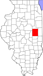
 Location in Champaign County | |
 Champaign County's location in Illinois | |
| Coordinates: 40°10′49″N 88°11′13″W | |
| Country | United States |
| State | Illinois |
| County | Champaign |
| Established | November 8, 1859 |
| Area | |
| • Total | 32.68 sq mi (84.6 km2) |
| • Land | 32.65 sq mi (84.6 km2) |
| • Water | 0.03 sq mi (0.08 km2) 0.09% |
| Elevation | 735 ft (224 m) |
| Population (2010) | |
| • Estimate (2016)[1] | 1,246 |
| • Density | 38.8/sq mi (15.0/km2) |
| Time zone | UTC-6 (CST) |
| • Summer (DST) | UTC-5 (CDT) |
| FIPS code | 17-019-70382 |
History
Somer Township changed its name from Pleasant Hill Township on April 30, 1860.
Geography
Somer is Township 20 North, Range 9 East of the Third Principal Meridian.
According to the 2010 census, the township has a total area of 32.68 square miles (84.6 km2), of which 32.65 square miles (84.6 km2) (or 99.91%) is land and 0.03 square miles (0.078 km2) (or 0.09%) is water.[2]
Unincorporated towns
- Leverett
- Wilbur Heights
(This list is based on USGS data and may include former settlements.)
Cemeteries
The township contains these cemeteries: Clements (Section 35), Coslet and Yearsley (Section 26).
Historic cemeteries (some of these may no longer be visible): Adkins Grave Yard (Section 21), Brownfield (Section 26), Heater (Section 23), Indian burial ground (Section 16), Methodist Church site (Section 27), Rhinehart Grave Yard (Section 34), Somers (Section 27).[3]
Grain Elevators
Leverett elevator (Section 17) was built along the Illinois Central—Canadian National railroad.
Sharp's Crossing elevator (Section 4) was built on the short–lived Kankakee and Urbana Traction Company interurban line around 1920, and was operated by the Sharp Grain Company.[4] The wooden elevator on the west side of U.S. Route 45 at County Road 2300 North was destroyed by fire.
Major highways
 Interstate 57
 U.S. Route 45
Demographics
| Historical population | |||
|---|---|---|---|
| Census | Pop. | %± | |
| 2016 (est.) | 1,246 | [1] | |
| U.S. Decennial Census[5] | |||
References
- "Somer Township, Champaign County, Illinois". Geographic Names Information System. United States Geological Survey. Retrieved 2010-01-04.
- United States Census Bureau cartographic boundary files
- "Population and Housing Unit Estimates". Retrieved June 9, 2017.
- "Population, Housing Units, Area, and Density: 2010 - County -- County Subdivision and Place -- 2010 Census Summary File 1". United States Census. Archived from the original on 2020-02-12. Retrieved 2013-05-28.
- Historical Map of Champaign County 1819−1940 by Champaign County Regional Planning Commission, Karl B. Lohmann, chairman; M. Eugene Baughman, cartographer. Urbana, Illinois: 1940. Reprinted 1968.
- "Cathedrals of the Countryside" by Anne Cook. The News–Gazette. Champaign, Illinois, 9 July 2000. pp. E–1, E–5, illus.
- "Census of Population and Housing". Census.gov. Retrieved June 4, 2016.
External links
Places adjacent to Somer Township, Champaign County, Illinois | ||||||||||||||||
|---|---|---|---|---|---|---|---|---|---|---|---|---|---|---|---|---|
| ||||||||||||||||
Municipalities and communities of Champaign County, Illinois, United States | ||
|---|---|---|
County seat: Urbana | ||
| Cities |
|  |
| Villages | ||
| Townships | ||
| CDPs |
| |
| Other unincorporated communities | ||
| Ghost town |
| |
| Footnotes | ‡This populated place also has portions in an adjacent county or counties | |
| ||
Другой контент может иметь иную лицензию. Перед использованием материалов сайта WikiSort.org внимательно изучите правила лицензирования конкретных элементов наполнения сайта.
WikiSort.org - проект по пересортировке и дополнению контента Википедии