world.wikisort.org - USA
Saint Joseph Township is a township in Champaign County, Illinois, USA. As of the 2010 census, its population was 5,876 and it contained 2,252 housing units.[2]
Saint Joseph Township | |
|---|---|
Township | |
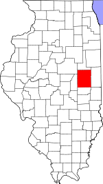
 Location in Champaign County | |
 Champaign County's location in Illinois | |
| Coordinates: 40°06′09″N 88°03′46″W | |
| Country | United States |
| State | Illinois |
| County | Champaign |
| Established | November 8, 1859 |
| Area | |
| • Total | 36.63 sq mi (94.9 km2) |
| • Land | 36.48 sq mi (94.5 km2) |
| • Water | 0.15 sq mi (0.4 km2) 0.41% |
| Elevation | 669 ft (204 m) |
| Population (2010) | |
| • Estimate (2016)[1] | 5,859 |
| • Density | 161.1/sq mi (62.2/km2) |
| Time zone | UTC-6 (CST) |
| • Summer (DST) | UTC-5 (CDT) |
| FIPS code | 17-019-66963 |
Geography
St. Joseph is Township 19 North, Range 10 East of the Third Principal Meridian.
According to the 2010 census, the township has a total area of 36.63 square miles (94.9 km2), of which 36.48 square miles (94.5 km2) (or 99.59%) is land and 0.15 square miles (0.39 km2) (or 0.41%) is water.[2]
The western section of the Kickapoo Rail Trail follows the former Big Four—Conrail System railroad right–of–way along U.S. Route 150 from the City of Urbana to the Village of St. Joseph. Going east from Urbana landmarks along the trail include Urbana Walmart, John Deere implement dealer, Cottonwood Road (CR 1700E), CR 1800E, Mt. Olive Cemetery, Mayview, Sellers Road (CR 1900E), Full′s Siding elevator, CR 1975E, CR 2075E, Corteva (Pioneer Supply) seed company, Salt Fork Paintball, the baseball field, Salt Fork River bridge, St. Joseph water tower, Wheelhouse restaurant and Main Street Mall, St. Joseph business district and elevator.
Cities and towns
Cemeteries
Mt. Olive Cemetery (Section 7) is west of Mayview on the north side of U.S. Route 150.
Historic cemeteries (some of these may no longer be visible): Bartley Cemetery (Section 26), Cora Brooks farm (Section 3), Deadman′s Grove (Section 7), Huss Cemetery (Section 33), Indian burial ground (Section 27), Patterson Cemetery (Section 24), Peters or Thompson Cemetery (Section 25), Stayton Cemetery (Section 28) [3]
Grain Elevators
Full's Siding elevator (Section 17) was built on the Big Four—Conrail System railroad. The concrete silos and steel bins are on the south side of U.S. Route 150 east of Mayview.
Mayview elevators (Section 18), built on the Big Four—Conrail System railroad, are no longer standing. J.B. Walton and Son and E.C. Saddoris were operators in 1913.
St. Joseph elevator (Section 14), built on the Big Four—Conrail System railroad, is in the Village of St. Joseph. Operated by the Rising Farmer's Grain Company in 1918.
Tipton elevator (Section 26) was built on the Chicago and Eastern Illinois—Union Pacific railroad. Operated by Dryer and Burt Grain and Coal in 1913; Ogden and Burt in 1929.
Major highways
 Interstate 74
 U.S. Route 150
Demographics
| Historical population | |||
|---|---|---|---|
| Census | Pop. | %± | |
| 2016 (est.) | 5,859 | [1] | |
| U.S. Decennial Census[4] | |||
References
- "St. Joseph Township, Champaign County, Illinois". Geographic Names Information System. United States Geological Survey. Retrieved 2010-01-04.
- United States Census Bureau cartographic boundary files
- "Population and Housing Unit Estimates". Retrieved June 9, 2017.
- "Population, Housing Units, Area, and Density: 2010 - County -- County Subdivision and Place -- 2010 Census Summary File 1". United States Census. Archived from the original on 2020-02-12. Retrieved 2013-05-28.
- Historical Map of Champaign County 1819−1940 by Champaign County Regional Planning Commission, Karl B. Lohmann, chairman; M. Eugene Baughman, cartographer. Urbana, Illinois: 1940. Reprinted 1968.
- "Census of Population and Housing". Census.gov. Retrieved June 4, 2016.
External links
Places adjacent to St. Joseph Township, Champaign County, Illinois | ||||||||||||||||
|---|---|---|---|---|---|---|---|---|---|---|---|---|---|---|---|---|
| ||||||||||||||||
Municipalities and communities of Champaign County, Illinois, United States | ||
|---|---|---|
County seat: Urbana | ||
| Cities |
|  |
| Villages | ||
| Townships |
| |
| CDPs |
| |
| Other unincorporated communities | ||
| Ghost town |
| |
| Footnotes | ‡This populated place also has portions in an adjacent county or counties | |
| ||
Другой контент может иметь иную лицензию. Перед использованием материалов сайта WikiSort.org внимательно изучите правила лицензирования конкретных элементов наполнения сайта.
WikiSort.org - проект по пересортировке и дополнению контента Википедии