world.wikisort.org - USA
Rote is a census-designated place[1] located in Lamar Township in southern Clinton County, Pennsylvania, United States. As of the 2010 census, the population was 507.[2]
Rote, Pennsylvania | |
|---|---|
Census-designated place | |
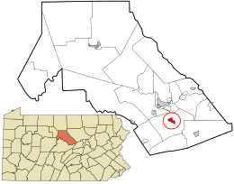 Location in Clinton County and the state of Pennsylvania. | |
| Coordinates: 41°04′44″N 77°25′12″W | |
| Country | United States |
| State | Pennsylvania |
| County | Clinton |
| Township | Lamar |
| Area | |
| • Total | 1.1 sq mi (2.8 km2) |
| • Land | 1.1 sq mi (2.8 km2) |
| • Water | 0.0 sq mi (0.0 km2) |
| Elevation | 755 ft (230 m) |
| Population (2010) | |
| • Total | 507 |
| • Density | 466/sq mi (179.9/km2) |
| Time zone | UTC-5 (Eastern (EST)) |
| • Summer (DST) | UTC-4 (EDT) |
| ZIP code | 17751 |
| FIPS code | 42-66384 |
| GNIS feature ID | 2630037 |
Rote is located near the center of Lamar Township in southern Clinton County, along Pennsylvania Route 477 near the northeastern end of the Nittany Valley. PA 477 leads west 3 miles (5 km) to U.S. Route 220 at Cedar Springs, and east 7 miles (11 km) to Exit 185 on Interstate 80 near Loganton. Exit 178 on I-80 is 2.5 miles (4.0 km) southwest of Rote, via a local road and US 220.
References
- "By Decade".
- "Geographic Identifiers: 2010 Census Summary File 1 (G001): Rote CDP, Pennsylvania". U.S. Census Bureau, American Factfinder. Archived from the original on February 13, 2020. Retrieved May 19, 2015.
External links
Municipalities and communities of Clinton County, Pennsylvania, United States | ||
|---|---|---|
County seat: Lock Haven | ||
| City |  | |
| Boroughs | ||
| Townships | ||
| CDPs | ||
| Other communities |
| |
| Footnotes | ‡This populated place also has portions in an adjacent county | |
| ||
This Clinton County, Pennsylvania state location article is a stub. You can help Wikipedia by expanding it. |
Текст в блоке "Читать" взят с сайта "Википедия" и доступен по лицензии Creative Commons Attribution-ShareAlike; в отдельных случаях могут действовать дополнительные условия.
Другой контент может иметь иную лицензию. Перед использованием материалов сайта WikiSort.org внимательно изучите правила лицензирования конкретных элементов наполнения сайта.
Другой контент может иметь иную лицензию. Перед использованием материалов сайта WikiSort.org внимательно изучите правила лицензирования конкретных элементов наполнения сайта.
2019-2026
WikiSort.org - проект по пересортировке и дополнению контента Википедии
WikiSort.org - проект по пересортировке и дополнению контента Википедии