world.wikisort.org - USA
Leidy Township is a township in Clinton County, Pennsylvania, United States. The population was 155 at the 2020 census,[2] down from 180 in 2010.[3] Kettle Creek State Park is located in Leidy Township.
Leidy Township, Pennsylvania | |
|---|---|
Township | |
 Leidy Township | |
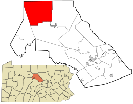 Location in Clinton County and the state of Pennsylvania. | |
| Country | United States |
| State | Pennsylvania |
| County | Clinton |
| Settled | 1813 |
| Incorporated | 1847 |
| Area | |
| • Total | 97.15 sq mi (251.61 km2) |
| • Land | 96.54 sq mi (250.04 km2) |
| • Water | 0.61 sq mi (1.57 km2) |
| Population (2020)[2] | |
| • Total | 155 |
| • Estimate (2021)[2] | 156 |
| • Density | 1.85/sq mi (0.72/km2) |
| Time zone | UTC-5 (EST) |
| • Summer (DST) | UTC-4 (EDT) |
| FIPS code | 42-035-42544 |
Geography
Leidy Township is in northern Clinton County and is bordered by Potter County to the north and partially by Cameron County to the west. According to the United States Census Bureau, the township has a total area of 97.1 square miles (251.6 km2), of which 96.5 square miles (250.0 km2) is land and 0.62 square miles (1.6 km2), or 0.62%, is water.[3]
Demographics
| Historical population | |||
|---|---|---|---|
| Census | Pop. | %± | |
| 1980 | 263 | — | |
| 1990 | 214 | −18.6% | |
| 2000 | 229 | 7.0% | |
| 2010 | 180 | −21.4% | |
| 2020 | 155 | −13.9% | |
| 2021 (est.) | 156 | [2] | 0.6% |
| source:[4][5] | |||
As of the census[6] of 2000, there were 229 people, 117 households, and 69 families residing in the township. The population density was 2.4 people per square mile (0.9/km2). There were 759 housing units at an average density of 7.8/sq mi (3.0/km2). The racial makeup of the township was 97.82% White, 1.31% Native American and 0.87% Asian.
There were 117 households, out of which 16.2% had children under the age of 18 living with them, 53.0% were married couples living together, 6.0% had a female householder with no husband present, and 40.2% were non-families. 35.9% of all households were made up of individuals, and 19.7% had someone living alone who was 65 years of age or older. The average household size was 1.96 and the average family size was 2.53.
In the township the population was spread out, with 13.5% under the age of 18, 3.5% from 18 to 24, 19.7% from 25 to 44, 39.3% from 45 to 64, and 24.0% who were 65 years of age or older. The median age was 52 years. For every 100 females, there were 112.0 males. For every 100 females age 18 and over, there were 106.3 males.
The median income for a household in the township was $33,125, and the median income for a family was $37,000. Males had a median income of $40,313 versus $16,875 for females. The per capita income for the township was $28,279. About 4.7% of families and 8.4% of the population were below the poverty line, including 23.1% of those under the age of eighteen and 3.4% of those sixty five or over.
References
- "2016 U.S. Gazetteer Files". United States Census Bureau. Retrieved Aug 13, 2017.
- Bureau, US Census. "City and Town Population Totals: 2020—2021". Census.gov. US Census Bureau. Retrieved August 7, 2022.
- "Geographic Identifiers: 2010 Census Summary File 1 (G001): Leidy township, Clinton County, Pennsylvania". U.S. Census Bureau, American Factfinder. Archived from the original on February 13, 2020. Retrieved May 18, 2015.
- "Clinton County Comprehensive Plan" (PDF). Clinton County, Pennsylvania. Archived from the original (PDF) on 2007-11-29. Retrieved 2007-09-19.
- "Population Change 1990–2000: Pennsylvania". Pennsylvania State Data Center. Archived from the original on 2007-11-17. Retrieved 2007-09-19.
- "U.S. Census website". United States Census Bureau. Retrieved 2008-01-31.
Municipalities and communities of Clinton County, Pennsylvania, United States | ||
|---|---|---|
County seat: Lock Haven | ||
| City |  | |
| Boroughs |
| |
| Townships | ||
| CDPs | ||
| Other communities |
| |
| Footnotes | ‡This populated place also has portions in an adjacent county | |
| ||
Другой контент может иметь иную лицензию. Перед использованием материалов сайта WikiSort.org внимательно изучите правила лицензирования конкретных элементов наполнения сайта.
WikiSort.org - проект по пересортировке и дополнению контента Википедии