world.wikisort.org - USA
Riva is a census-designated place (CDP) in Anne Arundel County, Maryland, United States. The population was 4,076 at the 2010 census.[2] The area is scenic, especially where the two-lane Riva Road crosses the South River on a bridge. The area is growing with large new homes as the suburbs of Annapolis grow outward. Riva is bordered by Annapolis to the north, Edgewater to the east, and Davidsonville to the west.
Riva, Maryland | |
|---|---|
Census-designated place | |
 Aerial view of Riva. | |
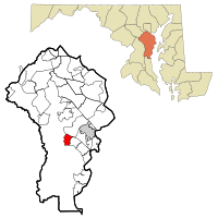 Location of Riva, Maryland | |
| Coordinates: 38°57′7″N 76°34′56″W | |
| Country | |
| State | |
| County | |
| Area | |
| • Total | 2.90 sq mi (7.52 km2) |
| • Land | 2.46 sq mi (6.36 km2) |
| • Water | 0.45 sq mi (1.16 km2) |
| Elevation | 43 ft (13 m) |
| Population (2020) | |
| • Total | 4,257 |
| • Density | 1,732.60/sq mi (669.08/km2) |
| Time zone | UTC−5 (Eastern (EST)) |
| • Summer (DST) | UTC−4 (EDT) |
| ZIP code | 21140 |
| Area code(s) | 410, 443, and 667 |
| FIPS code | 24-66400 |
| GNIS feature ID | 0591136 |
Currently Riva is served by Central Elementary School, Davidsonville Elementary School, Central Middle School, and South River High School in Edgewater, Maryland.
History
Aisquith Farm E Archeological Site was listed on the National Register of Historic Places in 1991.[3]
There have been several large developments made in Riva over the years.
Sylvan Shores
Riva Farms
Berkshire 1978 - 1981
Annapolis Landing 1979 -
Geography
Riva is located at 38°57′7″N 76°34′56″W (38.952079, −76.582135).[4]
According to the United States Census Bureau, the CDP has a total area of 2.9 square miles (7.5 km2), of which 2.5 square miles (6.4 km2) is land and 0.46 square miles (1.2 km2), or 15.37%, is water.[2]
Demographics
| Historical population | |||
|---|---|---|---|
| Census | Pop. | %± | |
| 2020 | 4,257 | — | |
| U.S. Decennial Census[5] | |||
As of the census[6] of 2000, there were 3,966 people, 1,423 households, and 1,169 families residing in the CDP. The population density was 1,589.0 people per square mile (612.5/km2). There were 1,453 housing units at an average density of 582.2/sq mi (224.4/km2). The racial makeup of the CDP was 94.23% White, 3.43% African American, 1.21% Asian, 0.15% from other races, and 0.98% from two or more races. Hispanic or Latino of any race were 2.12% of the population.
There were 1,423 households, out of which 37.6% had children under the age of 18 living with them, 72.1% were married couples living together, 6.3% had a female householder with no husband present, and 17.8% were non-families. 13.6% of all households were made up of individuals, and 4.1% had someone living alone who was 65 years of age or older. The average household size was 2.79 and the average family size was 3.07.
In the CDP, the population was spread out, with 26.1% under the age of 18, 5.1% from 18 to 24, 28.8% from 25 to 44, 32.0% from 45 to 64, and 7.9% who were 65 years of age or older. The median age was 39 years. For every 100 females, there were 102.1 males. For every 100 females age 18 and over, there were 98.3 males.
The median income for a household in the CDP was $88,287, and the median income for a family was $95,457. Males had a median income of $54,750 versus $36,122 for females. The per capita income for the CDP was $41,975. About 1.1% of families and 0.9% of the population were below the poverty line, including 1.2% of those under age 18 and 1.5% of those age 65 or over.
Notable people
- Peter Bondra, former NHL player, former general manager of the Slovakia men's national ice hockey team
Riva Businesses
Riva is primarily residential, but is home to a few small, locally owned businesses.
Mike's Crab House is located on Riva Road directly on the South River. This is by far the largest and most popular business in Riva. Mike's is known for its blue crabs and bar. It also has a deli, liquor store and sandwich shop. In addition small bait and tackle can be purchased for local fishing.
Next to Mike's was Paul's on the South River which was as a restaurant from the 1980s to 2010's. This was purchased by Mike's crab house and is now called Michael's on the South River. This is now a special event venue, now under the same ownership as Mike's Crab House. In the 80's through its closure it was considered a fine dining restaurant.
Both restaurants to this day suffer occasionally from extreme weather events which leads to flooding events. This type of flooding has occurred at least from the 1970s.
Riva Gardens is a local garden shop and produce stand, located on Riva Road.
The Riva Market (currently closed) was formerly a deli and small market. It was sold in 2017 and remains vacant. Riva also has a post office and a volunteer fire station.
References
- "2020 U.S. Gazetteer Files". United States Census Bureau. Retrieved April 26, 2022.
- "Geographic Identifiers: 2010 Demographic Profile Data (G001): Riva CDP, Maryland". U.S. Census Bureau, American Factfinder. Archived from the original on February 12, 2020. Retrieved June 3, 2013.
- "National Register Information System". National Register of Historic Places. National Park Service. April 15, 2008.
- "US Gazetteer files: 2010, 2000, and 1990". United States Census Bureau. 2011-02-12. Retrieved 2011-04-23.
- "Census of Population and Housing". Census.gov. Retrieved June 4, 2016.
- "U.S. Census website". United States Census Bureau. Retrieved 2008-01-31.

Mike's Crab House, Riva MD Riva Gardens, Riva MD
Другой контент может иметь иную лицензию. Перед использованием материалов сайта WikiSort.org внимательно изучите правила лицензирования конкретных элементов наполнения сайта.
WikiSort.org - проект по пересортировке и дополнению контента Википедии