world.wikisort.org - USA
Brooklyn Park is a census-designated place (CDP) in Anne Arundel County, Maryland, United States. The population was 14,373 at the 2010 census.[2]
Brooklyn Park, Maryland | |
|---|---|
Census-designated place | |
 View east along Maryland State Route 171 (Church Street) at Maryland State Route 2 (Governor Ritchie Highway) in Brooklyn Park. | |
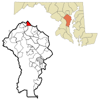 Location of Brooklyn Park, Maryland | |
| Coordinates: 39°13′29″N 76°36′46″W | |
| Country | |
| State | |
| County | |
| Area | |
| • Total | 4.27 sq mi (11.06 km2) |
| • Land | 4.21 sq mi (10.91 km2) |
| • Water | 0.06 sq mi (0.15 km2) |
| Elevation | 112 ft (34 m) |
| Population (2020) | |
| • Total | 16,112 |
| • Density | 3,826.17/sq mi (1,477.44/km2) |
| Time zone | UTC−5 (Eastern (EST)) |
| • Summer (DST) | UTC−4 (EDT) |
| FIPS code | 24-10475 |
| GNIS feature ID | 0589827 |
Geography
Brooklyn Park is located at 39°13′29″N 76°36′46″W (39.224857, −76.612655)[3] on the northern edge of Anne Arundel County and borders the city of Baltimore along its southern boundary of 1919. The CDP is bordered as well by Interstate 695 (the Baltimore Beltway) to the south, by Maryland Route 648 (Baltimore Annapolis Boulevard) to the west, and by the Patapsco River, which forms the Anne Arundel County/Baltimore County boundary, to the northwest.
According to the United States Census Bureau, the CDP has a total area of 4.3 square miles (11.1 km2), of which 4.2 square miles (10.9 km2) is land and 0.077 square miles (0.2 km2), or 1.65%, is water,[2] consisting largely of the Patapsco River and associated wetlands.
Within the Baltimore city limits, adjacent to the CDP, are the older neighborhoods of Brooklyn (founded 1853), Curtis Bay (development proposed in 1874, buildings began in 1889), and several smaller communities that are now defunct: Fairfield, Masonville, Wagner's Point (also known as East Brooklyn), Arundel Cove, and Hawkins Point.
The Brooklyn Park CDP in Anne Arundel County is composed of several smaller neighborhoods: old Brooklyn Park (west of Gov. Ritchie Highway - Maryland Route 2), Brooklyn Heights (east of Gov. Ritchie Highway), Arundel Village (along and north of Church Street), Roland Terrace (along and south of Church Street), Arundel Gardens (southwest of Gov. Ritchie Highway and south of Hammonds Lane), and Pumphrey, which lies along Belle Grove Road, south of the Patapsco River.
A History of Brooklyn-Curtis Bay, of approximately 200 pages, was published in September 1976, in celebration of the American Bicentennial by the members of the Brooklyn-Curtis Bay Historical Committee.[4] Brooklyn Park has many different types of buildings such as schools and senior centers.
Demographics
| Historical population | |||
|---|---|---|---|
| Census | Pop. | %± | |
| 1970 | 13,896 | — | |
| 1980 | 11,508 | −17.2% | |
| 1990 | 10,987 | −4.5% | |
| 2000 | 10,938 | −0.4% | |
| 2010 | 14,373 | 31.4% | |
| 2020 | 16,112 | 12.1% | |
| source:[5][6] | |||
As of the census[7] of 2000, there were 10,938 people, 4,093 households, and 2,910 families residing in the CDP. The population density was 3,701.0 inhabitants per square mile (1,429.0/km2). There were 4,311 housing units at an average density of 1,458.7 per square mile (563.2/km2). The racial makeup of the CDP was 92.15% White, 4.21% African American, 0.48% Native American, 1.50% Asian, 0.04% Pacific Islander, 0.58% from other races, and 1.05% from two or more races. Hispanic or Latino of any race were 1.59% of the population.
There were 4,093 households, out of which 30.6% had children under the age of 18 living with them, 50.2% were married couples living together, 15.1% had a female householder with no husband present, and 28.9% were non-families. 22.8% of all households were made up of individuals, and 11.2% had someone living alone who was 65 years of age or older. The average household size was 2.67 and the average family size was 3.10.
In the CDP, the population was spread out, with 24.9% under the age of 18, 8.0% from 18 to 24, 28.9% from 25 to 44, 22.2% from 45 to 64, and 16.0% who were 65 years of age or older. The median age was 38 years. For every 100 females, there were 94.8 males. For every 100 females age 18 and over, there were 90.5 males.
The median income for a household in the CDP was $42,207, and the median income for a family was $50,496. Males had a median income of $33,476 versus $26,316 for females. The per capita income for the CDP was $18,582. About 6.6% of families and 8.0% of the population were below the poverty line, including 13.5% of those under age 18 and 6.3% of those age 65 or over.
By the 2010 census,[8] the local population had grown and changed substantially. In 2010 Brooklyn Park had 14,373 people, 5,158 households and 3,634 families. The racial makeup of the CDP was 76.8% White, 18.6% African American, 6% Latino, and 3.4% Asian (NB: some Latinos had responded as both Latino and white).
See also
References
- "2020 U.S. Gazetteer Files". United States Census Bureau. Retrieved April 26, 2022.
- "Geographic Identifiers: 2010 Demographic Profile Data (G001): Brooklyn Park CDP, Maryland". U.S. Census Bureau, American Factfinder. Archived from the original on February 12, 2020. Retrieved May 29, 2013.
- "US Gazetteer files: 2010, 2000, and 1990". United States Census Bureau. 2011-02-12. Retrieved 2011-04-23.
- A History of Brooklyn-Curtis Bay, September 1976. Brooklyn-Curtis Bay Historical Committee, Hubert J. McCormick, general chairman; ed. Duane E. Tressler. 200 pp., illustrated
- "CENSUS OF POPULATION AND HOUSING (1790-2000)". U.S. Census Bureau. Retrieved 2010-07-17.
- Census area returned as Brooklyn in 1970.
- "U.S. Census website". United States Census Bureau. Retrieved 2008-01-31.
- "U.S. Census website". United States Census Bureau. Retrieved 2015-11-18.
External links

На других языках
[de] Brooklyn Park (Maryland)
Brooklyn Park ist ein Census-designated place in Anne Arundel County im US-Bundesstaat Maryland und ein Vorort von Baltimore.- [en] Brooklyn Park, Maryland
Другой контент может иметь иную лицензию. Перед использованием материалов сайта WikiSort.org внимательно изучите правила лицензирования конкретных элементов наполнения сайта.
WikiSort.org - проект по пересортировке и дополнению контента Википедии