world.wikisort.org - USA
Rhodelia is a rural unincorporated community in Meade County, Kentucky, United States. It is a small community that lies a few miles west of Brandenburg on KY 144 near its intersection with Rhodes Road and south of KY 144's intersection with KY 259.
Rhodelia, Kentucky | |
|---|---|
Unincorporated community | |
 Rhodelia Location within the state of Kentucky  Rhodelia Rhodelia (the United States) | |
| Coordinates: 38°00′25″N 86°25′14″W | |
| Country | United States |
| State | Kentucky |
| County | Meade |
| Elevation | 646 ft (197 m) |
| Time zone | UTC-5 (Eastern (EST)) |
| • Summer (DST) | UTC-4 (EST) |
| GNIS feature ID | 508929[1] |
History
A post office called Rhodelia was established in 1879.[2] The community was named for Elias Rhodes, a pioneer settler.[3]
Near Rhodelia is St. Theresa Roman Catholic Church, listed on the National Register of Historic Places.
References
- U.S. Geological Survey Geographic Names Information System: Rhodelia, Kentucky
- "Meade County". Jim Forte Postal History. Retrieved 25 December 2015.
- Rennick, Robert M. Kentucky Place Names. University Press of Kentucky. p. 250. ISBN 0-8131-2631-2.
Municipalities and communities of Meade County, Kentucky, United States | ||
|---|---|---|
County seat: Brandenburg | ||
| Cities | 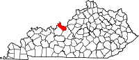 | |
| CDPs |
| |
| Unincorporated communities |
| |
| Footnotes | ‡This populated place also has portions in an adjacent county or counties | |
| ||
This Meade County, Kentucky state location article is a stub. You can help Wikipedia by expanding it. |
Текст в блоке "Читать" взят с сайта "Википедия" и доступен по лицензии Creative Commons Attribution-ShareAlike; в отдельных случаях могут действовать дополнительные условия.
Другой контент может иметь иную лицензию. Перед использованием материалов сайта WikiSort.org внимательно изучите правила лицензирования конкретных элементов наполнения сайта.
Другой контент может иметь иную лицензию. Перед использованием материалов сайта WikiSort.org внимательно изучите правила лицензирования конкретных элементов наполнения сайта.
2019-2026
WikiSort.org - проект по пересортировке и дополнению контента Википедии
WikiSort.org - проект по пересортировке и дополнению контента Википедии