world.wikisort.org - USA
Doe Valley is an unincorporated community and census-designated place in Meade County, Kentucky, United States. Its population was 1,931 as of the 2010 census.[3]
Doe Valley, Kentucky | |
|---|---|
Census-designated place | |
 Doe Valley, Kentucky  Doe Valley, Kentucky | |
| Coordinates: 37°57′24″N 86°07′00″W | |
| Country | United States |
| State | Kentucky |
| County | Meade |
| Government | |
| • Type | Homeowners Association |
| Area | |
| • Total | 4.63 sq mi (12.00 km2) |
| • Land | 4.06 sq mi (10.51 km2) |
| • Water | 0.57 sq mi (1.48 km2) |
| Elevation | 607 ft (185 m) |
| Population (2020) | |
| • Total | 2,270 |
| • Density | 559.11/sq mi (215.89/km2) |
| Time zone | UTC-5 (Eastern (EST)) |
| • Summer (DST) | UTC-4 (EDT) |
| Area code(s) | 270 |
| FIPS code | 21-21844 |
| GNIS feature ID | 2631652[2] |
| Website | http://doevalley.org/ |
Doe Valley was originally conceived as a planned residential community in 1965.[4]
Geography
According to the U.S. Census Bureau, the community has an area of 4.631 square miles (11.99 km2); 4.059 square miles (10.51 km2) of its area is land, and 0.572 square miles (1.48 km2) is water.[3]
Demographics
| Historical population | |||
|---|---|---|---|
| Census | Pop. | %± | |
| 2020 | 2,270 | — | |
| U.S. Decennial Census[5] | |||
References
- "2020 U.S. Gazetteer Files". United States Census Bureau. Retrieved March 18, 2022.
- "Doe Valley". Geographic Names Information System. United States Geological Survey.
- "2010 Census Gazetteer Files - Places: Kentucky". U.S. Census Bureau. Retrieved April 2, 2017.
- "History". Retrieved 2020-02-14.
- "Census of Population and Housing". Census.gov. Retrieved June 4, 2016.
Municipalities and communities of Meade County, Kentucky, United States | ||
|---|---|---|
County seat: Brandenburg | ||
| Cities | 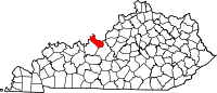 | |
| CDPs |
| |
| Unincorporated communities |
| |
| Footnotes | ‡This populated place also has portions in an adjacent county or counties | |
| ||
This Meade County, Kentucky state location article is a stub. You can help Wikipedia by expanding it. |
Текст в блоке "Читать" взят с сайта "Википедия" и доступен по лицензии Creative Commons Attribution-ShareAlike; в отдельных случаях могут действовать дополнительные условия.
Другой контент может иметь иную лицензию. Перед использованием материалов сайта WikiSort.org внимательно изучите правила лицензирования конкретных элементов наполнения сайта.
Другой контент может иметь иную лицензию. Перед использованием материалов сайта WikiSort.org внимательно изучите правила лицензирования конкретных элементов наполнения сайта.
2019-2026
WikiSort.org - проект по пересортировке и дополнению контента Википедии
WikiSort.org - проект по пересортировке и дополнению контента Википедии