world.wikisort.org - USA
Randolph County is a county located in the U.S. state of West Virginia. As of the 2020 census, the population was 27,932.[1] Its county seat is Elkins.[2] The county was founded in 1787 and is named for Edmund Jennings Randolph.[3]
Randolph County | |
|---|---|
U.S. county | |
 Randolph County Courthouse in Elkins | |
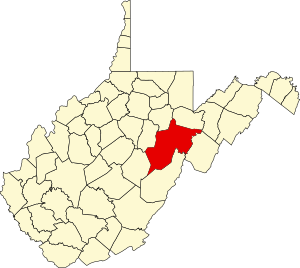 Location within the U.S. state of West Virginia | |
 West Virginia's location within the U.S. | |
| Coordinates: 38°47′N 79°52′W | |
| Country | |
| State | |
| Founded | October 16, 1787 |
| Named for | Edmund Jennings Randolph |
| Seat | Elkins |
| Largest city | Elkins |
| Area | |
| • Total | 1,040 sq mi (2,700 km2) |
| • Land | 1,040 sq mi (2,700 km2) |
| • Water | 0.3 sq mi (0.8 km2) 0.03%% |
| Population (2020) | |
| • Total | 27,932 |
| • Estimate (2021) | 27,806 |
| • Density | 27/sq mi (10/km2) |
| Time zone | UTC−5 (Eastern) |
| • Summer (DST) | UTC−4 (EDT) |
| Congressional district | 2nd |
| Website | elkinsrandolphwv |
Randolph County comprises the Elkins, West Virginia, Micropolitan Statistical Area.
History
The first attempt by whites at settlement in present-day Randolph County came in 1752 or '53 when David Tygart — for whom the Tygart Valley River was named — and Robert Foyle (later called Files) located (separately) with their families in the vicinity of present-day Beverly. Although there had been no recent history of conflicts between whites and Indians in that immediate area, that summer a party of Indians traveling the Shawnee Trail discovered the Foyle cabin and killed seven members of the family. One son escaped and alerted the Tygart family, allowing all to escape. (The Tygart-Foyle settlements were the first white settlements attempted anywhere within the Monongahela River watershed in present-day West Virginia.) No other white settlement was attempted in present Randolph until 1772.[4][5]
Thomas Skidmore (ca. 1733–1807), born in Maryland, obtained a title to 400 acres of land (“by virtue of a settlement”) in the future Elkins area before 1778. This land, on the east side of the Tygart Valley River, was surveyed by John Poage in 1780 and included the land that is now most of downtown Elkins. Thus, Skidmore was probably the first white settler in what became Elkins. [6]
When Randolph County, Virginia (now West Virginia) was created out of the vast Harrison County on October 16, 1787, it included not only present-day Randolph County, but parts of what are now eight other counties.[7] It took its name from the surname of the then Governor of Virginia. The name of the new county seat, originally Randolph Court House, or Edmundton (the latter from the Governor's given name), was changed to Beverly by 1790.[8] Beverly remained the county seat until 1890 when county government was moved to Elkins.
Minor actions of the American Civil War which took place in Randolph County include the Battle of Rich Mountain and a part of the Battle of Cheat Mountain, both in 1861. These operations came in the course of the Western Virginia Campaign.
Randolph was one of fifty Virginia counties that were admitted to the Union as the state of West Virginia on June 20, 1863. Later that year, the new state's counties were divided into civil townships, with the intention of encouraging local government. This proved impractical in the heavily rural state, and in 1872 the townships were converted into magisterial districts.[9] Randolph County was divided into nine districts: Beverly, Clarke, Clay, Dry Fork, Green, Mingo Flats, Reynolds, Scott, and Union. Several of these were renamed during the 1870s: Clark became Valley Bend, Clay became New Interest, Green became Leadsville, Mingo Flats was abbreviated to Mingo, Reynolds became Huttonsville, Scott became Roaring Creek, and Union became Middle Fork.[10]
Geography


According to the United States Census Bureau, the county has a total area of 1,040 square miles (2,700 km2), of which 1,040 square miles (2,700 km2) is land and 0.3 square miles (0.78 km2) (0.03%) is water.[11] It is the largest county in West Virginia by area.
Rivers
- Tygart Valley River
- Shavers Fork
- Laurel Fork
Mountains
- Point Mountain
- Cheat Mountain
- White Top, a knob of Cheat Mountain
- Laurel Mountain
- Rich Mountain
- Shavers Mountain
- Gaudineer Knob, a knob of Shavers Mountain
Caves and caverns
- Bowden Cave
- Sinks of Gandy
National Natural Landmarks
- Blister Run Swamp
- Gaudineer Scenic Area
- Shavers Mountain Spruce-Hemlock Stand
Major highways
|
|
Adjacent counties
- Tucker County (northeast)
- Pendleton County (east)
- Pocahontas County (south)
- Webster County (southwest)
- Upshur County (west)
- Barbour County (northwest)
National protected area
- Monongahela National Forest (part)
- United States National Radio Quiet Zone (part)
Demographics
| Historical population | |||
|---|---|---|---|
| Census | Pop. | %± | |
| 1790 | 951 | — | |
| 1800 | 1,826 | 92.0% | |
| 1810 | 2,854 | 56.3% | |
| 1820 | 3,357 | 17.6% | |
| 1830 | 5,000 | 48.9% | |
| 1840 | 6,208 | 24.2% | |
| 1850 | 5,243 | −15.5% | |
| 1860 | 4,990 | −4.8% | |
| 1870 | 5,563 | 11.5% | |
| 1880 | 8,102 | 45.6% | |
| 1890 | 11,633 | 43.6% | |
| 1900 | 17,670 | 51.9% | |
| 1910 | 26,028 | 47.3% | |
| 1920 | 26,084 | 0.2% | |
| 1930 | 25,049 | −4.0% | |
| 1940 | 30,259 | 20.8% | |
| 1950 | 30,558 | 1.0% | |
| 1960 | 26,349 | −13.8% | |
| 1970 | 24,596 | −6.7% | |
| 1980 | 28,734 | 16.8% | |
| 1990 | 27,803 | −3.2% | |
| 2000 | 28,262 | 1.7% | |
| 2010 | 29,405 | 4.0% | |
| 2020 | 27,932 | −5.0% | |
| 2021 (est.) | 27,806 | [12] | −0.5% |
| U.S. Decennial Census[13] 1790–1960[14] 1900–1990[15] 1990–2000[16] 2010–2020[1] | |||
2000 census
As of the census of 2000, there were 28,262 people, 11,072 households, and 7,661 families living in the county. The population density was 27 people per square mile (10/km2). There were 13,478 housing units at an average density of 13 per square mile (5/km2). The racial makeup of the county was 97.69% White, 1.07% Black or African American, 0.16% Native American, 0.38% Asian, 0.01% Pacific Islander, 0.16% from other races, and 0.53% from two or more races. 0.68% of the population were Hispanic or Latino of any race.
There were 11,072 households, out of which 29.80% had children under the age of 18 living with them, 54.70% were married couples living together, 9.80% had a female householder with no husband present, and 30.80% were non-families. 26.30% of all households were made up of individuals, and 11.90% had someone living alone who was 65 years of age or older. The average household size was 2.41 and the average family size was 2.89.
In the county, the population was spread out, with 22.30% under the age of 18, 8.70% from 18 to 24, 28.50% from 25 to 44, 25.40% from 45 to 64, and 15.10% who were 65 years of age or older. The median age was 39 years. For every 100 females there were 101.30 males. For every 100 females age 18 and over, there were 99.70 males.
The median income for a household in the county was $27,299, and the median income for a family was $32,632. Males had a median income of $24,751 versus $17,819 for females. The per capita income for the county was $14,918. About 13.40% of families and 18.00% of the population were below the poverty line, including 24.30% of those under age 18 and 12.90% of those age 65 or over.
2010 census
As of the 2010 United States census, there were 29,405 people, 11,695 households, and 7,753 families living in the county.[17] The population density was 28.3 inhabitants per square mile (10.9/km2). There were 14,189 housing units at an average density of 13.6 per square mile (5.3/km2).[18] The racial makeup of the county was 97.3% white, 1.2% black or African American, 0.3% Asian, 0.2% American Indian, 0.1% from other races, and 0.8% from two or more races. Those of Hispanic or Latino origin made up 0.7% of the population.[17] In terms of ancestry, 26.3% were German, 15.9% were Irish, 12.0% were English, 10.2% were American, and 5.4% were Italian.[19]
Of the 11,695 households, 27.1% had children under the age of 18 living with them, 51.0% were married couples living together, 10.5% had a female householder with no husband present, 33.7% were non-families, and 28.4% of all households were made up of individuals. The average household size was 2.32 and the average family size was 2.81. The median age was 43.4 years.[17]
The median income for a household in the county was $36,176 and the median income for a family was $47,071. Males had a median income of $34,903 versus $25,988 for females. The per capita income for the county was $18,472. About 12.7% of families and 17.1% of the population were below the poverty line, including 26.1% of those under age 18 and 11.4% of those age 65 or over.[20]
Politics
| Year | Republican | Democratic | Third parties |
|---|---|---|---|
| 2020 | 71.1% 8,673 | 27.6% 3,362 | 1.3% 165 |
| 2016 | 69.6% 7,629 | 24.9% 2,735 | 5.5% 605 |
| 2012 | 63.0% 6,160 | 34.2% 3,342 | 2.8% 276 |
| 2008 | 55.9% 6,060 | 41.9% 4,539 | 2.2% 234 |
| 2004 | 56.7% 6,512 | 42.6% 4,892 | 0.8% 86 |
| 2000 | 55.0% 5,248 | 42.2% 4,028 | 2.8% 266 |
| 1996 | 33.2% 3,348 | 54.2% 5,469 | 12.6% 1,272 |
| 1992 | 34.2% 3,496 | 49.9% 5,097 | 15.9% 1,629 |
| 1988 | 47.4% 4,746 | 52.2% 5,233 | 0.4% 38 |
| 1984 | 55.6% 6,100 | 44.1% 4,839 | 0.2% 25 |
| 1980 | 40.1% 4,374 | 54.4% 5,937 | 5.6% 610 |
| 1976 | 39.9% 4,822 | 60.1% 7,265 | |
| 1972 | 64.5% 6,923 | 35.5% 3,809 | |
| 1968 | 41.1% 4,508 | 50.7% 5,562 | 8.2% 897 |
| 1964 | 27.1% 2,984 | 72.9% 8,012 | |
| 1960 | 41.8% 5,018 | 58.2% 6,989 | |
| 1956 | 48.9% 5,448 | 51.1% 5,697 | |
| 1952 | 43.9% 5,452 | 56.1% 6,976 | |
| 1948 | 36.5% 3,802 | 63.3% 6,586 | 0.2% 24 |
| 1944 | 36.9% 3,681 | 63.1% 6,299 | |
| 1940 | 33.1% 4,196 | 66.9% 8,465 | |
| 1936 | 31.3% 3,711 | 68.5% 8,109 | 0.2% 22 |
| 1932 | 31.3% 3,418 | 67.7% 7,397 | 1.0% 108 |
| 1928 | 46.2% 4,436 | 53.0% 5,085 | 0.8% 76 |
| 1924 | 36.6% 3,526 | 55.1% 5,314 | 8.3% 797 |
| 1920 | 46.1% 4,158 | 51.9% 4,676 | 2.0% 184 |
| 1916 | 39.8% 2,165 | 55.6% 3,024 | 4.7% 253 |
| 1912 | 14.8% 756 | 50.3% 2,563 | 34.9% 1,782 |
Communities

City
- Elkins (county seat)
Towns
Magisterial districts
- Beverly
- Dry Fork
- Huttonsville
- Leadsville
- Middle Fork
- Mingo
- New Interest
- Roaring Creek
- Valley Bend
Census-designated places
Unincorporated communities
- Adolph
- Aggregates
- Alpena
- Arnold Hill
- Bemis
- Brady Gate
- Bruxton
- Canfield
- Cassity
- Crystal Springs
- Czar
- Dryfork
- Elkins Junction
- Elkwater
- Ellamore
- Evenwood
- Faulkner
- Glady
- Horton
- Jimtown
- Kerens
- Little Italy
- Mabie
- Mingo
- Monterville
- Newlonton
- Norton
- Osceola
- Pumpkintown
- Read
- Spangler
- Sullivan
- Tigheville
- Upper Mingo
- Weaver
- Whyte
Notable people
- Herman Ball, football player
- Lemuel Chenoweth, master covered bridge builder
- William Wallace Barron, former governor who was indicted for bribery and jury tampering.
- Dellos Clinton "Sheriff" Gainer, major league baseball player
- Marshall Goldberg, football player
- Wilma Lee Cooper Grand Ole Opry and WWVA Jamboree star
- Stoney Cooper, Grand Ole Opry and WWVA Jamboree star
- Eldora Marie Bolyard Nuzum, American newspaper editor and interviewer of U.S. Presidents
See also
- Becky Creek Wildlife Management Area
- National Register of Historic Places listings in Randolph County, West Virginia
References
- "State & County QuickFacts". United States Census Bureau. Retrieved October 19, 2022.
- "Find a County". National Association of Counties. Retrieved June 7, 2011.
- "Randolph County history sources". Archived from the original on October 29, 2013. Retrieved November 26, 2014.
- It has been thought that Tygart was again among those settling then, but this is not certain.
- Maxwell, Hu (1899). The History of Barbour County, From its Earliest Exploration and Settlement to the Present Time, The Acme Publishing Company, Morgantown, W.Va. (Reprinted, McClain Printing Company, Parsons, W.Va., 1968). pp. 180–181.
- “He obtained a clear title to 400 acres of land by virtue of a settlement made before 1778 on the east side of the Tygart Valley River, adjoining the land of Robert Cunningham. It was surveyed by John Poage on 14 November 1780, who with his chain carriers set off the tract as 288 acres, and on 1 June 1782 a perfected title to the land was returned to him from the Land Office. It included the land that is now most of downtown Elkins, the park, the Wees Addition, both sides of the river from roughly the rear entrance of McDonald's Restaurant to Porter Avenue, South Elkins north of 11th Street, and all of Diamond and Wees Street. David Armstrong, who has made a careful study of the early land titles in Elkins, thinks that his cabin stood on the west side of Randolph Avenue at its intersection with Henry Avenue where St. Brendan's Catholic School was later located. He credits Thomas Skidmore with being the first white settler in central Elkins. He does not seem to have made an immediate settlement at Elkins however, for he appears in 1784 on a tax list taken on the South Branch in Pendleton County where he headed a family of seven white souls.” (Skidmore, Warren (2010), Thomas Skidmore (Scudamore), 1605-1684, of Westerleigh, Gloucestershire, and Fairfield, Connecticut; his ancestors, and descendants to the ninth generation; Akron, Ohio; Sixth Edition; pg 143.)
- These current counties are Upshur, Braxton, Pocohontas, Preston, Barbour, Tucker, Lewis and Webster.
- Kenny, Hamill (1945). West Virginia Place Names: Their Origin and Meaning, Including the Nomenclature of the Streams and Mountains. Piedmont, WV: The Place Name Press. p. 110.
- Otis K. Rice & Stephen W. Brown, West Virginia: A History, 2nd ed., University Press of Kentucky, Lexington (1993), p. 240.
- United States Census Bureau, U.S. Decennial Census, Tables of Minor Civil Divisions in West Virginia, 1870–2010.
- "2010 Census Gazetteer Files". United States Census Bureau. August 22, 2012. Retrieved July 30, 2015.
- "Annual Estimates of the Resident Population for Counties: April 1, 2020 to July 1, 2021". Retrieved October 19, 2022.
- "U.S. Decennial Census". United States Census Bureau. Retrieved January 11, 2014.
- "Historical Census Browser". University of Virginia Library. Retrieved January 11, 2014.
- "Population of Counties by Decennial Census: 1900 to 1990". United States Census Bureau. Retrieved January 11, 2014.
- "Census 2000 PHC-T-4. Ranking Tables for Counties: 1990 and 2000" (PDF). United States Census Bureau. Archived (PDF) from the original on October 9, 2022. Retrieved January 11, 2014.
- "DP-1 Profile of General Population and Housing Characteristics: 2010 Demographic Profile Data". United States Census Bureau. Archived from the original on February 13, 2020. Retrieved April 3, 2016.
- "Population, Housing Units, Area, and Density: 2010 - County". United States Census Bureau. Archived from the original on February 13, 2020. Retrieved April 3, 2016.
- "DP02 SELECTED SOCIAL CHARACTERISTICS IN THE UNITED STATES – 2006-2010 American Community Survey 5-Year Estimates". United States Census Bureau. Archived from the original on February 13, 2020. Retrieved April 3, 2016.
- "DP03 SELECTED ECONOMIC CHARACTERISTICS – 2006-2010 American Community Survey 5-Year Estimates". United States Census Bureau. Archived from the original on February 13, 2020. Retrieved April 3, 2016.
- Leip, David. "Dave Leip's Atlas of U.S. Presidential Elections". uselectionatlas.org. Retrieved March 28, 2018.
Places adjacent to Randolph County, West Virginia | ||||||||||||||||
|---|---|---|---|---|---|---|---|---|---|---|---|---|---|---|---|---|
| ||||||||||||||||
Municipalities and communities of Randolph County, West Virginia, United States | ||
|---|---|---|
County seat: Elkins | ||
| City |  | |
| Towns | ||
| CDPs | ||
| Other communities |
| |
| Ghost towns | ||
| Footnotes | ‡This populated place also has portions in an adjacent county or counties | |
| ||
State of West Virginia | |
|---|---|
Charleston (capital) | |
| Topics |
|
| Society |
|
| Insignia |
|
| Regions |
|
| Metro areas |
|
| Largest cities | |
| Counties |
|
Authority control | |
|---|---|
| General | |
| National libraries | |
| Other |
|
На других языках
[de] Randolph County (West Virginia)
Randolph County[1] ist ein County im Bundesstaat West Virginia der Vereinigten Staaten. Der Verwaltungssitz (County Seat) ist Elkins.- [en] Randolph County, West Virginia
[ru] Рандолф (округ, Западная Виргиния)
Округ Рандолф (англ. Randolph County) расположен в США, штат Западная Виргиния. Официально образован 16-го октября 1787 года, получил своё название в честь американского политического и государственного деятеля, 2-го Государственного секретаря США Эдмунда Рэндольфа. По состоянию на 2012 год, численность населения составляла 29 384 человек.Другой контент может иметь иную лицензию. Перед использованием материалов сайта WikiSort.org внимательно изучите правила лицензирования конкретных элементов наполнения сайта.
WikiSort.org - проект по пересортировке и дополнению контента Википедии