world.wikisort.org - USA
Powhattan Township is a township in Brown County, Kansas, USA. As of the 2000 census, its population was 874.
Powhattan Township | |
|---|---|
Township | |
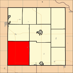 Location in Brown County | |
| Coordinates: 39°42′48″N 095°41′11″W | |
| Country | United States |
| State | Kansas |
| County | Brown |
| Area | |
| • Total | 89.82 sq mi (232.63 km2) |
| • Land | 89.76 sq mi (232.49 km2) |
| • Water | 0.05 sq mi (0.14 km2) 0.06% |
| Elevation | 1,096 ft (334 m) |
| Population (2000) | |
| • Total | 874 |
| • Density | 9.7/sq mi (3.8/km2) |
| GNIS feature ID | 0472964 |
Geography
Powhattan Township covers an area of 89.82 square miles (232.6 km2) and contains one incorporated settlement, Powhattan. According to the USGS, it contains two cemeteries: Powhattan and Powhattan.
The streams of Plum Creek, Pony Creek, Roys Creek and Squaw Creek run through this township.
Transportation
Powhattan Township contains one airport or landing strip, Croxton Airport.
References
External links
Municipalities and communities of Brown County, Kansas, United States | ||
|---|---|---|
County seat: Hiawatha | ||
| Cities |  | |
| Unincorporated communities |
| |
| Indian reservations |
| |
| Townships | ||
| Footnotes | †This community is designated a Census-Designated Place (CDP) by the United States Census Bureau. ‡This community also has portions in an adjacent county or counties. | |
| ||
Текст в блоке "Читать" взят с сайта "Википедия" и доступен по лицензии Creative Commons Attribution-ShareAlike; в отдельных случаях могут действовать дополнительные условия.
Другой контент может иметь иную лицензию. Перед использованием материалов сайта WikiSort.org внимательно изучите правила лицензирования конкретных элементов наполнения сайта.
Другой контент может иметь иную лицензию. Перед использованием материалов сайта WikiSort.org внимательно изучите правила лицензирования конкретных элементов наполнения сайта.
2019-2026
WikiSort.org - проект по пересортировке и дополнению контента Википедии
WikiSort.org - проект по пересортировке и дополнению контента Википедии