world.wikisort.org - USA
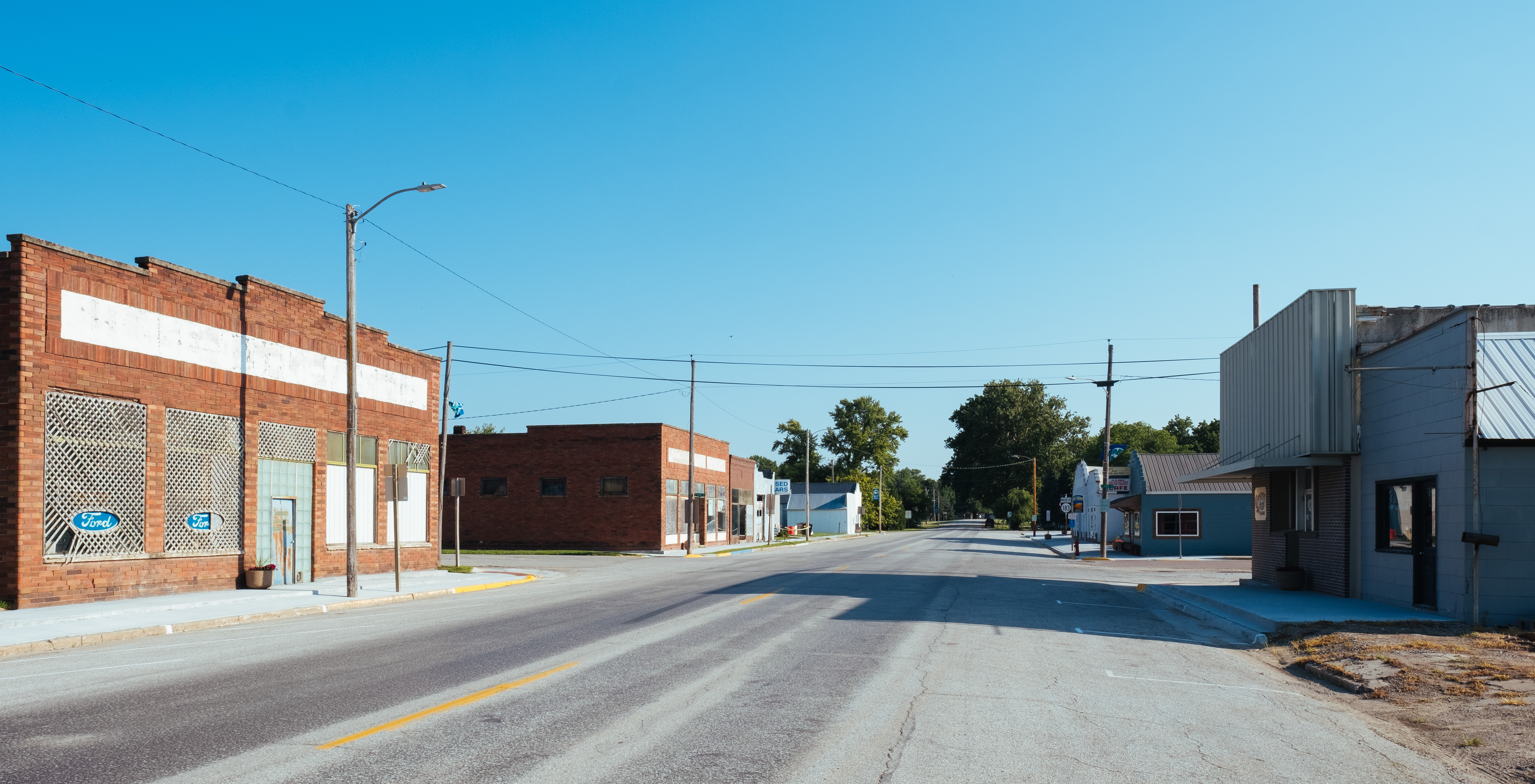
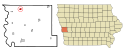
Pisgah is a city in Harrison County, Iowa, United States, along the Soldier River. The community is located in the midst of the Loess Hills. The population was 249 at the time of the 2020 census.[2]
Pisgah, Iowa | |
|---|---|
City | |
 | |
 | |
 Pisgah Location within Iowa  Pisgah Location within the United States | |
| Coordinates: 41°49′58″N 95°55′35″W | |
| Country | United States |
| State | Iowa |
| County | Harrison |
| Township | Jackson |
| Area | |
| • Total | 0.50 sq mi (1.30 km2) |
| • Land | 0.50 sq mi (1.30 km2) |
| • Water | 0.00 sq mi (0.00 km2) |
| Elevation | 1,060 ft (323 m) |
| Population (2020) | |
| • Total | 249 |
| • Density | 498.00/sq mi (192.12/km2) |
| Time zone | UTC-6 (Central (CST)) |
| • Summer (DST) | UTC-5 (CDT) |
| ZIP code | 51564 |
| Area code | 712 |
| FIPS code | 19-63075 |
| GNIS feature ID | 0460192 |
History
Pisgah was laid out in 1899.[3] The town's name is a biblical one chosen by members of The Church of Jesus Christ of Latter-day Saints (Mormons), who established a temporary settlement in central Iowa near a hill they christened Mount Pisgah. A post office called Pisgah has been in operation since 1902.[4]
Geography
Pisgah is located at 41°49′58″N 95°55′35″W (41.832684, -95.926464).[5]
According to the United States Census Bureau, the city has a total area of 1.01 square miles (2.62 km2), all of it land.[6]
Demographics
| Year | Pop. | ±% |
|---|---|---|
| 1910 | 212 | — |
| 1920 | 421 | +98.6% |
| 1930 | 400 | −5.0% |
| 1940 | 397 | −0.7% |
| 1950 | 327 | −17.6% |
| 1960 | 343 | +4.9% |
| 1970 | 286 | −16.6% |
| 1980 | 307 | +7.3% |
| 1990 | 268 | −12.7% |
| 2000 | 316 | +17.9% |
| 2010 | 251 | −20.6% |
| 2020 | 249 | −0.8% |
| Source:"U.S. Census website". United States Census Bureau. Retrieved 2020-03-29. and Iowa Data Center Source: | ||
2010 census
At the 2010 census there were 251 people, 121 households, and 66 families living in the city. The population density was 248.5 inhabitants per square mile (95.9/km2). There were 143 housing units at an average density of 141.6 per square mile (54.7/km2). The racial makeup of the city was 97.6% White, 0.8% Native American, and 1.6% from two or more races. Hispanic or Latino people of any race were 3.2%.[8]
Of the 121 households 21.5% had children under the age of 18 living with them, 37.2% were married couples living together, 14.0% had a female householder with no husband present, 3.3% had a male householder with no wife present, and 45.5% were non-families. 43.8% of households were one person and 24% were one person aged 65 or older. The average household size was 2.07 and the average family size was 2.83.
The median age was 48.2 years. 23.1% of residents were under the age of 18; 5.3% were between the ages of 18 and 24; 16.8% were from 25 to 44; 30% were from 45 to 64; and 25.1% were 65 or older. The gender makeup of the city was 46.2% male and 53.8% female.
2000 census
At the 2000 census there were 316 people, 143 households, and 84 families living in the city. The population density was 314.4 inhabitants per square mile (121.4/km2). There were 147 housing units at an average density of 146.2 per square mile (56.4/km2). The racial makeup of the city was 99.05% White, 0.32% Native American, 0.32% Asian, and 0.32% from two or more races. Hispanic or Latino people of any race were 0.63%.[9]
Of the 143 households 24.5% had children under the age of 18 living with them, 51.0% were married couples living together, 7.0% had a female householder with no husband present, and 40.6% were non-families. 36.4% of households were one person and 25.2% were one person aged 65 or older. The average household size was 2.21 and the average family size was 2.89.
26.6% of the people are under the age of 18, 1.9% from 18 to 24, 21.2% from 25 to 44, 21.2% from 45 to 64, and 29.1% 65 or older. The median age was 45 years. For every 100 females, there were 83.7 males. For every 100 females age 18 and over, there were 88.6 males.
The median household income was $26,125 and the median family income was $37,292. Males had a median income of $27,250 versus $17,500 for females. The per capita income for the city was $13,837. About 10.8% of families and 15.5% of the population were below the poverty line, including 16.4% of those under age 18 and 18.0% of those age 65 or over.
Education
It is within the West Harrison Community School District.[10]
Notable people
- James Allen, Mormon Battalion organizer
- Loren Babe, Major League Baseball third baseman
References
- "2020 U.S. Gazetteer Files". United States Census Bureau. Retrieved March 16, 2022.
- "2020 Census State Redistricting Data". census.gov. United states Census Bureau. Retrieved 12 August 2021.
- Chicago and North Western Railway Company (1908). A History of the Origin of the Place Names Connected with the Chicago & North Western and Chicago, St. Paul, Minneapolis & Omaha Railways. p. 114.
- "Harrison County". Jim Forte Postal History. Retrieved 21 March 2015.
- "US Gazetteer files: 2010, 2000, and 1990". United States Census Bureau. 2011-02-12. Retrieved 2011-04-23.
- "US Gazetteer files 2010". United States Census Bureau. Archived from the original on January 12, 2012. Retrieved 2012-05-11.
- "Census of Population and Housing". Census.gov. Retrieved June 4, 2015.
- "U.S. Census website". United States Census Bureau. Retrieved 2012-05-11.
- "U.S. Census website". United States Census Bureau. Retrieved 2008-01-31.
- "West Harrison Archived 2018-04-27 at the Wayback Machine." Iowa Department of Education. Retrieved on July 16, 2018.
Metropolitan area of Omaha–Council Bluffs | ||||||
|---|---|---|---|---|---|---|
| Primary cities |
|  | ||||
| Cities over 10,000 (per 2010 Census) |
| |||||
| Cities of 5,000 to 10,000 (per 2010 Census) |
| |||||
| Cities of 1,000 to 5,000 (per 2010 Census) |
| |||||
| Census-designated places |
| |||||
| Cities and villages of fewer than 1,000 (per 2010 Census) |
| |||||
| Counties |
| |||||
Municipalities and communities of Harrison County, Iowa, United States | ||
|---|---|---|
County seat: Logan | ||
| Cities |  | |
| Townships |
| |
| CDPs | ||
| Other unincorporated communities | ||
| Footnotes | ‡This populated place also has portions in an adjacent county or counties | |
| ||
Authority control | |
|---|---|
| General |
|
| National libraries | |
Другой контент может иметь иную лицензию. Перед использованием материалов сайта WikiSort.org внимательно изучите правила лицензирования конкретных элементов наполнения сайта.
WikiSort.org - проект по пересортировке и дополнению контента Википедии